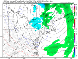
A very unusual weather pattern will bring to the northeast something it didn’t bring much of this past winter: wintry weather. Unsettled weather, even some snow, will return to the northeast, further squashing fears of prolonged drought there.

On Thursday, a high pressure system providing fair, dry, and pleasant weather to much of the eastern United States will push east, allowing for a strong low pressure system to enter into the Tennessee and Ohio Valleys. This storm system will slow as it pushes east. While warmer air will stream north up the east coast ahead of this low on a southerly flow, winds at the surface will have more of an easterly component to them. With water temperatures still cold in the Atlantic, this easterly component will moderate temperatures across the northeast, especially at the immediate coastline where temperatures will be 5-10 degrees colder than they are further inland.
On Thursday night, the low pressure system will spread rain into the eastern United States, with the heaviest rain focused on the Mid Atlantic region. With a deep connection to Gulf of Mexico moisture present, this rain will become even heavier on Friday morning for places like Delaware, Maryland, eastern Pennsylvania, New Jersey, New York City, and Long Island. Throughout the day on Friday, this heavy rain will eventually pivot its way up the coast, soaking southeastern New England with moderate to heavy rainfall.
On Friday, generally 1-2″ of rain will fall across the Mid Atlantic and southeastern New England areas, with some isolated 2-3″ amounts possible. Some thunderstorms could be embedded in the precipitation shield, producing the heavier amounts for some localized areas.
While the main event exits the region late Friday and early Saturday, unsettled weather will linger for many days. The main low pressure system will slow down, with several shortwaves working their way through the mid-level flow behind it.
Cloudy skies and below to much-below normal temperatures are expected over the weekend and to the start of the new week. With an unusually cold pool of air moving overhead, in addition to scattered rain showers, snow showers are also likely. The threat of snow showers will exist over northern New Jersey, central and northeastern Pennsylvania, the higher terrain of West Virginia, Upstate New York, and interior New England. While no accumulation is expected in places like New Jersey, a light coating to a few inches of snow is possible across the higher elevations of the northeast. Some parts of northern New York, Vermont, and New Hampshire could see as much as 3-4″ of heavy wet snow over the weekend. Again, accumulating snowfall will be limited to high terrain areas; accumulating snow is not expected near the I-95 corridor, the major cities, and southern valleys.
Any precipitation is good news to help squash any lingering drought issues across the northeast. In the latest Drought Monitor update, a Moderate Drought area was defined over western Connecticut while small areas of Maine, New Hampshire, Massachusetts, New York, and Maryland were officially described as “abnormally dry.” Precipitation from Friday’s soaking rains and lingering rain and snow shower activity on the weekend should help restore moisture levels in this region.
While snow in New England in May is not a frequent occurrence, it is an even more rare occurrence in Hawaii. While the northeast prepares for the chance of snow shower activity this weekend, portions of Hawaii’s Big Island are digging out from 6″ of snow that fell over the weekend. More snow continues to fall on Hawaii today.