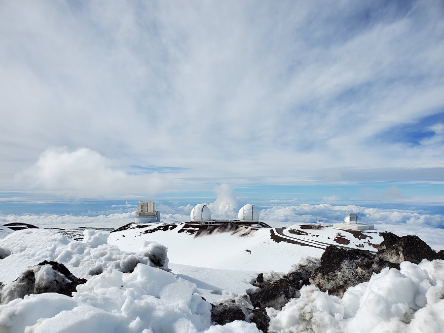
Hawaii, known as the Aloha State for its welcoming tropical tradewinds, sunny beaches, and spectacular sunsets is facing a fierce battle with Old Man Winter: a potent storm known as a Kona Low will bring heavy precipitation and strong winds to Hawaii. In the highest elevations of the Big Island of Hawaii, 2 to 4 feet of snow could fall. Combined with 60 mph winds, epic blizzard conditions could unfold there.
Deep tropical moisture will stream over the island chain during the next few days, dumping potentially flooding, heavy rains state-wide. Due to that flood threat, the National Weather Service has issued a Flood Watch for all of Hawaii. With temperatures hovering near or below freezing over the highest elevations of the Big Island, precipitation will fall as heavy snow. Additionally, gusty winds will produce widespread blowing and drifting snow, as well as near-zero visibility at times. Due to those hazards, the National Weather Service in Honolulu has also issued a Winter Storm Warning for the Big Island Summits where 2-4 feet of snow is in the forecast. A Winter Storm Warning is issued whenever the National Weather Service believes a significant amount of snow, sleet, and/or ice is expected or is occurring.
View this post on Instagram
According to the National Weather Service, travel could be very difficult to impossible. Blowing snow will significantly reduce visibility at times, with periods of zero visibility. The Honolulu office of the National Weather Service warns, “This will make travel very hazardous or impossible. Any travel plans to the summits should be postponed until the threat diminishes.”
Rangers at Mauna Kea have already closed the access road leading to the summit on Hawaii Island. “The Mauna Kea access road is closed to the public at the Visitor information station at an elevation of 9,200 feet due to fog, ice, freezing temperatures, convection, and snow. Rangers will continue to check the road and weather conditions and will reopen the road when the conditions are safe,” the Rangers said in a statement released earlier today. They will typically close the road whenever there is any ice or snow on the road, winds more significant than 55 mph for more than 1 hour and gusts greater than 65 mph are expected, or when visibility less than 50 feet is happening or expected to happen soon.
While most people don’t associate the tropical paradise Hawaii is known for with snow, they’re surprised to learn that it does snow in the winter due to the elevation of the volcanic peaks on Hawaii and Maui islands. Mauna Kea is the highest of the bunch at 13,803 feet. Maui’s Haleakala is much lower at 10,023 feet. Because of that difference, Hawaii Island will see snow more frequently than the lower Maui Island. Just one storm in January 2020 dropped 2-3 feet of snow on Hawaii Island and created snow drifts that were far deeper. Another storm in January 2021 brought snowboarders and skiers out to the mountain by the dozens. A blizzard hit the Big Island last December, guaranteeing a White Christmas there for 2022 just 2 months ago.
The Kona Low gets its name from the change in wind direction that occurs when such a storm like today’s moves over the Hawaiian Islands. Hawaii is dominated by the trade winds that typically blow in from the northeast. However, the counter-clockwise flow around a Kona low located west of Hawaii results in southwesterly winds over the islands, which is typically the leeward or “Kona” side. Kona Lows are most common between October and April. These type of storms draw abundant moisture up from the warm tropical waters that surround Hawaii; when this moist flow interacts with the steep topography of the islands which helps to wring-out moisture, extremely heavy precipitation can fall. Because the wind flow around a Kona Low is atypical, flooding rains occur in places that may not ordinarily flood in tropical downpours that impact the islands from time to time.
While the highest mountains will see exceptionally heavy snow, even resorts at the coast will see soaking rains and gusty winds.
According to the National Weather Service, significant flooding may occur due to the overflow of streams and drainages across the state. Roads may also be closed, along with property damage in urban or low lying spots due to runoff. Landslides may also occur in areas with steep terrain. Areas of particular concern include east and southeast sections of the Big Island, where washout of roads could isolate communities.
Widespread heavy rainfall and even a few thunderstorms will be possible, with the heavy rain beginning over the Big Island later today, then spreading to the smaller islands tonight. High rainfall rates for an extended period of time could result in flash flooding, particularly in areas which are already saturated from recent rainfall. In a statement released to the public, the Honolulu-based National Weather Service office said, “A Flood Watch means that conditions are favorable for flash flooding. Flash Flooding is LIFE THREATENING. Do not cross fast flowing water in your vehicle or on foot.”
This will be a prolonged winter storm which should linger in Hawaii through at least Saturday afternoon.