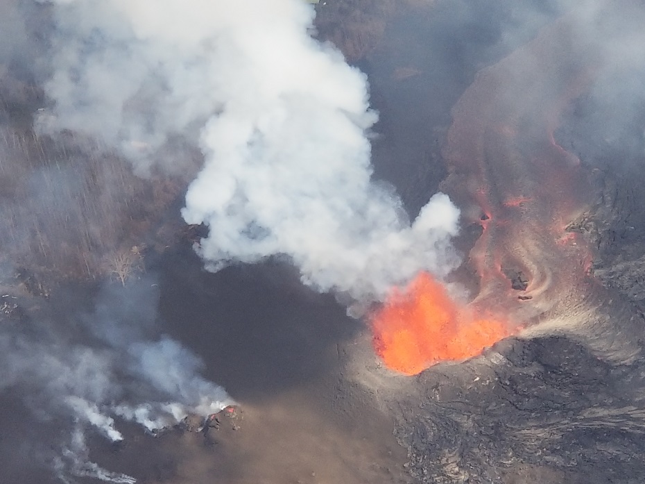
An internal report developed for Hawaii County officials by the USGS on July 15 was approved for public release yesterday and published today, July 20; it describes likely scenarios involved with the current volcanic eruption event underway in the Lower East Rift Zone (LERZ) of Hawaii’s Big Island. While many residents had hoped the eruption would be a short-term event, with abundant lava continuing to pour from the eruption site, the USGS report says that “given this volume and the sustained withdrawal of magma from the summit reservoir without appreciable deformation in the lower East Rift Zone, it is most likely that the LERZ eruption may continue for months to years.” While the eruption volume and general flow direction has been relatively stable in recent days, the USGS warns that “the main hazard from the source cone and the channel system is failure of the cone or channel walls or blockage of the channel where it divides into narrower braids. Either could divert most, if not all, of the lava to a new course depending on where the breach occurs.
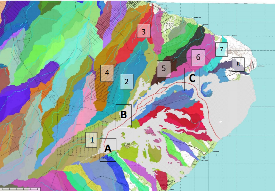
If the source cone or channel system fails, a flash flood of lava could head into an area that has yet to see any this eruption. In their report, the USGS showcases a lavashed map with different threat areas. In the lavashed map shown here, potential breakouts in the ongoing eruption could impact a wide area.
According to the USGS report, “Any major flow caused by a breach of the west wall of the channel between the vent (A) and the intersection of Pohoiki Road and Highway 132 (B) is likely to advance northeast into lavashed 1, hugging the northeast edge of the existing flow.” Such a lava flow could threaten Nanawale Estates; if the flow was significant enough, it would cross Railroad Avenue and Government Beach Road, enter lavashed 3, and reach the ocean southeast of Kahakai Boulevard. If the lava flow stalls, more populated areas could be impacted, according to the USGS.
“If the flow enters lavashed 2 and stalls, subsequent lava flows advancing along the west side of the stalled flow could enter lavashed 4 in Nanawale Estates and ultimately reach the coast slightly closer to the Hawaiian Beaches and Hawaiian Shores subdivisions.”
A breach along the middle channel (between B and C on the lavashed map) could create a different set of problems. According to the USGS, interruption to the flow there could redirect lava to the north into lavashed 5 or 6 and “threaten homes and infrastructure in the Noni Farms area, Railroad Avenue, Papaya Farms Road, and Government Beach Road before entering the ocean between Kalamanu and the northern edge of the 1960 lava flow.”
Failure around the lower channel (C) could also bring lava to the few areas not yet covered by the 2018 eruption. In their report, the USGS says, “flows advancing from a breach in the northeast side of the channel near Kapoho Crater may enter lavasheds 7 or 8 again and threaten the handful of remaining structures in the Kapoho Ag Lots and Beach Lots, structures built on the eastern section of the 1960 lava flow, and the Cape Kumukahi Lighthouse.”
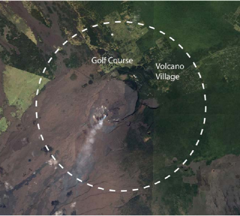
Beyond these potential lava threats from a continued eruption in the Lower East Rift Zone, the USGS has also expressed concern about the potential for a pyroclastic explosion at Kilauea’s summit, which is roughly 20-25 miles west of the LERZ eruption site. While the threat is very low, USGS scientist Janet Babb bluntly said “it isn’t zero.” Due to even the smallest risk, USGS scientists and county officials met with members of the community at two public events in recent weeks. The first was held in Volcano Village on July 5 and the second was held in Pahala on July 19. A pyroclastic surge is a fluidized mass of turbulent gas and rock fragments that is ejected during some volcanic eruptions. While Hawaii isn’t typically known for violent, explosive eruptions, a review of geology and history has led scientists to now believe that Kilauea is indeed an explosive volcano. The USGS cautioned that prior to a violent, explosive event, the volcano would likely give off seismic clues ahead of such an eruption and that no such seismic clues have happened or are happening at this moment.
The only thing certain with the ongoing Kilauea volcanic activity is uncertainty. In today’s report, USGS says, “If the ongoing eruption maintains its current style of activity at a high eruption rate, then it may take months to a year or two to wind down. While this seems to be the most likely outcome, a pause in the eruption, followed by additional activity, cannot be ruled out, nor can an abrupt cessation or a transition to steady, longer-lived activity at a lower effusion rate. “
