The USGS now has 6 volcanoes on ORANGE / WATCH status, up from 4 that were previously being monitored for eruptive action. While USGS actively monitors 161 volcanoes around the Pacific, Alaska, and the western U.S., the six volcanoes of concern today include the Great Sitkin volcano, Pavlof, Semisopochnoi, Kilauea, Karymsky, Sheveluch, and Ebeko. In addition to those volcanoes, Hawaii’s Mauna Loa and Alaska’s Davidof volcanoes remain at a heightened YELLOW / ADVISORY status. Bezymianny on the Kamchatka Peninsula is also at YELLOW / ADVISORY status. The rest of the volcanoes USGS is monitoring either lack status or are at “GREEN.”
Within the United States, the USGS tracks more than 160 potentially active volcanoes, most of which are in Alaska. Alaska is home to many volcanoes, though; there are more than 130 volcanoes and volcanic fields which have been active within the geologically young last 2 million years. 50 have been active since the mid 1700s and AVO studies those too. Another place famous for its volcanoes is Hawaii; on the Big Island of Hawaii, Kilauea, Mauna Loa, and Hualalai are considered active and potential threats, however only one is erupting today: Kilauea. The U.S. is only home to a fraction of the world’s volcanoes: according to USGS, there are normally around 2 dozen erupting volcanoes around the world at any given time. The USGS says there are about 1,500 potentially active volcanoes worldwide, with about 500 of the 1,500 erupting in modern historical times.
The Hawaii volcanoes are monitored by the Hawaii Volcano Observatory (HVO) while the Alaska volcanoes are monitored by the Alaska Volcano Observatory (AVO.) In addition to the AVO and HVO, there are also the California Volcano Observatory , Cascades Volcano Observatory, the Yellowstone Volcano Observatory, and the Northern Mariana Islands Volcano Observatory. Each of those additional volcano observatories within the USGS are monitoring volcanoes in their respective regions. At this time, none of those other observatories are reporting unusual activity or signs of anything more than background noise for now.
In the U.S., the USGS and volcano observatory units are responsible for issuing Aviation Codes and Volcanic Activity Alert Levels. Aviation Codes are green, yellow, orange, or red. When ground-based instrumentation is insufficient to establish that a volcano is at a typical background level of activity, it is simply “unassigned.” While green means typical activity associated with a non-eruptive state, yellow means a volcano is exhibiting signs of elevated unrest above known background levels. When a volcano exhibits heightened or escalating unrest with the increased potential of eruption, it jumps to orange. Finally, when an eruption is imminent with significant emission of volcanic ash expected in the atmosphere or an eruption is underway with significant emission of volcanic ash into the atmosphere, the code becomes red. Volcanic Activity Alert levels are normal, advisory, watch, or warning. As with aviation codes, if data is insufficient, it is simply labeled as “unassigned.” When the volcano is at typical background activity in a non-eruptive state, it is considered normal. If the volcano exhibits signs of elevated unrest above background level, an advisory is issued. If a volcano exhibits heightened or escalating unrest, a watch is issued while a warning is issued when a hazardous eruption is imminent.
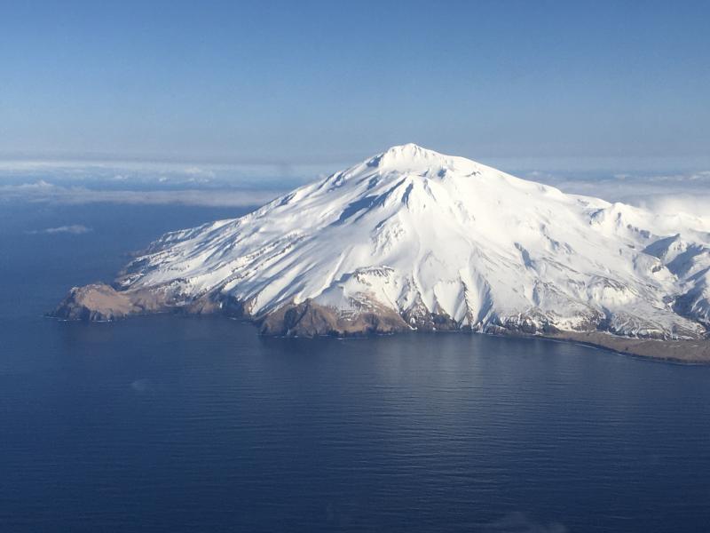
The Great Sitkin Volcano is a basaltic andesite volcano that occupies most of the northern half of Great Sitkin Island, a member of the Andreanof Islands group in the central Aleutian Islands. It’s located roughly 26 miles east of Adak, which is 1,192 miles southwest of Anchorage. According to the AVO, the volcano has a composite structure consisting of an older dissected volcano and a younger parasitic cone with a 1.8 mile diameter summit crater. A steep-sided lava dome, emplaced during an eruption in 1974, occupies the center of the crater. Within the past 280 years, a large explosive eruption here produced pyroclastic flows that partially filled the Glacier Creek valley on the southwest flank.
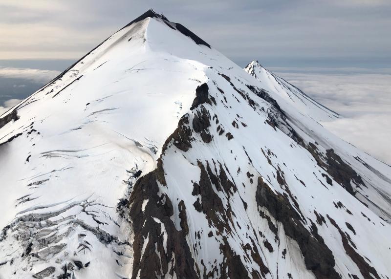
Pavlof Volcano is a stratovolcano located on the southwestern end of the Alaskan Peninsula just under 600 miles southwest of Anchorage. The volcano is about 4.4 miles in diameter and has active vents on the north and east sides near the summit. According to USGS, the volcano has had more than 40 historic eruptions, making it one of the most consistently active volcanoes in the Aleutian Arc. The Aleutian Arc is on the Pacific Ring of Fire.
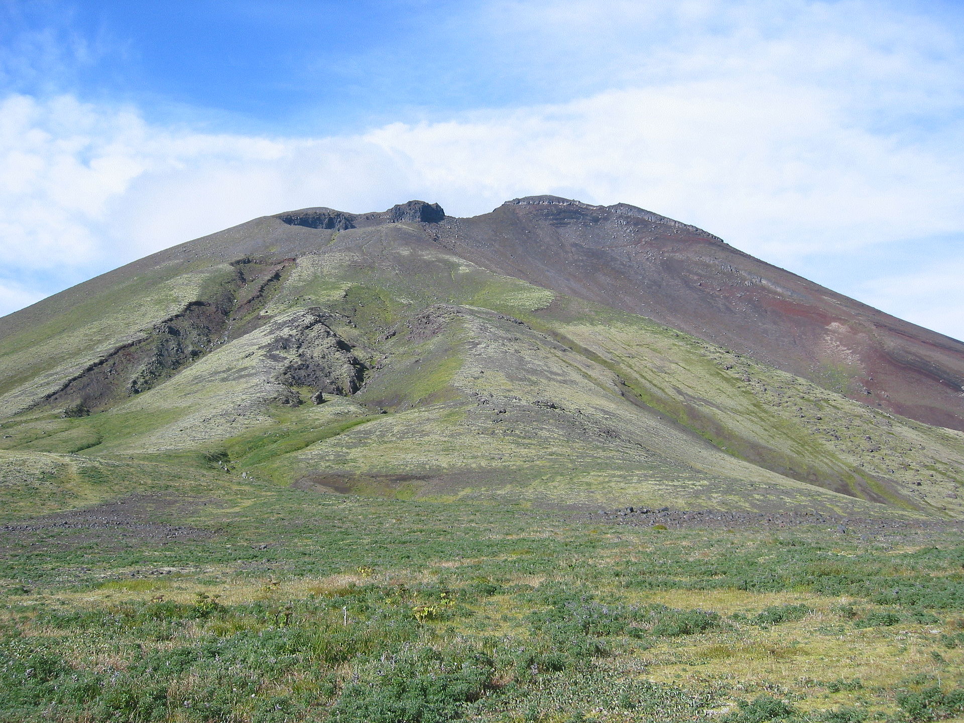
Based on its location on the globe at 179°46′ East, Semisopochnoi is the easternmost land location in the United States and North America, located just 9.7 miles west of the 180th Meridian in Alaska. Semisopochnoi is part of the Aleutian Islands, a chain of 14 large volcanic islands and 55 smaller other islands. These islands, with their 57 volcanoes, make the northernmost part of the Pacific Ring of Fire. Semisopochnoi is monitored by local seismic and infrasound sensors, satellite data, regional infrasound, and lightning detection instruments.
While it is only at YELLOW / WATCH status today, officials in Hawaii are actively pursuing an evacuation plan for the Big Island of Hawaii for the inevitable eruption expected there. While USGS is quick to point out that there is no eruption at Mauna Loa today nor is one expected in the immediate future, it remains the world’s largest active volcano.
In a news release issued earlier this year , Hawaiian Volcano Observatory (HVO) scientists with USGS cautioned, “While an eruption of Mauna Loa is not imminent, now is the time to revisit personal eruption plans. Similar to preparing for hurricane season, having an eruption plan in advance helps during an emergency.”
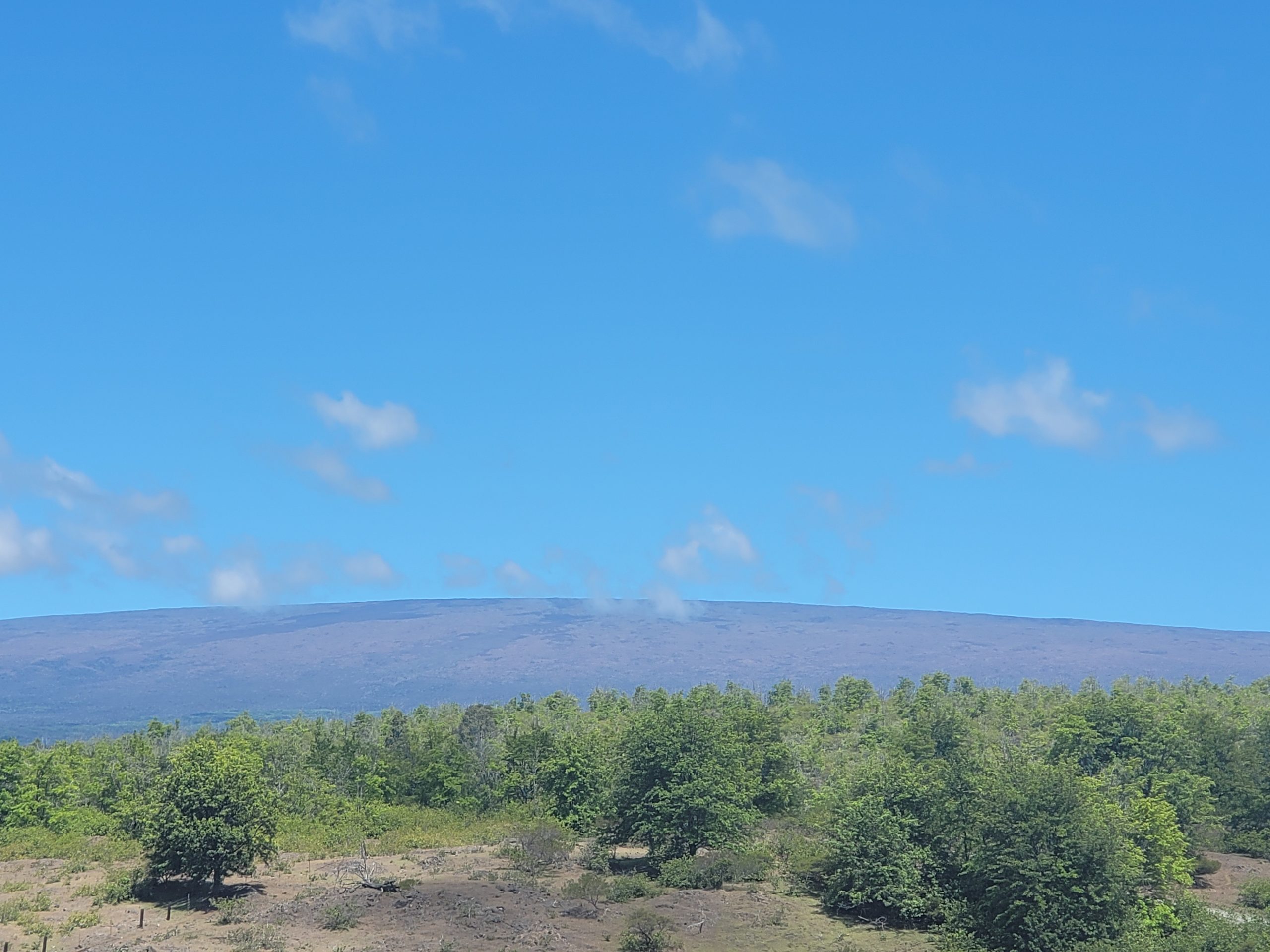
Mauna Loa is considered the largest active volcano on Earth, rising to 13,681 feet above sea level. Mauna Loa rises up from the ocean floor of the Central Pacific at a depth of about 3 miles. Because of the volcano’s significant mass, the ocean floor directly beneath Mauna Loa is depressed by another 5 miles. According to USGS, this places Mauna Loa’s summit about 56,000 feet above its base; the enormous volcano covers half of the island of Hawaii, also known simply as the “Big Island of Hawaii.”
Mauna Loa eruptions tend to produce voluminous, fast-moving lava flows that can impact communities on the east and west sides of the Big Island from Kona to Hilo. Since the 1850s, Hilo in eastern Hawaii has been threatened by 7 Mauna Loa lava flows. On the south and west sides of the island, Mauna Loa lava flows have reached the coast there 8 times: in 1859, 1868, 1887, 1926, 1919, and three times in 1950.
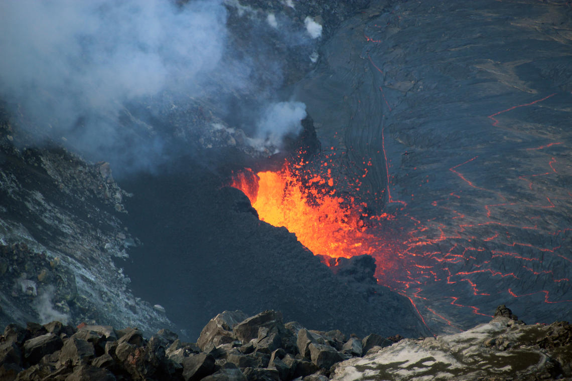
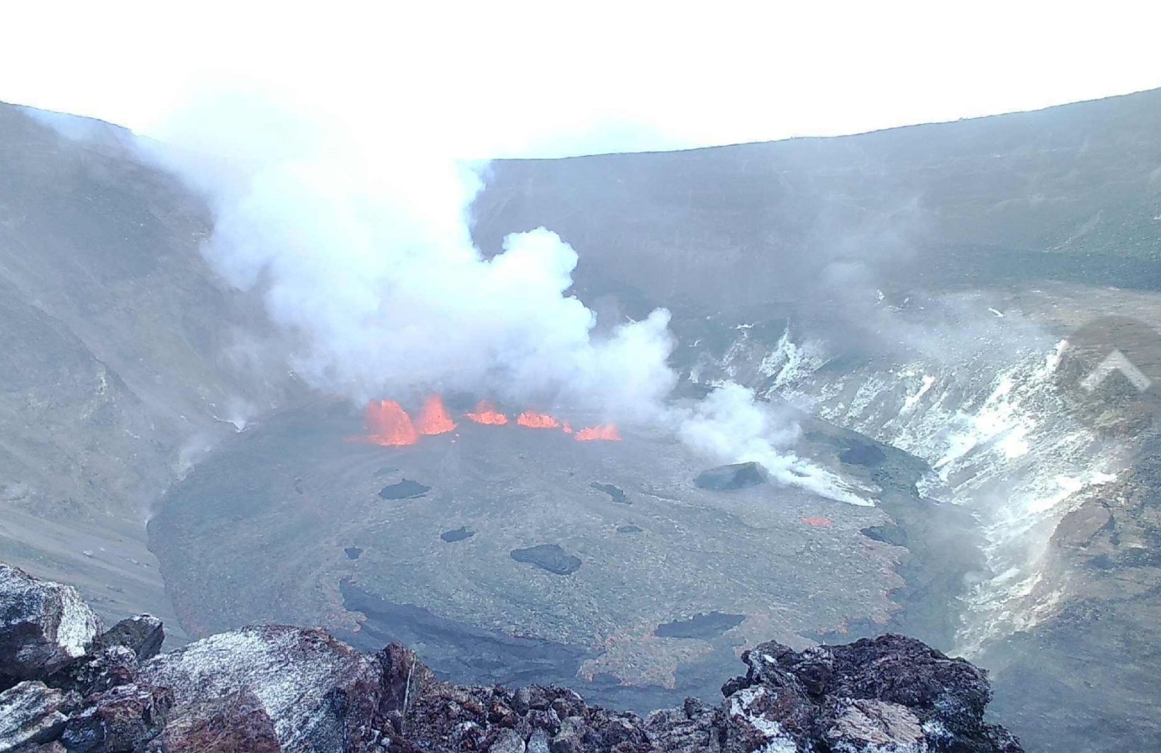
The smaller Kilauea Volcano, also located on Hawaii’s Big Island, is currently erupting. However, all of the lava associated with that eruption is contained within its summit caldera and is of no threat to surrounding communities.
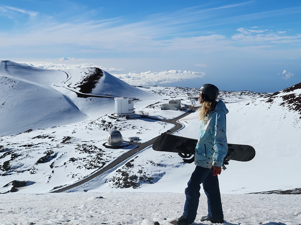
A dormant volcano on Hawaii Island, Mauna Kea, was covered in snow this Christmas. Recent snow storms, including a blizzard just weeks ago, covered the volcanic peak of Mauna Kea with several feet of snow. While more snow is expected in the coming weeks here, there is no threat of this volcano erupting.
In the continental United States, there are no volcanoes currently at an elevated status or color code.
