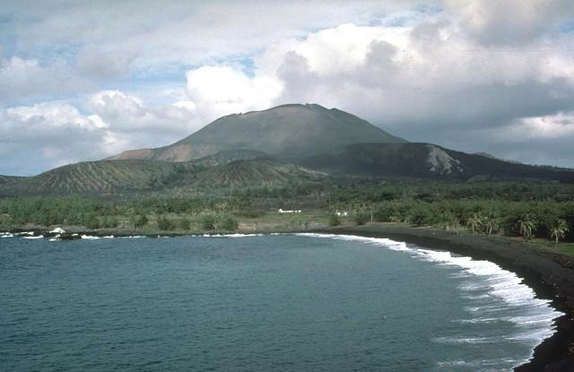
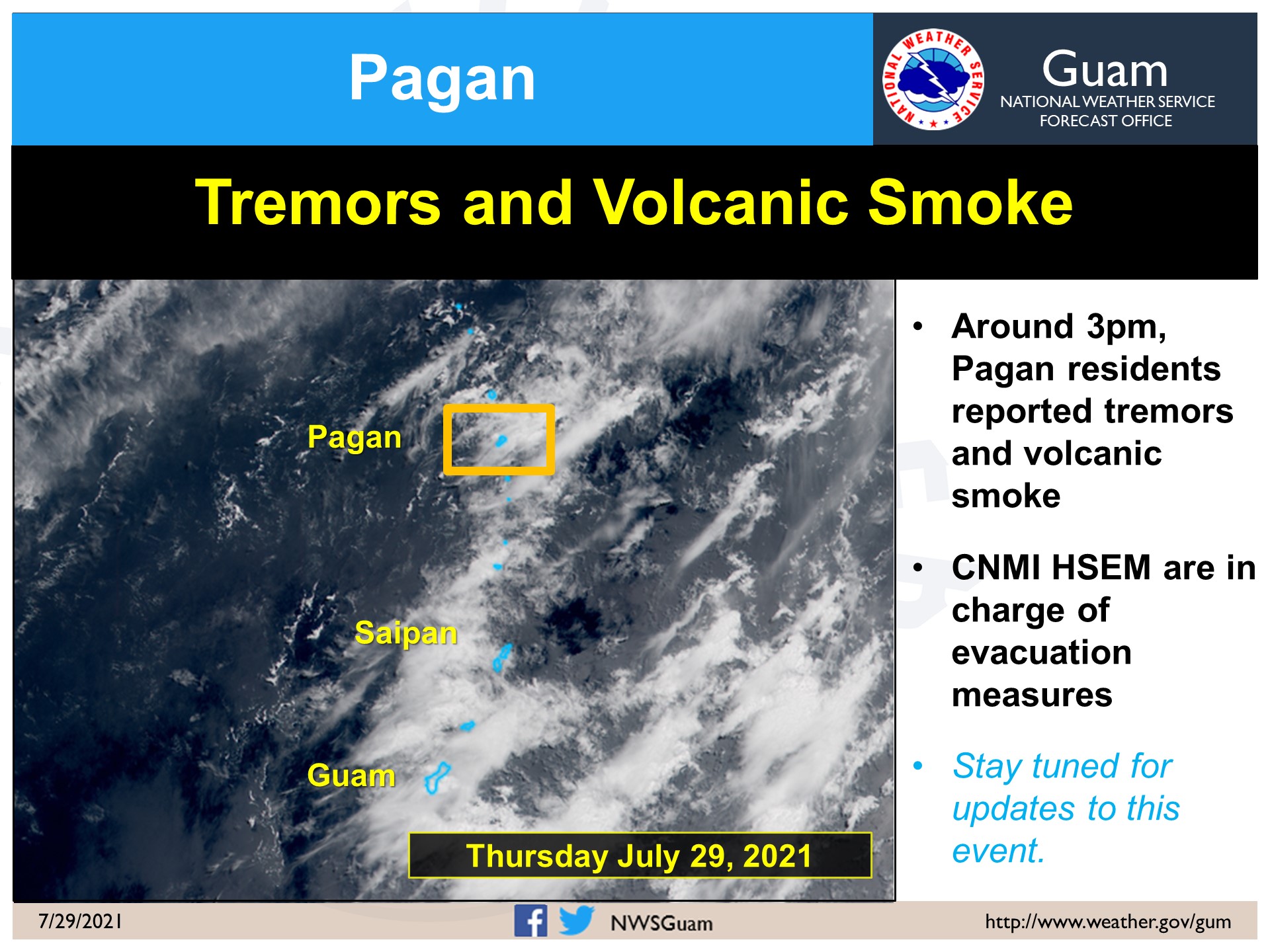
The USGS has raised a volcano alert level after reports of earthquakes and smoke emissions were reported by members of the public. The reports are centered around Mount Pagan, which is located on Pagan Island within the Commonwealth of the Northern Mariana Islands. Located just north of Saipan and Guam, the volcano there is monitored by the Northern Mariana Islands (NMI) USGS office.
“Ground-based observations from local residents indicate that there were felt earthquakes and a light emission from Mount Pagan at approximately 4:30 UTC July 29 (2:30pm local time July 28). This represents a departure from background activity and therefore the Aviation Color Code/Volcano Alert Status for Mount Pagan is being changed to YELLOW/ADVISORY,” the USGS NMI office said in an update.
USGS NMI is responsible for issuing Aviation Codes and Volcanic Activity Alert Levels. Aviation Codes are green, yellow, orange, or red. When ground-based instrumentation is insufficient to establish that a volcano is at a typical background level of activity, it is simply “unassigned.” While green means typical activity associated with a non-eruptive state, yellow means a volcano is exhibiting signs of elevated unrest above known background levels. When a volcano exhibits heightened or escalating unrest with the increased potential of eruption, it jumps to orange. Finally, when an eruption is imminent with significant emission of volcanic ash expected in the atmosphere or an eruption is underway with significant emission of volcanic ash into the atmosphere, the code becomes red. Volcanic Activity Alert levels are normal, advisory, watch, or warning. As with aviation codes, if data is insufficient, it is simply labeled as “unassigned.” When the volcano is at typical background activity in a non-eruptive state, it is considered normal. If the volcano exhibits signs of elevated unrest above background level, an advisory is issued. If a volcano exhibits heightened or escalating unrest, a watch is issued while a warning is issued when a hazardous eruption is imminent.
Mount Pagan is one of many volcanoes monitored by the NMI office; however, severe weather and years of no repairs have left geologists there nearly blind to what’s happening at the surface. In the latest NMI update for July, they report, “Ground-based geophysical monitoring data from stations on Anatahan and Sarigan islands have been unavailable since storm damage in August, 2017. Current logistical challenges in the CNMI prevent visiting these sites to make repairs. A timeline for returning these stations to operation is uncertain.”
Mount Pagan itself is not monitored with ground-based geophysical instrumentation like other volcanic sites, such as Hawaii’s Kilauea and Mauna Loa. USGS NMI said in an update, “We will continue to evaluate satellite imagery, distal geophysical data, on-island, and mariner reports when available, but because the volcano is not monitored with ground-based instruments, we cannot provide advanced warning of activity.”
USGS says Mount Pagan, one of two volcanoes that make up Pagan Island, is located on the northern end of the Island, and is one of the most historically active volcanoes in the Northern Mariana Islands. The last large eruption of the volcano was in 1981, followed by three and a half decades of intermittent activity. Recent activity prior to 2016 was characterized by vigorous steam plumes and degassing from a shallow magma source.
After World War II and under United States occupation, Pagan became part of the UN Trust Territory of the Pacific Islands. Pagan was eventually granted U.S. Commonwealth status. After World War II, the United States Navy maintained a small base on Pagan. In the 1950’s, several public buildings were built, including a church, a warehouse, an infirmary and a school house. However, by the 1970’s, the population dwindled, with many working and living on the nearby larger island of Saipan. On May 15, 1981, Mount Pagan erupted, with lava flows covering a large part of the island’s arable land and part of the airfield runway. During the eruption, the island’s inhabitants were evacuated to Saipan. The eruption continued until 1985, with further small outbreaks in 1987, 1988, 1992, 1993, 1996, 2006, 2009, 2010 and 2012.
