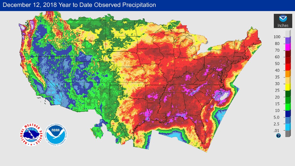
The eastern half of the country has been unusually wet while the west has been dry. Many areas from the Deep South to the East Coast have seen more than 50″ of rain (or melted snow) so far this year, which in many areas is more than 20″ above normal. With more rain expected later this week, some locations will break their all-time annual rainfall records.
A map released by the National Weather Service shows the distribution of precipitation observed so far this year across the mainland U.S. The extensive area of deep red from the Deep South northeast through much of the East Coast indicates that more than 50 inches of rain/snow has fallen so far this year. Many areas within the deep red have already observed precipitation of more than 20 inches (or 1.5 times) above normal (see magenta areas on the lower-left figure and blue areas on the lower-right figure). Some locations, such as Washington D.C., are seeing total rainfall approaching their all-time annual records/ Locations affected by Hurricanes Florence and Michael this year are seeing more than 80 inches of rain so far.
On the other hand, a lack of precipitation continues to plague the western U.S. This is especially true along coastal Pacific Northwest down to northern California, as well as parts of the central Rockies, where precipitation is more than 20 inches below normal.