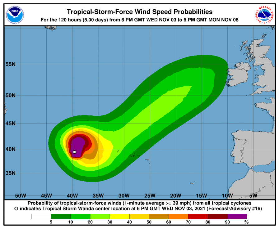
Tropical Storm Wanda, the 21st named storm of the 2021 Atlantic Hurricane Season, could ultimately end up impacting Ireland with time. For now, Wanda is maintaining a northward motion over the Northern Atlantic.
As of the last update from the National Hurricane Center, Tropical Storm Wanda was located near 39.8 N 39.5 W which puts it roughly 680 miles west-northwest of the Azores. Maximum sustained winds are now at 50 mph while the minimum central pressure is at 992 mb or 29.30″.
The National Hurricane Center is tracking Wanda’s movement. Right now, Wanda is moving toward the north near 10 mph and this general
motion should continue through early Thursday. A brief slowdown with a sharp turn to the southeast is forecast by Thursday night, followed by a southward acceleration on Friday. After that, the storm could move north and east towards Europe, perhaps interacting with Ireland in time.
The National Hurricane Center also says the storm could intensify over the next few days. For now, tropical-storm force winds extend outward by up to 105 miles from the center.