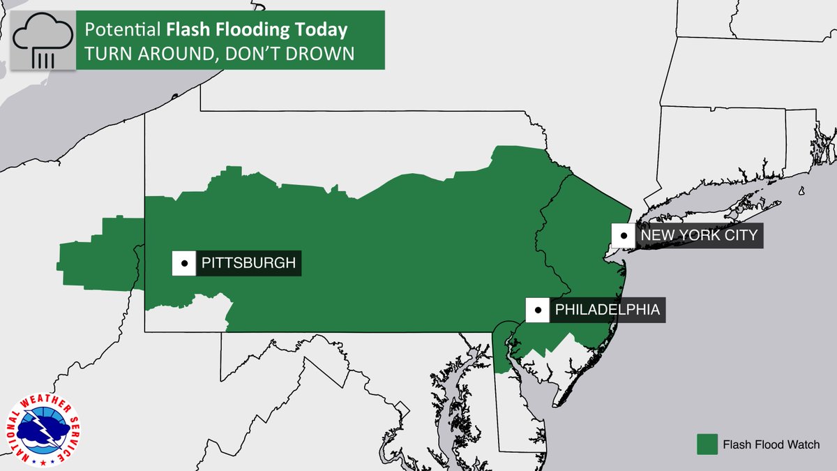
For the third day in a row due to an ongoing severe weather event, the National Weather Service’s Storm Prediction Center (SPC) has issued a watch box for portions of Pennsylvania, New Jersey, Delaware, and Maryland. Effective through 9pm tonight, a Severe Thunderstorm Watch is now up for this area. Because this area has been dealing with soaking rains from potent thunderstorms since Tuesday, the National Weather Service has also issued a Flash Flood Watch in areas with already-saturated soils. According to the National Weather Service, more deaths occur due to flooding than from any other thunderstorm hazard each year. Beyond heavy rain, the National Weather Service says the primary factor leading to the severe weather watch box are potential damaging winds from storms expected to develop there.

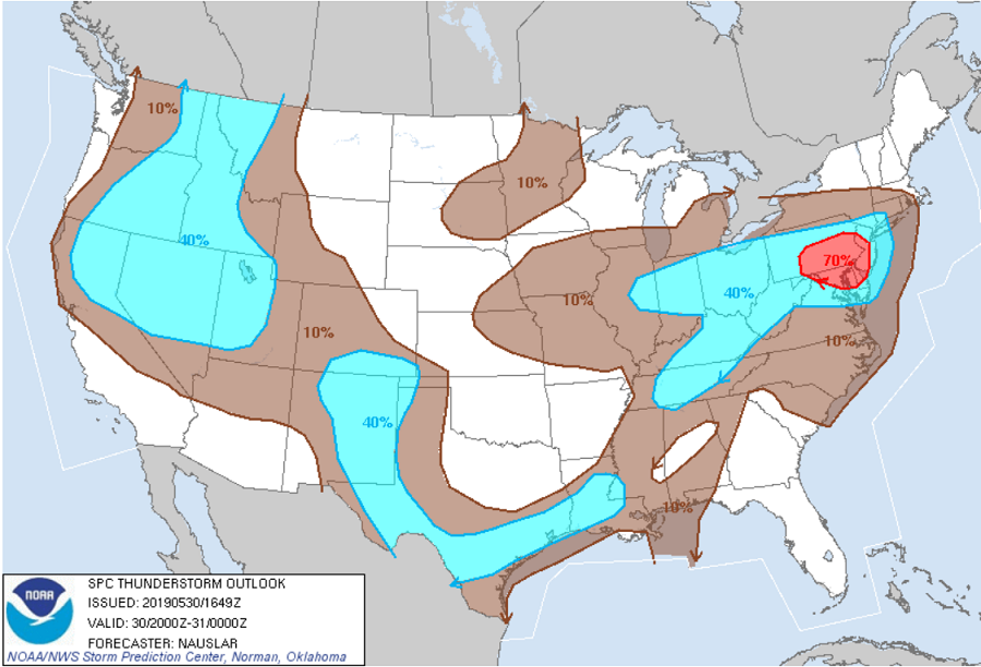
A variety of meteorological factors are coming together to produce severe weather in the Mid Atlantic again. A small perturbation embedded within fast mid-level westerly flow acted this morning to initiate convection across the higher terrain of western Pennsylvania and Maryland and eastern Maryland this morning. Recent visible satellite imagery shows increased vertical development in the cumulus field across this region. Diurnal heating downstream of this initial development is well underway for much of the Mid Atlantic to the south of a front draped generally east-west across Pennsylvania. Upper level dynamics will organize thunderstorms, and there is increasing concern that convection will grow upscale into a Mesoscale Quasi-Linear Convective System along/near the I-95 corridor in northern Virginia, Maryland, and eastern Pennsylvania. Squall lines and bow echoes are also known to cause tornadoes as well as other forms of severe weather such as high winds, hail, and microbursts; often times the supercells within this weather phenomena cause tornadoes to become rain wrapped, which are tornadoes that are surrounded by rain making them hard to see with the naked eye. Due to this, there is an isolated threat of a tornado or two from this severe weather outbreak, with the highest odds of tornadic touch-downs over eastern Pennsylvania and the state of New Jersey.
Beyond the isolated tornado threat, there is a more pronounced threat from severe winds, with some isolated large hail possible too. Scattered damaging winds could reach or exceed 65mph today while hail could get as large as 1.5″ in diameter or more.
A Severe Thunderstorm Watch means conditions are favorable for severe thunderstorms in and close to the watch area. Persons in these areas should be on the lookout for threatening weather conditions and listen for later statements and possible warnings. Severe thunderstorms can and occasionally do produce tornadoes.
If a Tornado Warning is issued:
- Go to the basement or take shelter in a small interior ground floor room such as a bathroom, closet or hallway.
- If you have no basement, protect yourself by taking shelter under a heavy table or desk.
- In all cases, stay away from windows, outside walls and doors.
High pressure will build into this region tonight, bringing the multi-day severe weather event to an end. Friday will feature fair and dry conditions and comfortable temperatures with the high pressure in place.
