A potential tropical cyclone’s expected intensification has prompted the issuance of numerous Tropical Storm Watches across portions of the Caribbean. Eyes are also on Florida and the U.S. East and Gulf coasts where this storm, expected to become Tropical Storm Fred over time, will eventually go.
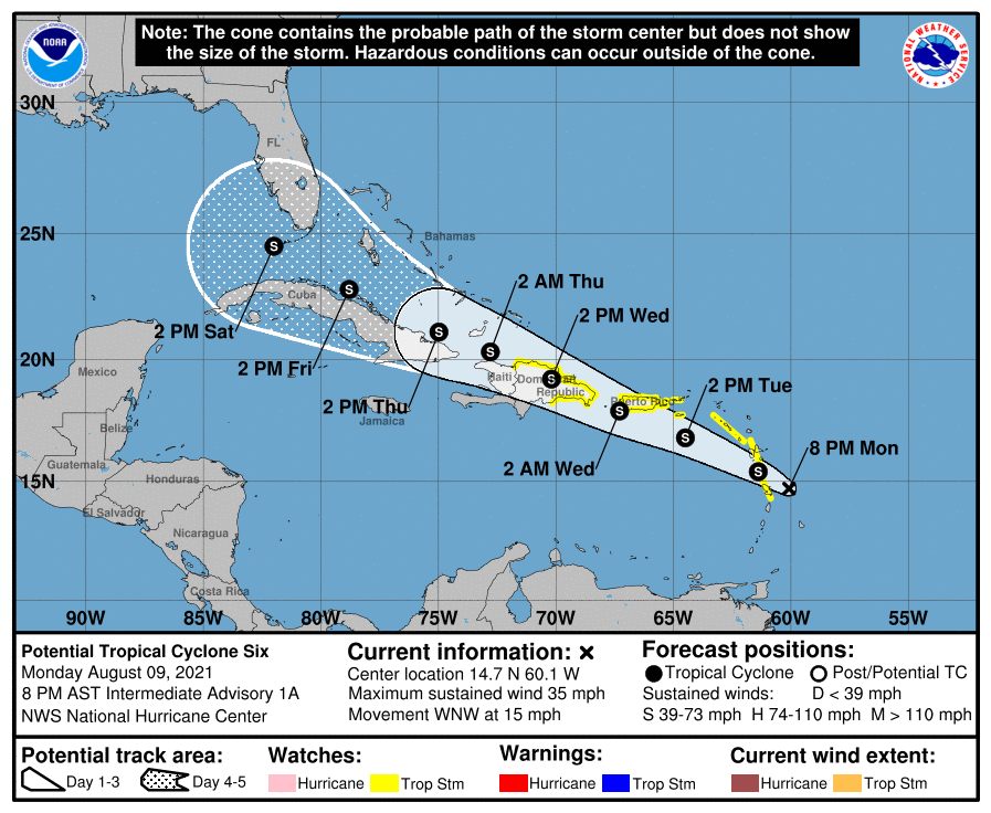
While it’s only a potential tropical cyclone for now, the government of France has issued a Tropical Storm Watch for Guadeloupe and Martinique; the government of Barbados has issued a Tropical Storm Watch for Dominica; the government of the Dominican Republic has issued a Tropical Storm Watch for the Dominican Republic from the Punta Palenque east along the southern coast of the island and the entire northern coast to the Dominican Republic / Haiti border. The National Hurricane Center (NHC) in Miami, Florida has issued a Tropical Storm Watch for the U.S. Virgin Islands and Puerto Rico, including Culebra and Vieques. A Tropical Storm Watch means that tropical storm conditions are possible within the watch area.
As of the 8pm advisory from the NHC, the disturbance was centered near latitude 14.7 North, longitude 60.1 West, which is roughly 90 miles east-southeast of Guadeloupe. The system is moving toward the west-northwest near 15 mph and the NHC expects this general motion to continue during the next few days.

Maximum sustained winds in the system officially known as “Potential Tropical Cyclone #6” are near 35 mph, with higher gusts. The NHC says gradual strengthening is forecast during the next day or two and the system is expected to become a full fledged tropical storm tonight. When upgraded to a tropical storm, the system will be named “Fred.”
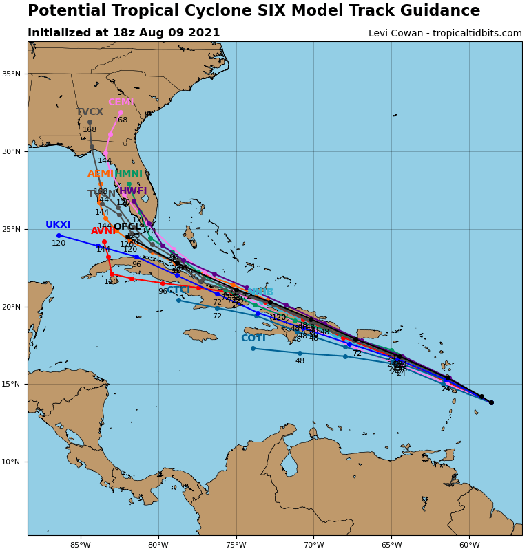
On the forecast track provided by the NHC, the disturbance is expected to move across the southern Leeward Islands later tonight, pass near or over the U.S. Virgin Islands and Puerto Rico late Tuesday and Tuesday night, and be near or over Hispaniola on Wednesday. It is too soon to say where Fred would go beyond that point or how strong it’ll be; as the center of circulation interacts with the Dominican Republic, Haiti, and Cuba, it could change the intensity, motion, and speed of the storm.
Even before it’s officially upgraded to Fred, the system will bring heavy rain, gusty winds, and rough surf to the Caribbean. Over the Leeward Islands, Virgin Islands, and Puerto Rico 2-4″ of rain, with isolated amounts of 6″, is possible. This rainfall could lead to flash, urban, and small stream flooding and potential mudslides across the U.S. Virgin Islands and Puerto Rico. Tropical storm wind conditions are possible within the watch area in the Lesser Antilles later tonight, and are also possible within the watch area in the U.S. Virgin Islands and Puerto Rico beginning Tuesday afternoon. Tropical storm conditions are possible within the watch area in the Dominican Republic beginning early Wednesday. Swells generated by the disturbance are affecting portions of the Leeward Islands. These swells are expected to spread across the U.S. Virgin Islands and Puerto Rico on Tuesday and across portions of Hispaniola on Wednesday, and they could cause life-threatening surf and rip current conditions.