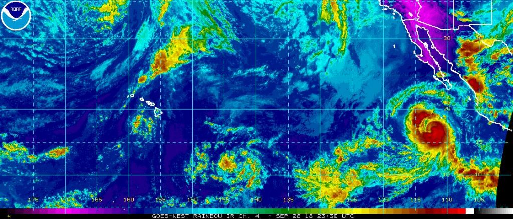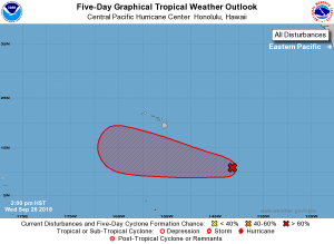
A new tropical cyclone is forecast to form and will likely be named from a rarely used list of tropical cyclones. Located in the Central Pacific, meteorologists are keeping an eye on an area of low pressure that could be named Walaka and pass to the south of Hawaii.
The system being watched is now an area of showers and thunderstorms located about 990 miles southeast of Hilo on Hawaii’s Big Island. The system today appears to becoming slightly more organized. The Central Pacific Hurricane Center cautions that storms within the system “continue to flare up and down in coverage and intensity” in their latest Tropical Outlook, suggesting rapid intensification or organization aren’t expected for now. However, a low-level circulation center is now apparent on visible satellite imagery. According to the Central Pacific Hurricane Center, environmental conditions remain conducive for gradual development of this system over the next few days as it moves westward across the central Pacific. Both the American GFS and European ECMWF global forecast models call for the system to become a robust tropical cyclone, but both models also suggest the storm will miss the islands for now.

Formation into a tropical cyclone could take days. The Central Pacific Hurricane Center says there’s only a 30% chance of formation in the next 48 hours; however, the chance of formation over the next five days is high at 70%.
Once and if the system becomes a Tropical Storm, it would be given the name Walaka.
The list of names used for tropical storms and hurricanes are maintained by the United Nation’s World Meteorological Organization. Currently, only tropical cyclones are named in an official capacity; winter storms are not. The World Meteorological Organization from the United Nations develops a list of names for each ocean basin. In the United States, the National Hurricane Center maintains lists from the WMO for Atlantic Basin and eastern Pacific basin storms. Storms that form near Hawaii come from a list managed by the Central Pacific Hurricane Center which is co-located with the National Weather Service office in Honolulu. Storms are typically named in alphabetical order each season. “It is important to note that tropical cyclones/hurricanes are named neither after any particular person, nor with any preference in alphabetical sequence,” states the WMO. “The tropical cyclone/hurricane names selected are those that are familiar to the people in each region.”
What makes this potential storm interesting is where it is forming. The previous storms to pass near or through Hawaii, which were Hector, Lane, and Olivia, recently all formed in the Eastern Pacific basin and traveled into the Central Pacific Basin. In the case of this storm, it is forming within the Central Pacific basin west of 140°W, which means it would get a Central Pacific Basin storm name. Storms keep their name as they move from one basin to another. The next name to be used in the Central Pacific is Walaka, which is pronounced wah-LAH-kah. Unlike lists in other basins that start with the letter “A” every season, the storm name list in the Central Basin picks up where it last left off. Names are used from 4 lists and re-used unless retired. The last storm to form in the Central Pacific basin was Ulika; the next name to be used beyond Walaka will be Akoni.
It’s been two years since a storm was named in the Central Pacific Basin. On September 26, 2016, the National Hurricane Center classified a disturbance in the Eastern Pacific as Tropical Depression 19-E; within hours, it traveled west across 140°W , intensified, and was named Tropical Storm Ulika. The storm eventually became a Category 1 hurricane but never impacted land.