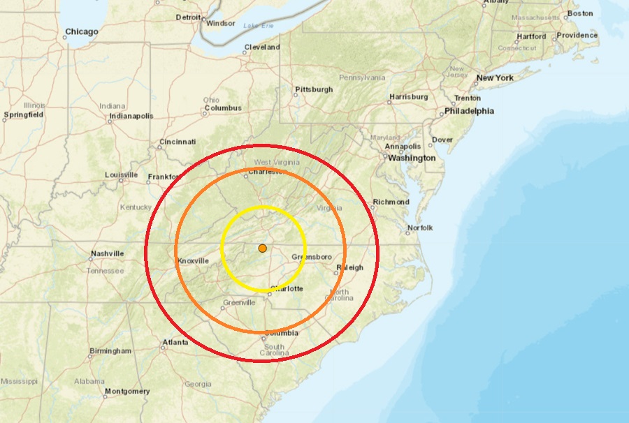
The weekend kicked off with an earthquake near the Virginia border in northern North Carolina early Saturday morning. According to USGS, at 5:44 am on Saturday morning, a magnitude 2.2 earthquake struck from a depth of 5.9 km near Sparta, North Carolina. The epicenter was located in the northwest corner of the state, just west of I-77 and north and west of Winston-Salem.
While there were no reports of damage or injuries, USGS said several dozen people did report shaking to them via their website “Did you feel it?” earthquake reporting tool.
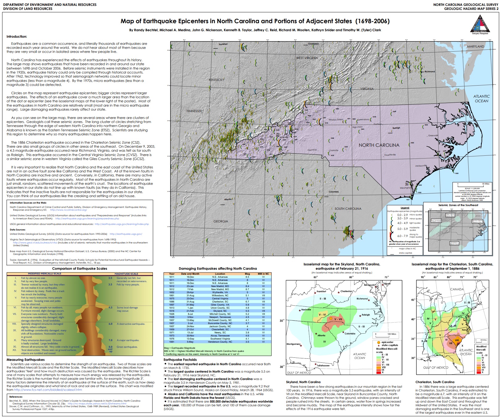
According to the North Carolina Department of Environmental Quality, while North Carolina is no stranger to earthquakes, large, damaging earthquakes are rare. Large, damaging seismic events are rare and the few felt in North Carolina had epicenters outside of the state. Most quakes in North Carolina originate from the East Tennessee seismic zone to the west, the Charleston, South Carolina seismic zone to the south, or the Central Virginia seismic zone to the north. The most common and strongest earthquakes to strike the state have been in the western part along the Appalachian Mountains.
The North Carolina Department of Environmental Quality (DEQ) cautions that people in the state should be prepared for the possibility of larger quakes. “Although strong earthquakes here in North Carolina are infrequent, proper construction techniques need to be followed. An earthquake of magnitude 5 or greater could block major transportation routes in the mountains and cause structural damage elsewhere,” the DEQ writes. They add, “Many of the larger earthquakes in North Carolina occurred when the state was more rural. Recent development includes buildings and infrastructure such as road and power networks. Modern building codes take into account the possibility of an earthquake but many older buildings were not constructed to withstand violent shaking.”