A weather system responsible for tornadic thunderstorms yesterday is shifting east today, bringing the threat of severe thunderstorms and tornadoes to portions of the eastern United States. Fortunately, today’s weather outbreak won’t be nearly as severe as yesterday’s, but some storms could approach severe limits nonetheless.
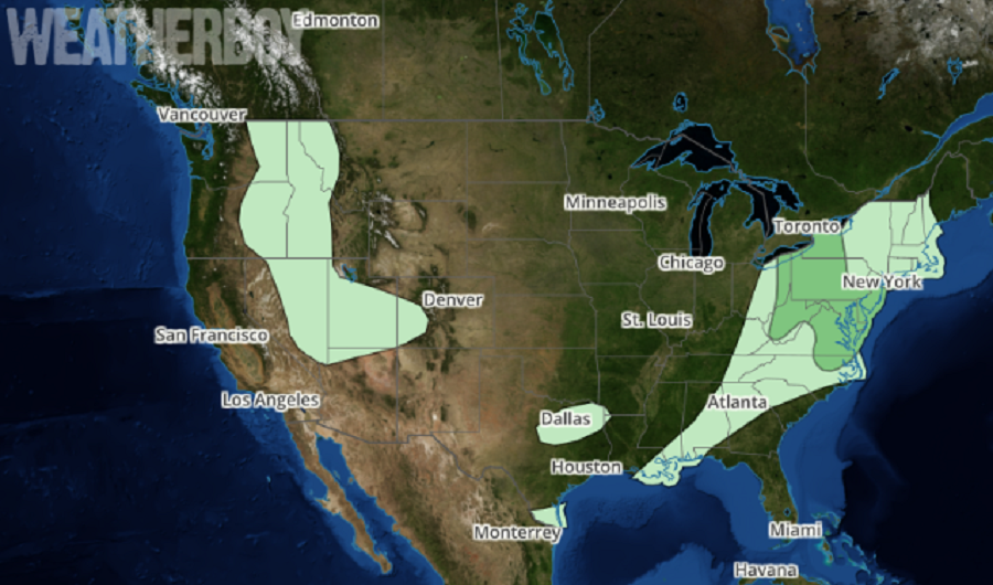
An upper trough will continue to advance slowly northeast through the Great Lakes and Ohio Valley today. A related occluded low will move from Wisconsin to southeast Ontario, Ontario while an occluded front will stretch from the surface low in Wisconsin eastward into Michigan and then trail southward as a cold front through western Ohio, the Tennessee Valley, and into the western Gulf of Mexico by late morning. A warm front will extend from central Virginia northeast into western Pennsylvania while a cold front will advance east through the Mid Atlantic throughout the day. All of these ingredients will set the stage for the possibility of severe weather, with the greatest threat over western New York, eastern Ohio, much of West Virginia, Pennsylvania, and New Jersey, all of Maryland and Delaware,
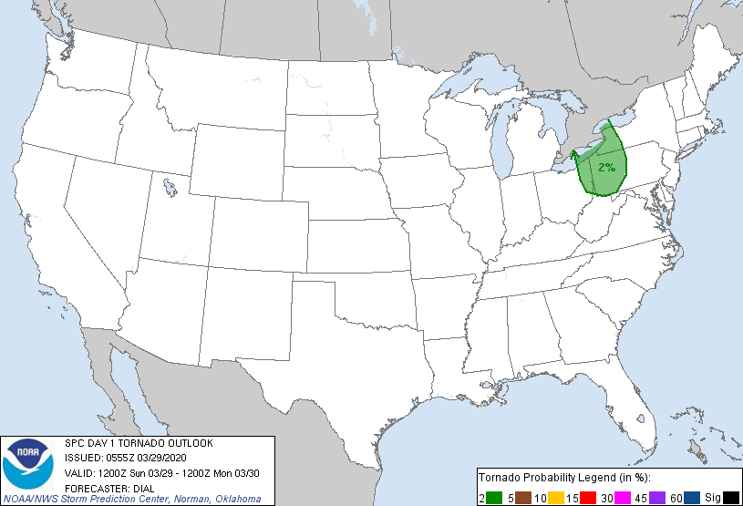
Fortunately, the most severe weather and possibility of tornadoes will be confined to a small area today. A leading band of convection along warm conveyor belt will likely continue weakening as it moves into a more stable atmosphere. In wake of this activity, a narrow corridor of weak instability may develop from eastern Ohio into western and central Pennsylvania, within the mid-upper dry slot region of the low pressure system and just ahead of the cold front. According to the National Weather Service’s Storm Prediction Center (SPC), a few storms might initiate in this strongly sheared, but weakly unstable environment by late morning or towards noon. Because of this, low-topped supercells and bowing segments are possible with threat for mainly locally strong wind gusts and perhaps a brief tornado.
The threat of severe weather will diminish throughout the day as the cold front clears the coast. High pressure will build in behind this weather system, providing people with fair and pleasant weather on Monday.
With many dealing with the COVID-19 Pandemic in various states of quarantine, shelter-in-place, or no-travel orders, it is imperative that people in severe weather risk areas know what they’d do if severe weather struck before it actually does. Places safe from COVID-19 may not be safe from violent weather like tornadic thunderstorms. People need to plan out how to contain the spread of disease and risk contamination while dealing with the risks of severe weather. Ideally, those plans should be flushed out before the severe weather arrives.
