A wet weather pattern in place over the country is bad news for snow lovers, but is good news for those that want to see drought conditions wane.
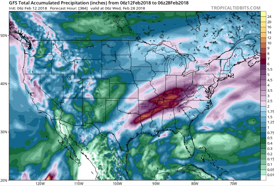
Computer forecast guidance is suggesting that a mild and wet weather pattern will persist across a large part of the country for the balance of February, with especially wet and warm conditions in the East. Before March arrives, it is possible for several inches of rain to fall in the Mississippi and Ohio River Valleys. An anticyclonic flow around a sprawling eastern surface high will allow moisture and mild temperatures to surge north from the deep south. The atmosphere is very moist, with a precipitable water anomaly of 2-3 times greater than normal. There will be atmospheric disturbances that will trigger heavy rains to fall, which could set the stage for flooding conditions.
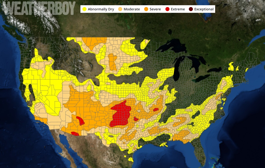
While floods aren’t needed, soaking rains are. Drought conditions began to show up on the latest Drought Monitor Outlook. However, these soaking rains will help put a dent in the growing drought problem across much of the country.
While snow is expected in the higher elevations of the Rockies and Pacific Northwest, as well as mountains of northern New England, there won’t be much snow in places that usually do see a decent amount of snow this time of year. Places like the Mid Atlantic and southeastern New England will simply be too mild for snow. Further south, record temperatures are possible across Florida and the southeastern US. Places like Miami could see record heat for mid/late February with this weather pattern in place.
There are some hints in extended guidance tools that conditions will turn colder and more wintry in March, but until that possible change happens, conditions will be wet and mild for many in the US.
