
With Hurricane Ernesto a memory, the Atlantic hurricane basin has quieted and the National Hurricane Center doesn’t expect any fresh tropical cyclones to develop there over the next 7 days. But the opposite is true for the Eastern and Central Pacific Hurricane Basins, where things are active. In fact, a new tropical cyclone could threaten Hawaii as soon as this weekend.
The Central Pacific Hurricane Center (CPHC) in Honolulu, Hawaii on the state’s central island of Oahu, says there is now a 90% chance that a tropical cyclone, either a tropical depression or tropical storm, will form within the next 24 hours.
“Showers and thunderstorms continue to become better organized in association with a well-defined area of low pressure located well east-southeast of the Hawaiian Islands. If these trends continue, a tropical depression or tropical storm is likely to develop later today while it moves generally westward at 10 to 15 mph,” said the CPHC in the latest Tropical Outlook. They added, “A weaker disturbance located just to its southwest is expected to merge with this system later today. This system is expected to strengthen as it moves into the Central Pacific basin tonight or on Thursday and moves near the Hawaiian Islands late this weekend or early next week.”
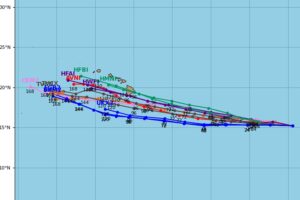
Where exactly it heads remains a big question. Computer forecast models have been inconsistent with their projections, with some models and their runs shifting possible storm tracks through, north, and south of the Aloha State. The latest run of global forecast models is embracing a track just to the south of the state; such a track would spare the islands from the worst rain and wind associated with the storm, but it would still be close enough to bring multiple hazards to the state, especially the Big Island of Hawaii which would be closest to the storm center.
“Interests in Hawaii should closely monitor this disturbance, though it remains too early to determine the exact location and magnitude
of potential impacts,” cautions the CPHC.
Tom Birchard, with the co-located Honolulu office of the National Weather Service, agrees. In the latest Forecast Discussion for Hawaii, Birchard wrote, “It is too early for forecast specifics with respect to potential impacts in the islands, but the triple threat that a tropical cyclone could bring includes strong and damaging winds, heavy and potentially flooding rainfall, as well as high surf and storm surge.”
Birchard adds, “It is the peak of hurricane season here in Hawaii, and now is a good time to make sure that you and your family are prepared. For more information, visit weather.gov/safety/hurricane-plan. ”
While the Pacific perks up with this threat and Hurricane Gilma, which is spinning away from land well off the coast of Mexico, the Atlantic is quiet. The National Hurricane Center in Miami, Florida was especially brief in their latest Tropical Outlook: “Tropical cyclone formation is not expected during the next 7 days.”
