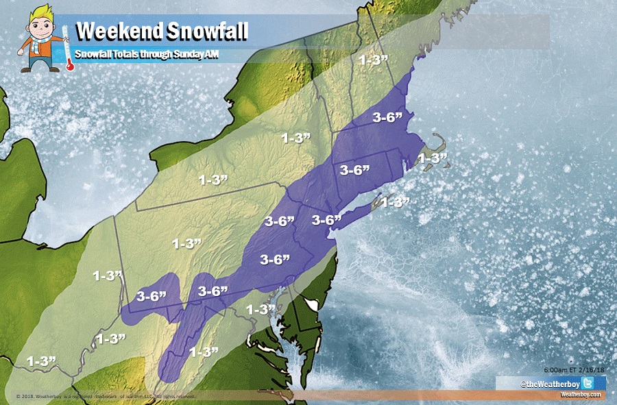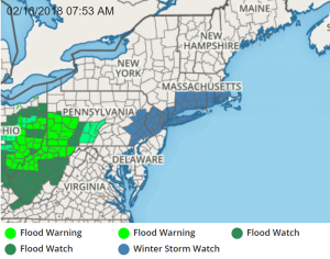
The National Weather Service has issued Winter Storm Watches for heavy snow ahead of a system that will bring accumulating snow to portions of the Mid Atlantic and Northeast. Winter Storm Watches are now up for portions of Pennsylvania, New Jersey, New York, Connecticut, Rhode Island, and Massachusetts for upwards of a half-foot of snow.

A quick moving but potent area of low pressure will approach the Mid Atlantic and Northeast late Saturday into Sunday. As a closed low remains nearly stationary near Hudson Bay, Canada through the weekend, a stronger short wave will allow for a quick moving but potent storm to blossom this weekend. Due to the fast-moving progressive flow established over the region, this will be a fast-moving system that won’t produce much in the way of wind and won’t leave behind much in the way of cold air in its wake.
It appears the low pressure system will develop just off the Mid-Atlantic coast late Saturday and then quickly tracking northeastward up the New England Coast early Sunday.
At this point, it appears snow will begin around the Washington, DC area around 5pm Saturday, 6pm around Wilmington, DE, around 7pm for the Philadelphia, PA metro area, by 8pm for the New York City area, and by 10pm for the Boston, MA metro region.
On the southern fringe of this storm, the snow will mix with or change to rain, keeping accumulations light; this will likely happen south and east of the I-95 corridor. Further south and east, from a line stretching from Dover, DE north and east through Vineland, NJ and Toms River, NJ, this area will see predominantly rain. Places like Bethany Beach, DE, the Wildwoods in NJ, and Atlantic City, NJ should simply see plain rain from this storm.
North of the rain area, snow will fall, and the snow could be heavy at times. This will be a slushy, heavy wet snow; perfect for making snowballs or snowmen. Because it’ll be heavy, it could be difficult to shovel; take your time and don’t over-exert yourself with snow removal activities.
Due to the progressive nature of the pattern and the fast moving forecast progress of this storm, the snow will quickly end from southwest to northeast by Sunday morning. Snow should end by midnight Saturday night around Washington, DC, by 3am in Wilmington, DE, by 4am in Philadelphia, PA, by 5am in New York City, and by 6am in the Boston metro area.
This quick-hitting winter storm will be followed by a taste of spring. Temperatures are expected to rebound quickly by the early part of next week, with even milder weather expected for the balance of the month.