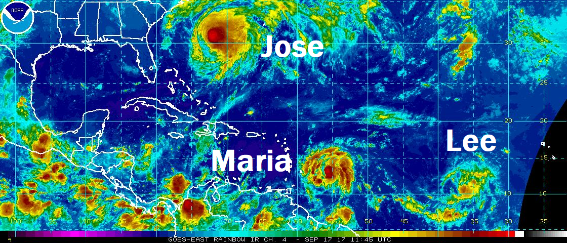
A trio of storms is tracking across the Atlantic, just a week after three storms, Jose, Irma, and Katia did the same. Today, Hurricane Jose, Tropical Storm Maria, and Tropical Storm Lee are spinning about, with Jose closest to the United States today and Maria having the potential to be the most destructive of the three.

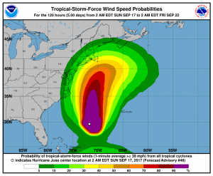
Hurricane Jose is forecast to continue its northward track over the next few days before stalling just southeast of New England. Tropical Storm force winds could brush the coastline from North Carolina to Massachussets; however, the worst winds associated with Jose should remain over the open waters of the Atlantic. While Jose’s winds and rain will have a limited reach onto land, the impacts of rough surf generated by the hurricane will threaten much of the US east coast with rough surf, life threatening rip currents, beach erosion, and the threat of coastal salt water flooding.
Worse, Jose’s future path may bring Maria, as a Major Hurricane, to the US East Coast over time. The future path and intensity of Jose will have a direct impact on Maria’s track. Even if Jose spares much of the northeast from wind and rain impacts, its path may help steer Maria on a collision course with the Mid Atlantic coast. It is still too early to say with certainty where Maria will go, especially with Jose’s track beyond 5 days in doubt.

This morning, Tropical Storm Maria is becoming better organized and is an increasing threat to islands hit hard by Hurricane Irma just over a week ago. Maria’s cloud pattern is becoming better organized with developing convective banding features and a gradually expanding central dense overcast. Upper-level outflow is only slightly restricted over the southern portion of the circulation. According to the National Hurricane Center (NHC), the environment should be conducive for continued strengthening for the next several days with low shear, a warm ocean and a fairly moist mid-tropospheric air mass. The official intensity forecast follows the model consensus, but a more rapid
intensification than indicated here is certainly possible over the
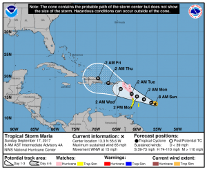
next couple of days. In fact, the NHC projects Maria to become a Major Hurricane with maximum sustained winds in excess of 110mph by Tuesday night.
Maria’s path is of huge concern to the Caribbean, especially the Virgin Islands, Puerto Rico, and the Dominican Republic which is in direct path of the storm. Maria is now moving west-northwestward at about 15mph. A mid-level high pressure area to the north of Maria is forecast to weaken slightly over the next several days. This should result in a continued west-northwestward motion with a slowing of forward speed.
The National Hurricane Center wants these two key messages to get out to the public about Maria:
Maria is expected to strengthen and affect portions of the Leeward Islands as a hurricane early next week, bringing dangerous wind, storm surge and rainfall hazards. Hurricane or Tropical Storm Warnings will likely be required for portions of these islands today.
Maria could also affect the British and U.S. Virgin Islands and Puerto Rico by mid week as a dangerous major hurricane, and hurricane watches could be issued for these islands as early as tonight. Interests in these areas should monitor the progress of Maria and follow any advice given by local officials.

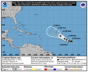
Lastly, Tropical Storm Lee continues to spin about over the open waters of the central Atlantic Ocean. Unlike Jose and Maria, Lee is not expected to threaten any landmass over its lifetime. On its current forecast track, the NHC believes Lee will weaken to a tropical depression, if not completely dissipate, by the end of the week.
Experts believe this Atlantic Hurricane Season, which runs through to the end of November, will be a busy one. Dr. Phil Klotzbach and the experts at Colorado State University updated their seasonal outlook again on July 5, showing a much more active than normal season expected. The National Oceanic and Atmospheric Administration (NOAA) also released their own forecast which shows this hurricane season to be likely more active than others.