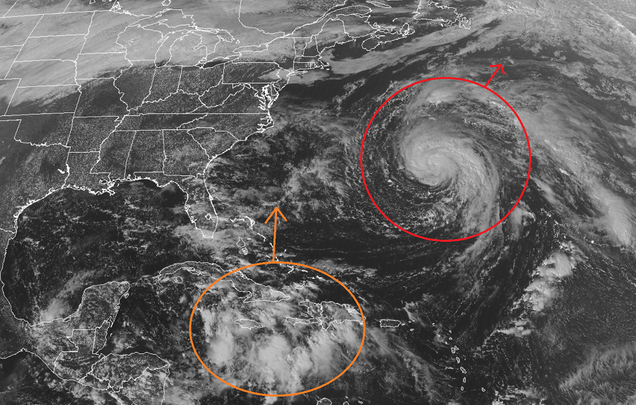
The Miami, Florida-based National Hurricane Center is tracking two systems in the Atlantic Hurricane Basin. The first and largest is Hurricane Epsilon; while it is weaker than it was yesterday, it is still packing a punch east of Bermuda. The other is an area of shower and thunderstorm activity over the Caribbean that could evolve into a tropical cyclone with time.
As of the latest advisory from the National Hurricane Center, Epsilon is moving north-northwest and should pass well east of Bermuda but cause tropical storm conditions through tonight. Located about 215 miles east-southeast of Bermuda now, the storm has maximum sustained winds of 90 mph and a minimum central pressure of 965 mb or 28.50 inches.
A Tropical Storm Warning remains in effect on the island of Bermuda for Hurricane Epsilon.
Tonight, Epsilon should move more north than northwest, followed by an acceleration to the northeast over the weekend. On this track, the center of Epsilon is forecast to remain well east of Bermuda and well south of Canada tomorrow.
Large swells generated by Epsilon will affect Bermuda, the Bahamas, the Greater Antilles, the Leeward Islands, the east coast of the United States, and Atlantic Canada during the next few days. These swells are likely to cause life-threatening surf and rip current conditions. Even expert swimmers and surfers are advised to avoid the ocean until more calm conditions return.
As Epsilon exits into the northern Atlantic, eyes are returning to the Caribbean where a tropical cyclone could form in the coming days. According to the National Hurricane Center, a trough of low pressure located over the western Caribbean Sea is producing a large area of disorganized showers and thunderstorms which primarily extend near Jamaica, the Cayman Islands, and Cuba. According to the National Hurricane Center’s latest Tropical Outlook report, some slow development of this system is possible during the next few days while it moves northeastward near western or central Cuba, the Straits of Florida and the Bahamas through the weekend. Regardless of tropical cyclone development, locally heavy rainfall is possible over portions of Cuba, South Florida, and the Bahamas through early next week. Right now, the National Hurricane Center has raised the odds of a tropical cyclone forming here from 10% to 30% over the next 5 days.

While computer forecast guidance suggests that conditions would be hostile near the U.S. East Coast for this system, that could change in November for future storms. A series of cold fronts are forecast to march through the eastern United States between now and the end of the month. As each one moves through, it helps by sweeping disturbances around the Atlantic Hurricane Basin away from the U.S. East Coast. While this could happen with the system that could develop in the Caribbean in the coming days, computer forecast guidance suggests an area of high pressure will develop along the eastern U.S. in early November, which could foster more impacts by future tropical cyclones.
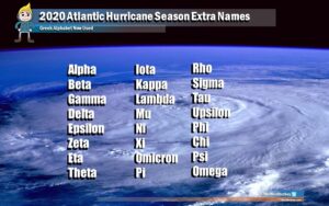
Epsilon was the tenth hurricane of the season that has produced 26 named tropical cyclones so far in the basin. Should another tropical cyclone form here before the end of the year, it would be named Zeta. Only once before was there a Zeta; it formed in December 2005. If another tropical cyclone were to earn a name in the Atlantic beyond Zeta, it would be called Eta and it would be the first time the name was ever used for a storm.