There’s a flurry of online rumor and speculation with talk of an east coast snowstorm arriving in time for Thanksgiving –but is a blizzard really going to happen? According to the latest computer forecast guidance, the answer is an emphatic no. But it does look like conditions will be stormy in and along the heavily trafficked I-95 corridor in the Mid Atlantic and Northeast around Thanksgiving and Black Friday which could bring substantial rain and snow to portions of the eastern U.S., but no blockbuster blizzard at this time.
Forecast models used by meteorologists to aid with their weather forecasting have been suggesting the possibility that December may kick off on a snowy note across portions of the Mid Atlantic and Northeast; while lake effect snow is likely throughout the rest of this month, there could be a more substantial winter weather event away from the Great Lakes in December’s first days. But after a light snow event actually brought pockets of heavy snow to portions of the northeast on Friday, with High Point, New Jersey getting 20″ , Vernon, NJ getting 12″, and Lake Harmony, Pennsylvania getting 15″, many area eager to know when any additional accumulating snow will arrive.
The GFS and ECMWF are among many computer models meteorologists use to assist in weather forecasting. While meteorologists have many tools at their disposal to create weather forecasts, two primary global forecast models they do use are the ECMWF from Europe and the GFS from the United States. While the models share a lot of the same initial data, they differ with how they digest that data and compute possible outcomes. One is better than the other in some scenarios, while the opposite is true in others. No model is “right” all the time. Beyond the ECMWF and GFS models, there are numerous other models from other countries, other academic institutions, and private industry that are also considered when making a forecast.
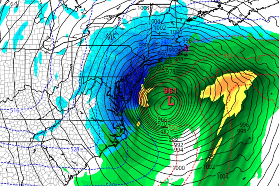
Just days ago, both the GFS and ECMWF models were calling for a substantial snowstorm in the northeast, with the area along and north and west of the I-95 corridor from Philadelphia to New York City to Boston set to receive more than 8″ of snow; some locations were even projecting more than 20″ of snowfall.
But now, as expected, the global forecast models have changed their tune. While the latest model output brings much needed precipitation to portions of the Mid Atlantic and Northeast, much of it is in liquid form.
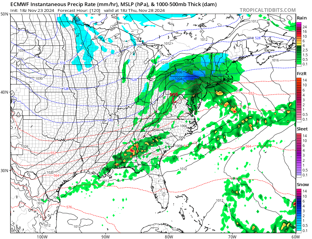
The latest model run from Europe shows a low pressure system intensifying as it swings through the northeast, bringing mainly rain and some Great Lakes snow with it, with a line of showers and thunderstorms lined up along a cold front stretching to the Gulf Coast. This scenario makes Black Friday wet and raw for the first half of the day across New England, with colder air wrapping behind the system as it departs the northeast. That wrap-around cold air will help turn any rain showers to snow showers, although most snow activity should be confined to the typical Lake Effect Snow Belt areas.
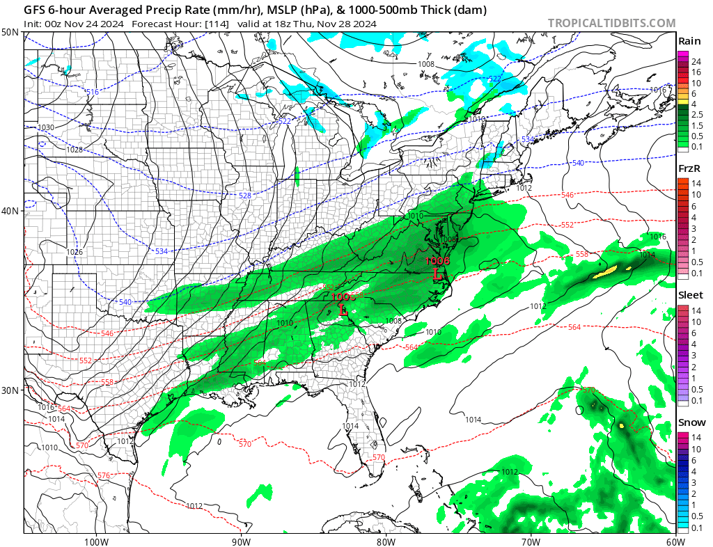
The latest American GFS model output is much more tame than it was just days ago; it has a more progressive system sliding across the Mid Atlantic, bringing rain showers there and to the New England Coast Thanksgiving into Friday. It intensifies the area of low pressure, but unlike its European counterpart, it does so near the Canadian Maritimes, preventing much of the U.S. from getting more significant precipitation. Wrap around snow is likely across the northern half of Maine and that snow should linger throughout most of the holiday weekend. But down the I-95 corridor to the heavily populated regions, if the GFS were to verify, much of the Mid Atlantic would be dry on Black Friday, including the big cities of Philadelphia and New York.
The National Weather Service continues to take a wait-and-see approach with their holiday forecast for now. In their latest Forecast Discussion, the Mount Holly, New Jersey office of the National Weather Services writes, “The weather for Wednesday night and much of Thursday will be determined by the path of a low pressure system which is expected to develop across the Tenn. or lower Ohio Valley and track to the east. A few forecasts model have a low moving to the Tidewater area of Virginia and the deepening as it moves up the coast. This would allow plenty of clouds and rain for our region. Up across the far north, it could be cold enough for snow to occur too. Other forecast models either don’t have the low, or show it weaker and further north….Stay tuned for more updates with this system, since we will be monitoring it into early next week and more details will become available as we get closer to the time of the event.”
