An extremely potent storm system is blasting through the eastern United States, surely bringing something not on anyone’s Christmas gift wish list: tornadoes, destructive winds, and life-threatening floods. The storm system responsible for this severe weather is in southeastern Canada, but it is dragging a cold front through the eastern part of the U.S.. It is this front that will be the focus of the bad weather.
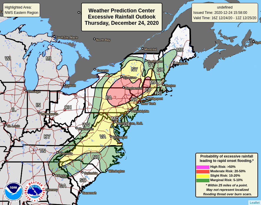
The first problem will be heavy rain. A widespread 2-3″ will fall across the eastern U.S., with some areas of New Jersey and Pennsylvania getting over 4″ of rain. With parts of New England still under substantial snowpack, the rain combined with the snow melt could make flooding problems worse. The National Weather Service is warning people: “Turn around, don’t drown; never drive through flood waters.”
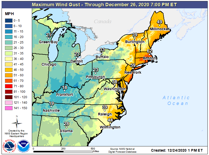
The next problem will be destructive winds. Winds will be gusting to tropical storm and near-hurricane strength across coastal areas of the northern Mid Atlantic and New England areas. The highest winds will be along the Jersey Shore, most of Long Island, Rhode Island, eastern Connecticut, and much of southeastern Massachusetts; gusts in these areas could be as high as 65-75 mph. Winds could gust as high as 44 mph in Wilmington, North Carolina, 38 mph in Washington, DC, 59 mph in New York City, and 62 mph in Boston.
Strong winds can damage holiday decorations, dislodge branches, and knock over trees. Flying debris and the winds alone could be strong enough to knock down wires too. People in high wind areas should expect power outages for Christmas Day. Due to the holiday and the ongoing global pandemic, some power outages could last for more than a day.
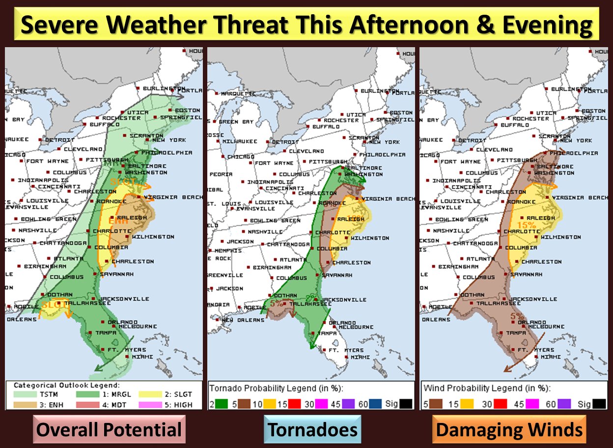
Tornadoes are possible too. The National Weather Service has issued Tornado Watches and Warnings for portions of the Carolinas. Severe weather is likely into tonight, although most severe storms should be confined to the central Mid Atlantic area and points south. The greatest threat of tornadoes will be from southeastern Virginia across eastern North Carolina and northeastern South Carolina.
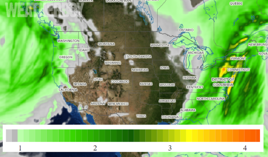
RADAR simulations from computer models show two waves of intense precipitation and thunderstorms slicing through the east; one near midnight, give or take a few hours depending on location, and another near sunrise, give or take a few hours depending on location. The most intense winds will occur in either the heaviest downpours or thunderstorms that fire up in this storm.
As the front clears the coast, rain will change to snow across portions of Pennsylvania and New York, where accumulating snow is possible, especially down-wind of the Great Lakes in the traditional lake effect snow areas. A stray snow flake or flurry may make its way to Washington, DC, Philadelphia, New York City, and even Boston, but in all of those areas, no accumulation of snow at all is expected on Christmas Day.
