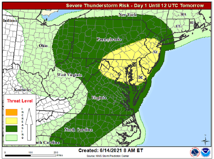
Severe weather is likely to break-out across portions of the Mid Atlantic today, with portions of Pennsylvania, New Jersey, Maryland, Delaware, and Virginia having the greatest odds of severe thunderstorms. Thunderstorms that blossom in this area could create damaging wind gusts, large hail, and even isolated tornadoes.
According to the National Weather Service’s Storm Prediction Center (SPC), Thunderstorms associated with damaging wind gusts and hail will be possible across Pennsylvania into parts of the Mid Atlantic this afternoon through early tonight. Isolated large hail and damaging gusts may also occur across the Piedmont of the Carolinas, as well as the central and northern High Plains this afternoon/evening.
A midlevel shortwave trough over the upper Great Lakes that will dig southeastward toward New York and the central Appalachians today is responsible for this severe weather outbreak. The midlevel trough will be preceded by a weak surface cold front that will move across Ohio, Pennsylvania, and western New York this afternoon; this same front will reach the Mid Atlantic coast by overnight tonight. While this frontal system could generate a severe weather outbreak, it will also help bump a developing tropical cyclone along the Mid Atlantic coast out to sea.
According to the SPC, surface heating today will boost temperatures into the mid 70s to lower 80s from southern and eastern Ohio into Pennsylvania ahead of the front, where boundary-layer dewpoints will range from the mid 50s to lower 60s. This will support moderate buoyancy with steep low-level lapse rates in response to surface heating and mixing, setting the stage for severe thunderstorm formation.
The SPC says that storm initiation will likely occur by early afternoon near the Pennsylvania/Ohio border as the band of weak convection now over Lower Michigan intersects the destabilizing
warm sector. In this type of set-up, there will be a mix of supercells and organized multicell clusters capable of producing damaging winds and isolated large hail. The convection will spread east-southeastward across Pennsylvania through the afternoon and evening, reaching the Mid-Atlantic coast tonight.
While hail is possible from central New York state south to central North Carolina and from eastern Ohio east to New Jersey, damaging wind gusts will be today’s primary severe weather threat. The risk of damaging winds is greatest over the southern half of Pennsylvania, most of New Jersey, Maryland, and Delaware, and portions of northeastern Virginia. Washington, DC could also see damaging wind gusts. There is a risk of isolated tornadoes in these storms, with the best chance of tornado formation in the southern half of Pennsylvania, northern Maryland, northern Delaware, and southwestern New Jersey. The Philadelphia metro area is included in this elevated tornado risk area. While there is an elevated risk of tornadoes today, they will be very isolated if they do indeed form.
As the front exits the coast, the threat of severe weather will diminish tonight.
