According to the National Hurricane Center (NHC), data from an Air Force Reserve reconnaissance aircraft, NOAA Doppler weather radars, and surface observations indicate that the center of Henri, which weakened from a hurricane to a tropical storm earlier today, made landfall along the coast of Rhode Island near Westerly at approximately 12:15 pm today. At the time of landfall, maximum sustained winds were estimated to be 60 mph.
A Weatherflow station near Point Judith, Rhode Island, measured a sustained wind of 57 mph and a gust to 70 mph near the time of landfall. The center of Henri passed over Block Island, Rhode
Island, around 11: 00 am.
As of 2pm, the center of Henri was located about 5 miles east of Westerly, Rhode Island and about 40 miles south-southwest of Providence, Rhode Island. Maximum sustained winds are down to 50
While all Hurricane and Storm Surge Warnings have been discontinued, Tropical Storm Warnings remain up for Block Island, Nantucket, Martha’s Vineyard, and from East Rockaway Inlet, New York, to Chatham, Massachusetts, including Long Island, as gusty winds continue to impact the region.
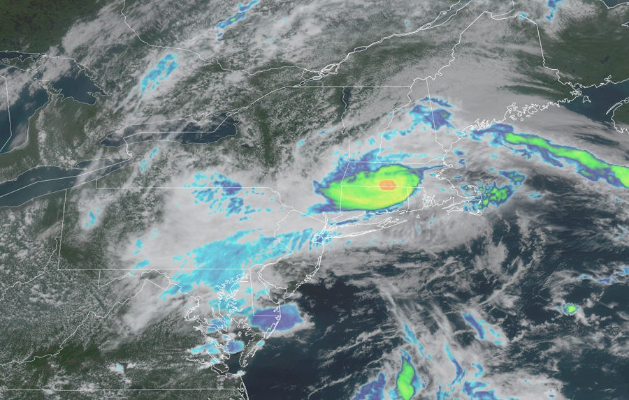
While storm surge and wind threats will lessen over time, Henri will still be a dangerous rain maker and flood producer. Henri is expected to produce rainfall amounts of 3-6″ over portions of Long Island, New England, southeast New York, New Jersey, and northeast Pennsylvania Sunday into Monday, with isolated maximum totals near 12″. Heavy rainfall from Henri may result in considerable flash, urban, and small stream flooding, along with the potential for widespread minor to isolated moderate river flooding.
A State of Emergency was declared in the Middlesex County town of Monroe Township, while adjacent areas of Jamesburg and Cranbury were hit hard too early today as flood waters overwhelmed the communities, trapping people in their flooded-out homes or trapping them in their cars. More than 40 water-rescues were needed in the senior community of Rossmoor in Monroe Township, where water submerged cars and came several feet up into peoples’ homes there. Many roads and bridges are closed in central New Jersey due to the extreme flooding created by Henri.
Henri is expected to slow down further and possibly stall near the Connecticut-New York border tonight, with an east-northeastward motion across northern Connecticut and southern Massachusetts on expected on Monday.
