A powerful bomb cyclone is unfolding over the Great Lakes over the next 24 hours, bringing destructive winds, coastal flooding, heavy rain, heavy snow, and a drastic, frigid temperature drop to a significant area. Due to threats from the storm, officials have started to order evacuations for portions of Upstate New York; U.S. President Joe Biden today warned people of the dangers, urging those in the Northeast, Mid Atlantic, and Great Lakes regions to “get out now” if they had travel plans over the next few days.
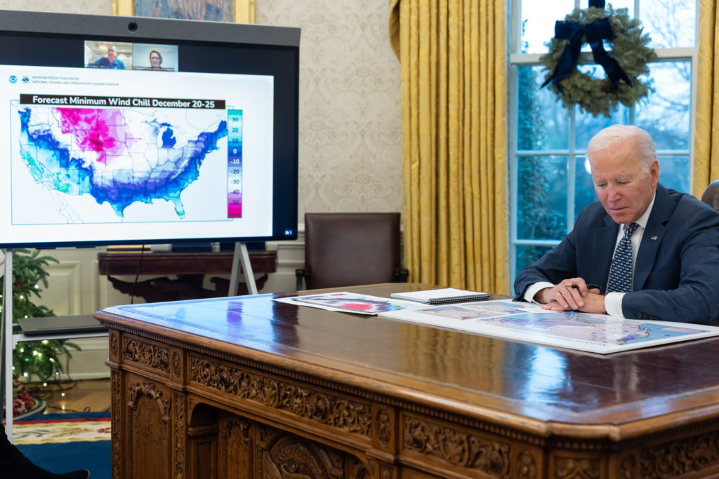
At the White House, after a briefing on the bomb cyclone, President Biden said: “This is not like a snow day when you were a kid. This is serious stuff.”
A meteorological process known as explosive cyclogenesis will create a bomb cyclone, which is an area of intense low pressure which drops significantly over a short period of time. Generally, an area of low pressure must drop by more than 24 mb in a 24 hour period, although the criteria changes at different latitudes. Bomb cyclones are common over the Pacific Ocean, especially the North Pacific near Alaska, and will sometimes form in the Atlantic from time to time; they could happen on land sometimes too, although it’s very rare. And it looks like such a rare scenario is about to unfold now over the Great Lakes. Some computer forecast models suggest that surface pressure could collapse by as much as 40 mb over a 24 hour period.
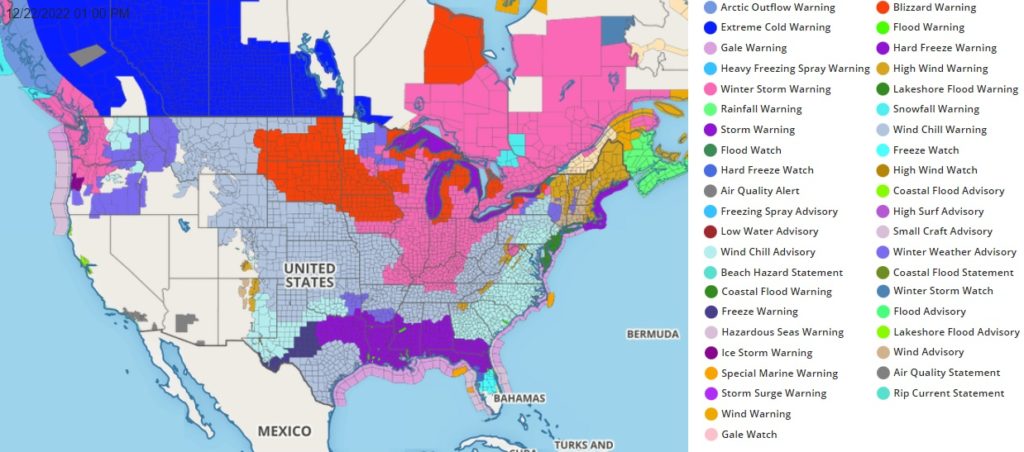
According to the National Weather Service in College Park, Maryland, over 200 million people, or roughly 60% of the U.S. population, are under some form of winter weather warnings or advisories across the United States. This includes nearly 177 million for wind chill warnings or advisories, 11 million for blizzard warning, 65 million for winter storm warnings, and 500,000 for ice storm warnings.
This storm will likely will have increasingly widespread impacts to travel going into the busy holiday travel time late this week, along with the potential for power outages from the expected high winds, heavy snows, significant icing and overall increased power consumption in places.
“It’s dangerous and threatening, it’s really very serious weather and it goes from Oklahoma all the way to Wyoming and Maine. …So I encourage everyone to please heed local warnings,” President Biden said in the Oval Office of the White House today. “If you all have travel plans, leave now, not a joke. I’m sending my staff … if they have plans to leave tomorrow, I’m telling them leave now.”
The Bomb Cyclone’s powerful winds of 50-70 mph are forecast to drive water up and out of Lake Erie in the height of the storm, driving a storm surge into the shore in Upstate New York. In addition to the rising storm surge, a flash freeze scenario in which temperatures drop more than 25 degrees within an hour will freeze and expand any flood water, trapping anyone or anything left behind in frigid conditions. As a result of that danger, Hamburg Supervisor Randy Hoak announced that Hoover Beach residents must evacuate no later than 8 pm tonight.
The powerful arctic front that brought huge temperature drops across the Plains over the past 24 hours will be sweeping eastward across the eastern third of the nation Thursday night into Friday behind the Bomb Cyclone. Many locations from portions of the Northern Rockies into the Central to Southern High Plains saw temperatures drops greater than 50 degrees in the wake of the passage of the arctic front, including 67 degrees colder at Cheyenne, Wyoming and 72 degrees colder at Denver, Colorado. While the temperature drops behind the arctic front are not expected to be as great from the Mississippi Valley into the eastern U.S., it will still feel abruptly colder with many locations 30-40 degrees colder in the wake of the arctic front. Widespread record low maximum temperature are possible Friday from the Lower Mississippi Valley, northeastward into the Tennessee and Ohio Valleys and stretching across large sections of the east from the Southeast, through the Southern to Central Appalachians and into the Mid-Atlantic on Friday. In addition to the very cold temperatures, high winds in the wake of the front will produce dangerous wind chill readings across nearly all of the central to eastern United States.

In addition to the very cold temperatures, a developing low pressure system along the arctic front over the Mid West and Great Lakes regions will produce widespread heavy snows from portions of the Mid West into the Great Lakes on Friday. This will be followed by active lake effect snow showers downwind of all of the Great Lakes on Saturday as the very cold arctic air streams across the Great Lakes. Blizzard Warnings and Winter Storm warnings are currently in effect from the Great Lakes, Mid West, Middle to Upper Mississippi Valley and into the Northern Plains.
Fortunately, the Bomb Cyclone will be a quick mover and is forecast to move into southeastern Canada by Christmas Eve. Conditions will generally moderate across much of the United States in its wake from west to east.
The latest NAM shows the #BombCyclone marching into Canada for Christmas Eve. pic.twitter.com/KxRbMjjvuo
— the Weatherboy (@theWeatherboy) December 22, 2022