
There is an elevated tornado threat today in portions of northern New Jersey, eastern Pennsylvania, Maryland, West Virginia, and New York, northern Virginia, southern New Hampshire and Vermont, northwestern Connecticut, and western Massachussetts. The National Weather Service’s Storm Prediction Center has flagged this region for an elevated tornado risk which is part of a broader area expected to see severe thunderstorms today.
Strong to severe storms are possible this afternoon into evening from parts of the Carolinas into the Mid-Atlantic and Northeast. An isolated severe threat may develop across the Southeast, and also across parts of the Great Basin. According to the Storm Prediction Center (SPC), the primary severe risk will focus today across parts of the Mid-Atlantic into southern New England, including western/northern Virginia and parts of West Virginia/Maryland into southern/eastern Pennsylvania to southeast New York and southern New England. Even with higher-level cloud cover spreading into the region, ample heating will occur within the prefrontal warm sector, generally coincident with near 60/lower 60s surface dewpoints in the lee of the Appalachians, with significant atmospheric energy available from Virginia/Delmarva into southeast Pennsylvania and New Jersey.
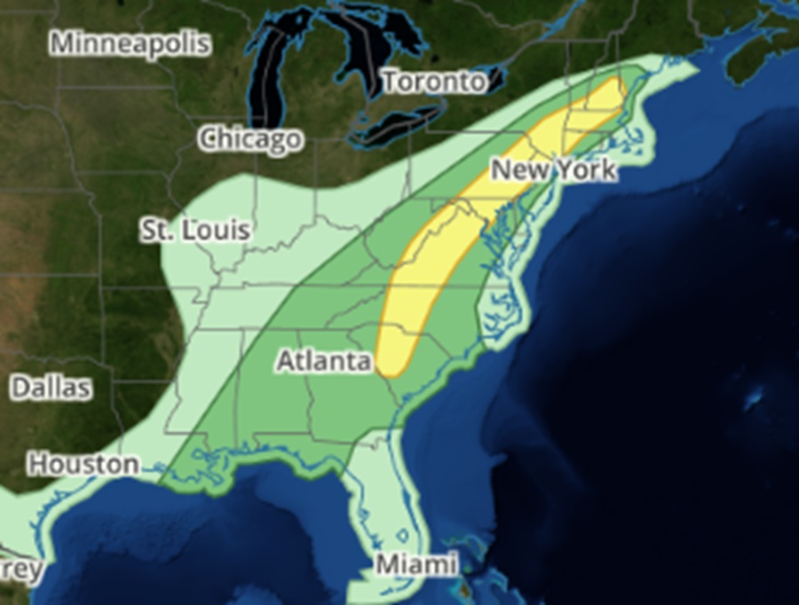
The SPC believes that organized cells and clusters of storms should develop during the afternoon from the Mid-Atlantic into southern New England as a frontal wave and modestly enhanced low-level jet move northeastward across the region.
“These storms will pose a threat of damaging winds and isolated hail, and possibly some localized tornado potential,” the SPC warns.
Farther south, scattered storm development is expected during the afternoon near/east of the Blue Ridge. Moderate buoyancy and shear and relatively steep low-level lapse rates will support a threat of damaging wind and hail with the strongest storms.
