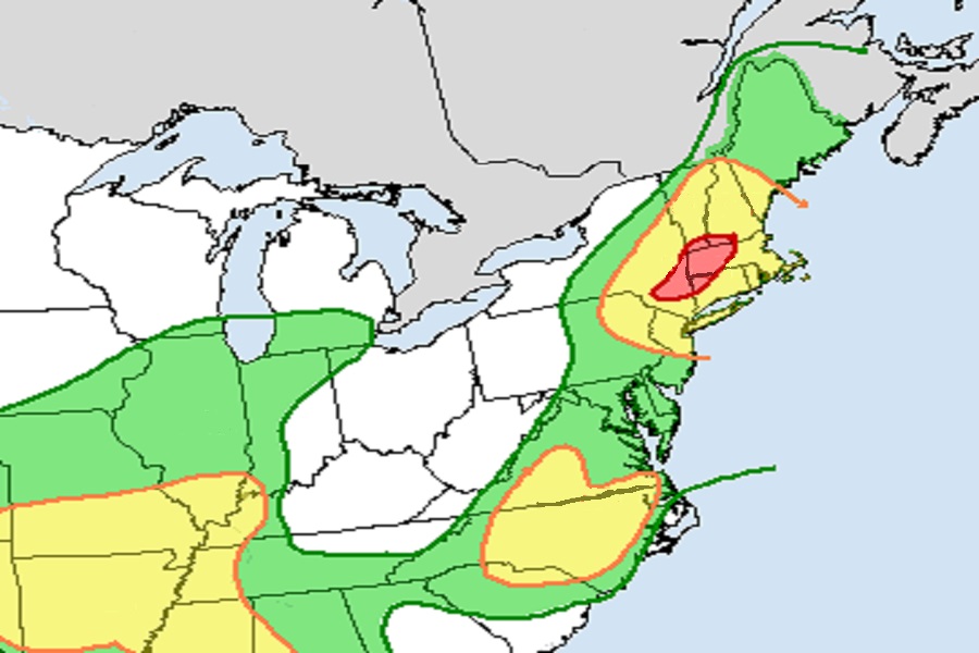
Another round of severe storms and flooding rains is likely to develop today between New Jersey and Vermont while a broader area of gusty strong to severe thunderstorms is possible from New England to the Carolinas. This atmospheric set-up is keeping meteorologists with the National Weather Service’s Storm Prediction Center and the Weather Prediction Center busy with a variety of meteorological hazards.
According to the Storm Prediction Center, diurnal heating of a moist air mass where dew points are averaging in the upper 60s to mid 70s) will lead to moderate atmospheric instability across a rather large area this afternoon. A weak shortwave trough will approach the mid-Atlantic states this afternoon, contributing to the development of widely scattered thunderstorms from North Carolina across the Mid-Atlantic into southern New England. Winds aloft will be relatively weak, but the potential will exist for a few slow-moving multicell clusters capable of gusty, damaging winds this afternoon and early evening. While isolated tornadoes are possible, conditions aren’t ripe to produce tornadic cells today as they have been in past bouts with severe weather.
Here we go again! More strong to severe thunderstorms, and more heavy downpours that could lead to localized flash flooding: https://t.co/Cm9MuzdRA9
— the Weatherboy (@theWeatherboy) July 14, 2023
According to the Weather Prediction Center, these storms and showers will produce more heavy rain in areas still recovering from major floods just days ago. The greatest threat of flooding rain from excessive rainfall is over southeastern New York , northwestern Connecticut, western Massachussetts, southern Vermont, and southwestern New Hampshire. Through the remainder of the day, according to the Weather Prediction Center, models focus most convective development from northeastern Pennsylvania through southern New York, with lower chances of storms farther southeast across Connecticut in the wake of morning convection in that area. The categorical risk adjustments are also consistent with model trends. Areas of 1-2″/hour rain rates and backbuilding and training could impact the northeast today, including the New York City metro area by the early evening hours. Robust convective development across central and eastern North Carolina this morning has left behind an outflow boundary across that area, leaving some doubt regarding convective coverage in eastern Virginia this afternoon. Surface dewpoints are still in the 70-76 range in eastern Virginia though, and any sunshine in the wake of morning rainfall could destabilize the area and cause a few storms to develop. With the greater focus for convective development now evident across central and eastern North Carolina, there is also an increased flash flood potential in North Carolina today.
Unfortunately, the northeastern U.S. isn’t out of the woods when it comes to flood threats anytime soon. More heavy rain and strong to severe thunderstorms are possible on Sunday again.
