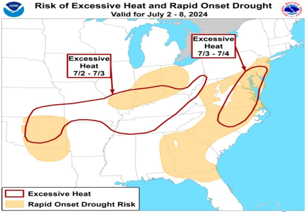
The recent heat wave which brought triple-digit readings to cities in the East also helped bake away plenty of moisture that fell earlier this year, resulting in growing drought concerns. According to the National Weather Service’s Climate Prediction Center, the risk of a rapid onset of drought is greatest along the Mid Atlantic and interior Southeast, the area north of the Ohio River Valley, and portions of Oklahoma and Texas.
According to the CPC, persistent warmer and drier than normal conditions over at least the last 2 weeks have impacted parts of the Mid-Atlantic, Southeast, and Southern Plains. These conditions have caused a risk of rapid onset drought. Hot and dry weather is likely to continue through the first week of July, with a moderate risk (40-60% chance) of excessive heat for several locations leading up to and including the 4th of July.
The two areas of greatest concern of excessive heat next week is from New Jersey to North Carolina, and from Oklahoma to Ohio. While periodic, localized heavy precipitation cannot be ruled out due to frontal and/or daytime thunderstorm activity, which may provide temporary relief, no widespread heavy rainfall is forecast for either of these areas over the next 7-14 days.
Dry soils, stressed vegetation, and reduced water availability due to low streamflows and groundwater may lead to increased impacts to agriculture and livestock, as well as increased fire danger. According to the CPC, several areas are already experiencing these impacts.
