The National Hurricane Center is tracking a new area of disturbed weather in the Atlantic Ocean likely to become a tropical cyclone behind where Hurricane Erin is now. However, it is also likely that like Erin, this new developing system will probably not directly impact the U.S. either.
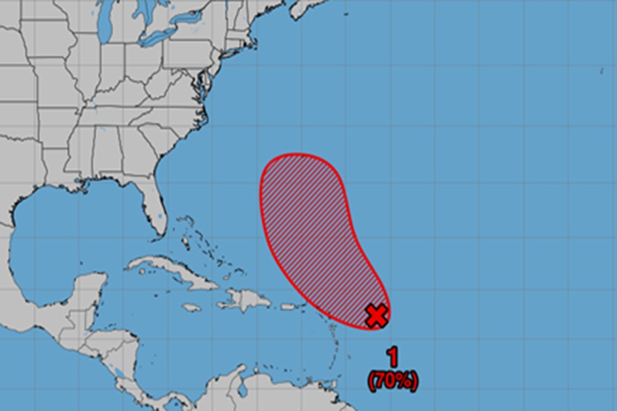
The disturbance in question is an area of disorganized showers and thunderstorms associated with a tropical wave is located a few hundred miles east of the Leeward Islands. According to the National Hurricane Center, environmental conditions appear conducive for further development of this system, and a tropical depression is likely to form this weekend while it moves near or to the north of the northern Leeward Islands.

Right now, the National Hurricane Center says there’s a 50-50 chance that a tropical cyclone will form within the next 48 hours but grows those odds to “likely” over the next 7 days, saying there is a 70% chance of tropical cyclone formation.
With Hurricane Erin heading north and east away from North America today, it is likely this new developing system would follow it too. Extended range guidance from computer forecast models suggest the storm will curve out to see even if it does develop into a tropical cyclone. While some guidance suggests potential impacts to Newfoundland, it appears Nova Scotia and the entire U.S. East Coast isn’t at risk of any direct strike from this storm.
The Atlantic Hurricane Season continues through to the end of November; the next few weeks are considered the typical peak of the season with the most tropical cyclone activity in the basin.
