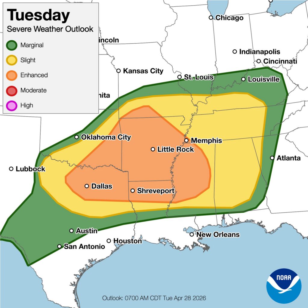
The National Weather Service’s Storm Prediction Center (SPC) is warning that more severe weather is likely again across portions of the southern Plains into the lower Mississippi/Tennessee Valleys and Southeast through this evening. Among the severe weather threats today is the chance giant hail of 2-4″ or greater in diameter will fall. Swaths of severe and damaging winds and a few tornadoes are also all possible.
First, a loosely organized complex of storms continues to progress east-northeastward along the Red River of southeast Oklahoma/northeast Texas and broader parts of eastern Oklahoma. According to the SPC, additional increasingly surface-based development seems probable on this near-frontal zone and associated moist axis and thermal gradient that extends east-northeastward to the Mid-South and ArkLaMiss area. Other initially elevated severe storms are expected to continue and increase today from northeast Oklahoma across the Ozarks toward parts of the Mid-South/Mississippi Valley.
The SPC says, “Broadly speaking outside on ongoing storms, a strongly unstable airmass exists across the southern Plains to the ArkLaTex, along and near a slowly retreating/northward-returning warm front. This is beneath relatively strong winds aloft, particularly in mid/high-levels based on morning upper-air data.” They add, “Additional intense surface-based convective development is forecast near the triple point in north-central Texas towards the ArkLaTex this afternoon…”
Very large to giant hail of 2-4″+ may occur with the strongest supercells given the overall very favorable environment and presence of steep mid-level lapse rates.
The SPC also says that some tornado threat may also exist with these supercells, even though
low-level shear is not forecast to be overly strong.
