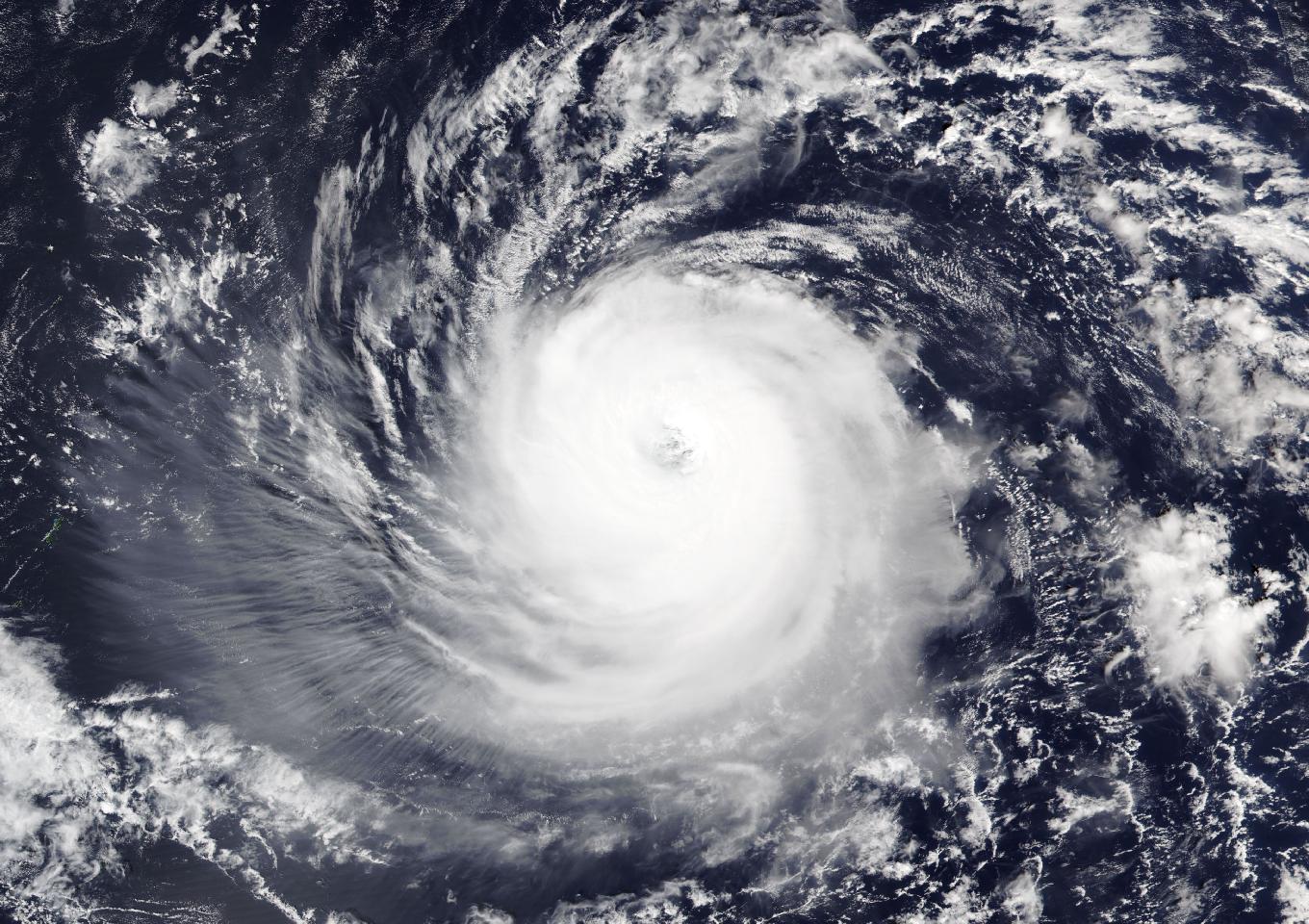
Typhoon In-fa churned toward the far northern Commonwealth of the Northern Mariana Islands on Thursday with maximum sustained winds of 140 mph, and forecasters said the compact Category 4 storm could pass close to or over Agrihan on Friday evening, bringing destructive winds, up to a foot of rain and several feet of coastal inundation to the remote islands.
A Typhoon Warning remained in effect for Alamagan, Pagan and Agrihan, the National Weather Service office in Tiyan, Guam, said in its 7 p.m. Chamorro Standard Time advisory, which was issued at 4:28 a.m. CDT Thursday. A typhoon warning means typhoon conditions, including winds of 74 mph or more, are expected, with damaging winds of 39 mph or more beginning within 24 hours.
At that time, In-fa’s center was about 420 miles east of Alamagan and 450 miles east-southeast of Agrihan, moving west-northwest at 20 mph.
Key Takeaways
1. Typhoon In-fa, a Category 4 storm with 140 mph sustained winds, is forecast to pass close to or over Agrihan on Friday afternoon or evening local time, with a typhoon warning in effect for Alamagan, Pagan and Agrihan.
2. The weather service warned of destructive winds of 110 to 130 mph with gusts up to 180 mph near the center, 8 to 12 inches of rain and coastal inundation of 3 to 6 feet on Agrihan.
3. Guam, Rota, Tinian and Saipan are expected to escape the strongest winds, but forecasters warned of dangerous surf and rip currents across the Marianas into the weekend.
Destructive Winds Expected Near the Center
The weather service said In-fa was expected to turn slightly toward the northwest and slow down through Saturday, a track that would take it close to Agrihan on Friday afternoon or evening. Forecasters said the storm’s strength could waver between 140 and 145 mph through Saturday before it weakens to a Category 3 typhoon Saturday night.
Typhoon-force winds extended outward up to 80 miles from the center, and tropical storm-force winds extended up to 175 miles, according to the advisory.
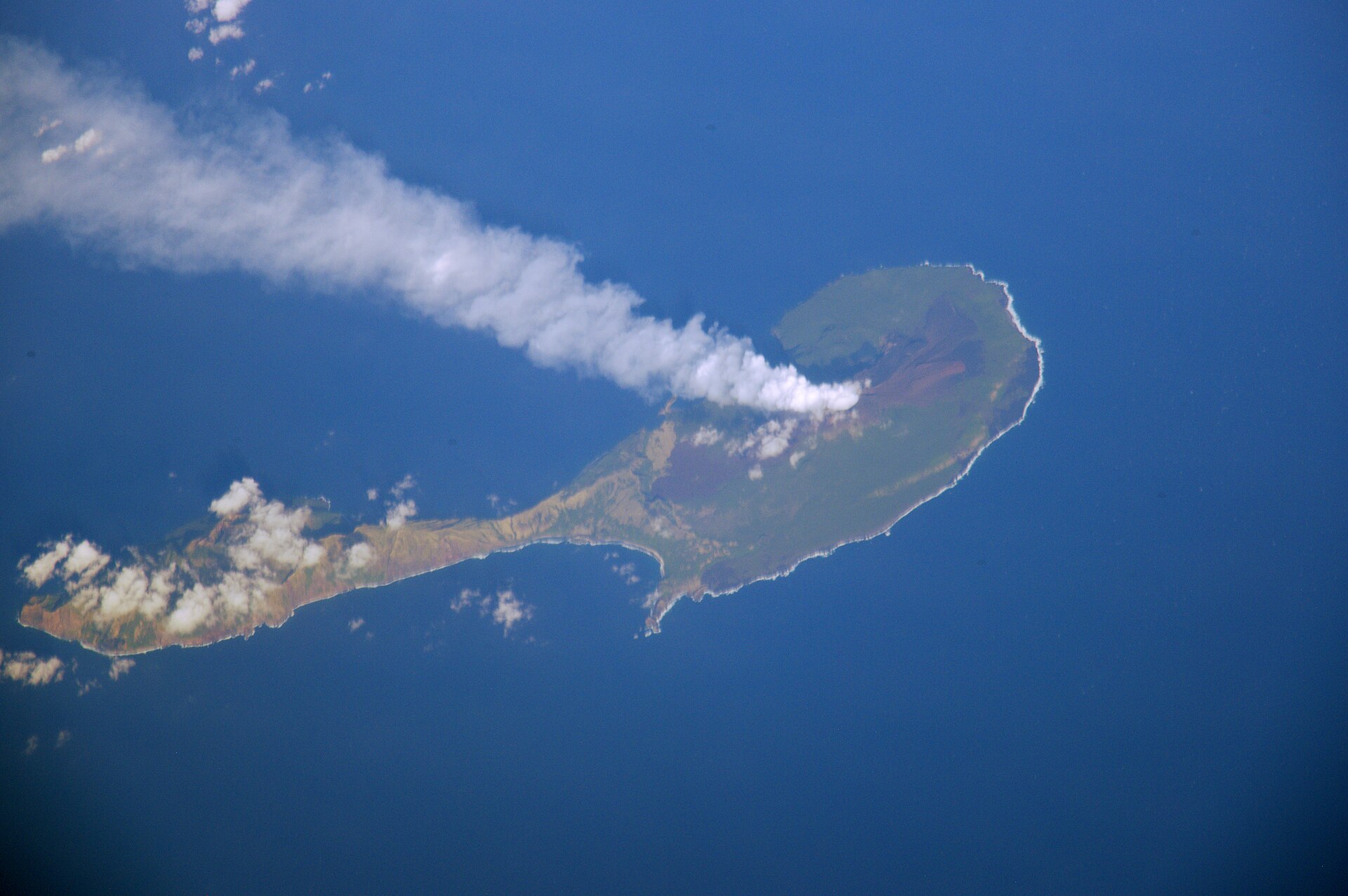
In a tropical cyclone local statement issued at 8:50 p.m. local time Thursday, the weather service said damaging tropical storm conditions would begin on Agrihan on Friday afternoon, with winds of 40 to 60 mph and gusts to 80 mph. Winds were forecast to keep climbing through Friday evening, with destructive winds of 110 to 130 mph possible near the center and gusts up to 180 mph.
“Direction of the winds will change quickly due to the proximity of the center of TY In-fa to Agrihan,” the statement said. Winds were forecast to diminish after midnight, with damaging tropical storm-force winds expected to exit the area Saturday morning.
Pagan and Alamagan could see destructive winds of 80 to 100 mph with gusts up to 150 mph, with Alamagan seeing less than Pagan, the weather service said.
Rain and the ocean also pose serious threats. The weather service said 8 to 12 inches of rain, with locally higher amounts, could fall on Agrihan through Saturday, and 6 to 10 inches could fall on Pagan and Alamagan. Surf of 13 to 19 feet was possible along reefs closest to the center’s passage, and the statement warned of significant coastal inundation of 3 to 6 feet near the center on Agrihan and 2 to 4 feet on Pagan and Alamagan.

A Small Storm with a Narrow Core
Forecasters have stressed that In-fa’s exact track will make a large difference for the northern islands.
“A direct hit would bring the full force of this Category-4 typhoon. However, an eye passage even 15 miles away would result in much less wind and damage overall,” Landon Aydlett, warning coordination meteorologist at the weather service office in Guam, said in an alert distributed Thursday afternoon, according to The Guam Daily Post.
Ken Kleeschulte, lead meteorologist at the Guam office, told the newspaper Thursday morning that the 7 a.m. forecast showed the eye passing about 8 miles from Agrihan around 8 p.m. Friday. Because the storm is compact, he said, it will be “going through some pretty high winds in a small spot.”
Aydlett said Wednesday that the storm’s forward speed was good news for the northern islands. “This will not be crawling over them or lingering for a couple days, but it’s going to move right on by around 15 to 18 miles per hour on Friday,” he said, according to the Post.
In-fa briefly reached super typhoon strength earlier this week. The weather service upgraded it to a super typhoon in a local statement Wednesday, and the Post reported that its winds reached 150 mph Wednesday evening before easing. The weather service counts In-fa as the seventh super typhoon in the western North Pacific this year and the seventh tropical cyclone to pass through the Marianas in 2026, the Post reported.
Residents Told to Shelter
The CNMI Office of Homeland Security and Emergency Management said in a bulletin Thursday morning that Gov. David M. Apatang was maintaining Typhoon Condition III for Agrihan, Pagan and Alamagan.
Earlier in the week, the agency said residents of the Northern Islands should be in safe shelter by Friday morning. Radio New Zealand reported that residents were urged to remain in shelter from Friday morning until sunrise Saturday and to secure food, water, medication, flashlights, batteries and radios.
The weather service urged people on the three islands to bring small loose objects indoors and stock up on a few days’ worth of food, water and medication. “If no concrete shelter is available, look for a cave or something similar,” its statement said.
Little Wind, Big Waves Farther South
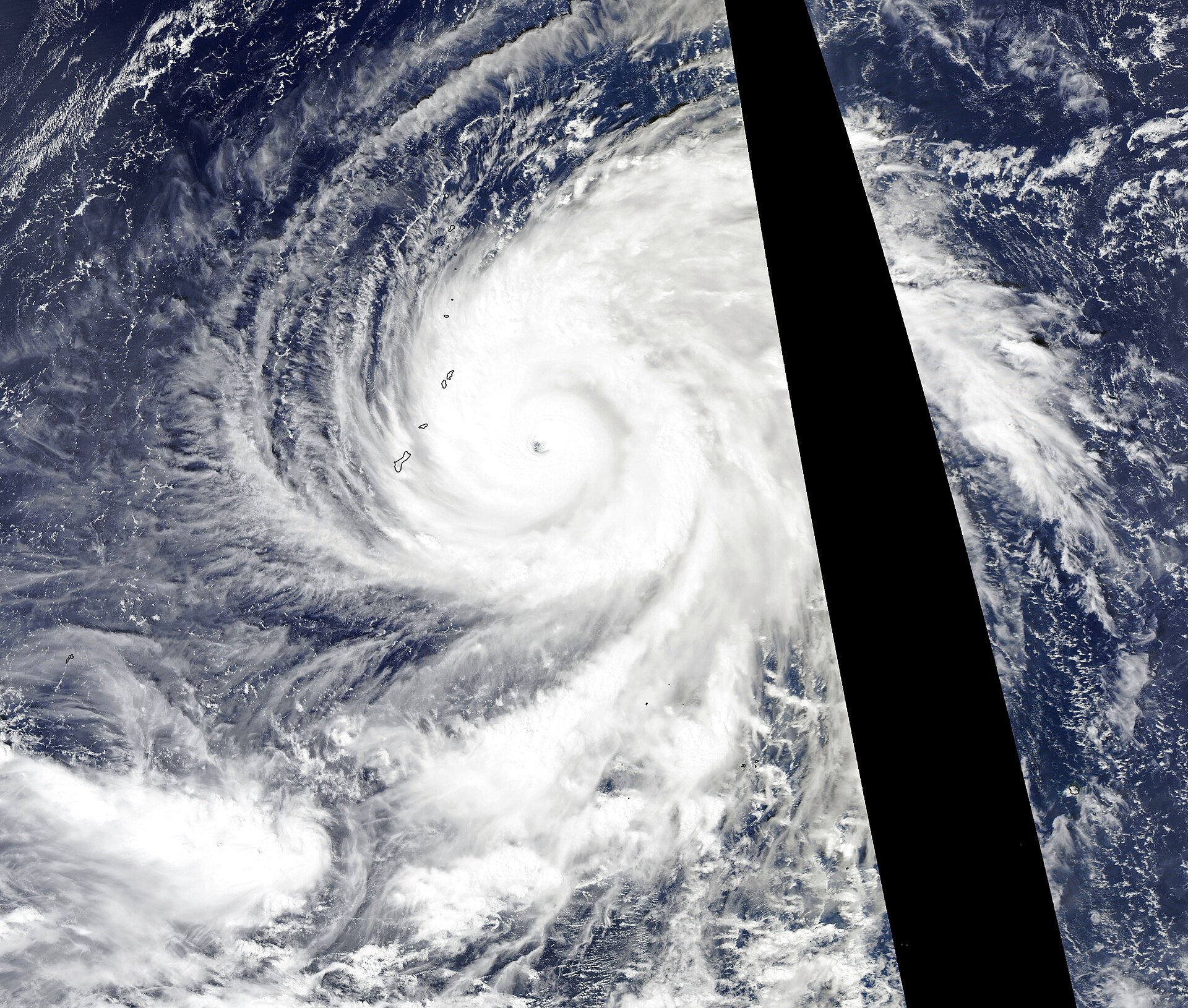
The more populated southern islands are expected to avoid the worst of the storm. Guam, Rota, Tinian and Saipan should see generally fair weather, Kleeschulte told the Post. He said the storm’s closest approach to Guam, about 341 miles to the northeast, would come Friday afternoon. “We’re not going to see anything out of it,” he said.
The water is another matter. A high surf warning was in effect for north- and east-facing reefs of Tinian and Saipan from 1 a.m. to 4 p.m. Friday local time, with dangerously large breaking waves of 12 to 18 feet expected, the weather service said. Dangerous rip currents and isolated minor coastal flooding up to 1 foot were also expected.
“Everyone should remain out of the water due to life-threatening surf conditions,” the warning said.
“There’s going to be some pretty hefty waves, strong rip currents, high surf,” Kleeschulte said, according to the Post. He estimated swells of 9 to 12 feet for Guam and Rota and possibly 15 feet or higher for Tinian and Saipan.
What Comes Next
Once it passes the Marianas, In-fa is forecast to keep moving west and weaken slowly. Kleeschulte told the Post it still appeared likely to be a Category 3 storm on Tuesday, when the current forecast ends. Asked whether it could move farther south, he said, “Always possible, but not likely.”
The storm arrives almost exactly eight years after Super Typhoon Yutu struck the Commonwealth of the Northern Mariana Islands on Oct. 25, 2018, devastating Tinian and Saipan. In-fa’s forecast track keeps its core far north of those islands.
