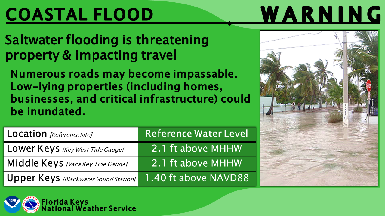
Seawater covered roads in low-lying neighborhoods across the Florida Keys for another night as the year’s highest tides combined with days of strong northeasterly winds, and the National Weather Service kept a coastal flood warning for major saltwater flooding in effect for the entire island chain until 5 a.m. EDT Friday.
Tide gauges along the Keys recorded peak water levels about 2 to 2.5 feet above normal high tide just after midnight, the weather service office in Key West said early Thursday. Preliminary NOAA data showed the Key West gauge peaked at about 2.4 feet above mean higher high water, a measure of the average daily high tide, at 11:48 p.m. Wednesday. That was the highest reading of the week and above the 2.1-foot level the Key West office uses as a reference for coastal flood warnings.
“Numerous roads may be closed. Low lying property including homes, businesses, and some critical infrastructure will be inundated,” the warning said.
Key Takeaways
1. A coastal flood warning for major saltwater flooding covers the Upper, Middle and Lower Keys until 5 a.m. EDT Friday as seasonal king tides peak.
2. Preliminary NOAA data showed water at the Key West tide gauge about 2.4 feet above the average daily high tide late Wednesday, the highest reading of the week and above the local warning reference level.
3. Officials urged drivers to avoid saltwater on flooded roads, and forecasters said water levels will fall only slowly, especially in the Upper Keys.
Water Over The Roads
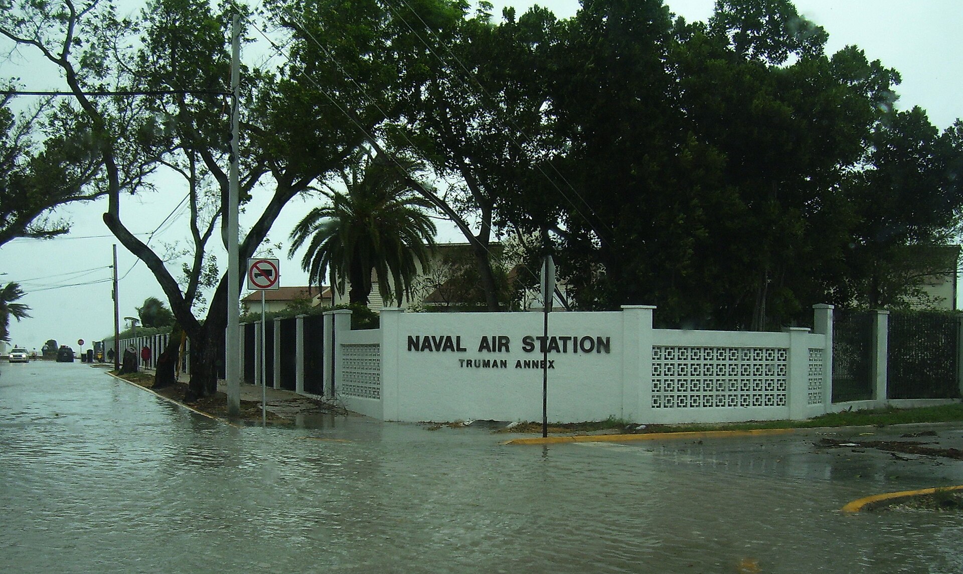
The weather service said Florida Department of Transportation cameras showed water over roads that forecasters could see with the help of streetlights overnight. “Some reports suggest that there are roads in low lying neighborhoods that are entirely covered in standing saltwater,” the Key West office said in its forecast discussion.
Water levels were trending down Thursday morning as low tide approached, but forecasters said another cycle of “higher than normal high tides” was coming. “Peak water levels are expected to very gradually trend downward after this morning, but it will be a slow trend to return to normal,” the office said.
The Vaca Key tide gauge in Marathon, a reference site for the Middle Keys, peaked at about 2.37 feet above mean higher high water at 2 a.m. Thursday, according to preliminary NOAA data, its highest reading of the week. The Key West gauge had peaked at about 2 feet late Monday and 2.2 feet late Tuesday before Wednesday night’s higher mark.
In the Upper Keys, king tide flooding covered part of Card Sound Road on Tuesday, according to photos from the Monroe County Sheriff’s Office published by the Florida Keys Free Press. Monroe County Emergency Management urged motorists to steer clear of saltwater on flooded roads, the newspaper reported.
Officials said high tides were generally expected along the oceanside between 9 p.m. and midnight and on the bayside between 11 p.m. and 5 a.m., and that elevated water could linger between cycles, especially in the Upper Keys, the Free Press reported.
Why the Water is So High
The flooding is driven by a mix of astronomy and weather. In a weather briefing posted by the city of Key Colony Beach on Wednesday, forecasters said prolonged strong north-northeasterly winds offshore of Florida’s Atlantic coast and the Southeast earlier in the week combined with the recent full moon’s spring tide cycle and the moon’s closest approach to Earth on Oct. 28.
The South Florida Water Management District said in its weekly outlook that the Keys’ annual maximum predicted tides fall on Oct. 28 and Oct. 30. The district said the current high-tide period in the Keys runs from Oct. 26 through Nov. 17.
Spring tides, often called king tides, are the highest of the high tides and typically peak in the fall and early winter around new and full moons, the Key West weather office says on its coastal flooding page.
The Keys are especially vulnerable because of their geology. “The low elevation and porous nature of the Florida Keys make us prone to coastal flooding, on average, several times each year,” the office says. The limestone that forms the island chain lets seawater seep up through the rock, flooding areas that may not appear connected to the ocean, according to the page.
The office says the shape of Florida Bay can act as a funnel, piling up water in bayside communities in the Upper Keys. The bay’s depth contours then cause water levels to recede slowly, extending flooding there.
Wednesday’s briefing told Upper Keys residents on the Florida Bay side to plan for water levels to rise another 3 to 6 inches that day above what was observed Wednesday morning. Peak tide levels are only expected to fall a couple inches each day beginning later Friday or this weekend, the briefing said.
For the Middle and Lower Keys, forecasters said levels would stay within an inch or two of earlier peaks, with similar levels expected again Thursday night and early Friday morning before slowly falling.
Protecting Vehicles and Homes
Officials warned that saltwater floodwater can damage the electrical and mechanical systems of vehicles. Monroe County officials encouraged drivers to avoid standing water and use alternate routes, the Free Press reported.
If driving through water is unavoidable, officials asked drivers to go slowly to reduce wakes that can push saltwater into yards, homes and businesses. They advised residents in flood-prone areas to move vehicles to higher ground, rinse undercarriages exposed to saltwater and use extra caution after dark.
The weather service warning urged residents to protect flood-prone property. “If travel is required, do not drive around barricades or through water of unknown depth,” it said.
Streets where king tide flooding normally occurs each autumn are likely to become impassable to smaller vehicles, and low-lying homes and businesses may see water intrusion and several inches of flooding, forecasters said in Wednesday’s briefing.
Boaters also face a hazard. Mariners “should be aware of reduced clearance under fixed bridges due to higher than normal high tides,” the weather service said Thursday.
Calmer Weather, Slowly Falling Water
The weather itself is expected to stay quiet. The Key West office said northeasterly breezes would weaken through the end of the week, which will help water levels ease, and it put the chance of rain at 20% until the weekend.
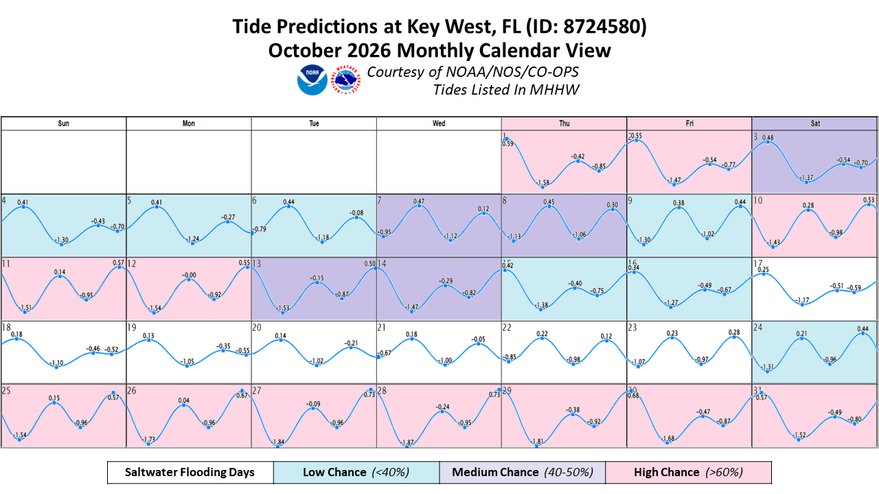
The district’s outlook said tidal water levels in the Keys may remain above the weather service’s minor flooding threshold through the weekend. The weather service’s October tide calendar for Key West showed a high chance of saltwater flooding from Oct. 25 through Oct. 31.
