
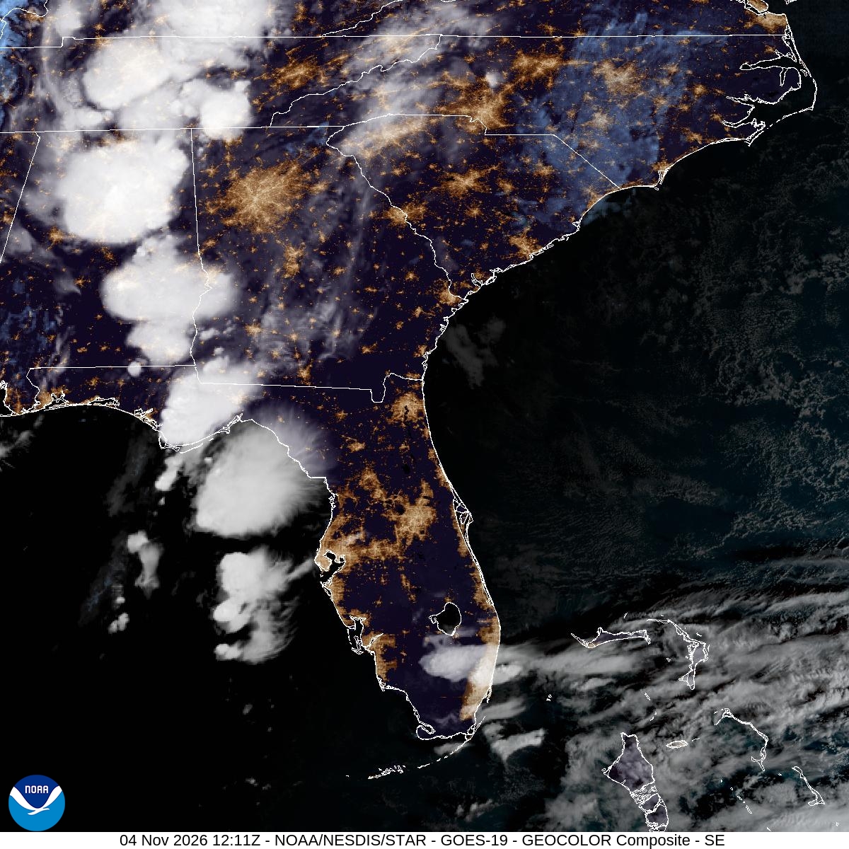
A cold front pushing into the Southeast on Wednesday was expected to bring rounds of heavy rain and thunderstorms to north Georgia, the western Carolinas and the southern Appalachians, with forecasters warning of isolated damaging wind gusts, localized flash flooding and the chance of a brief tornado.
The National Weather Service’s Storm Prediction Center placed parts of the Southeast and southern Appalachians under a marginal risk of severe thunderstorms, the lowest of its five levels. Forecasters said widespread severe weather is not expected, but a few storms could become strong enough to cause damage, mainly during the afternoon and early evening.
“Thunderstorms with isolated severe wind gusts and perhaps a brief tornado will be possible across parts of the Southeast into the southern Appalachians,” the Storm Prediction Center said in its overnight outlook.
What Forecasters Expect
An upper-level trough was moving east from the Ozarks into the lower Ohio and Tennessee valleys Wednesday, the Storm Prediction Center said. Ahead of it, a warm front was lifting north from the central Gulf Coast states into the southern Appalachians. Forecasters expected a cluster of strong storms to develop Wednesday morning from northeast Alabama into northwest Georgia, followed by a persistent band of storms from central Georgia north into the mountains during the afternoon.
Thick cloud cover was expected to limit how much the atmosphere could heat up, which tends to keep storms in check. But the Storm Prediction Center said enough instability and wind shear could develop near that band of storms to support isolated severe gusts or a brief tornado. The threat was expected to diminish by early evening.
The weather service office in Peachtree City, Georgia, which covers metro Atlanta, said low clouds and scattered light showers blanketed much of north and central Georgia early Wednesday and that “soggy, dreary conditions will persist through the day.” The office said instability may be limited by the clouds, but “if any breaks in the clouds occur, instability may increase.” It also expected continued gusty winds across north Georgia as the approaching system pressed against a wedge of cooler air east of the mountains.
Forecasters there said the main hazards were gusty winds and localized flooding in low-lying or poorly drained areas, “especially if showers or storms repeatedly move over the same areas or are slow moving.”
Rain Chances Peak in North Georgia
A rainfall forecast graphic from the weather service in Atlanta showed the highest chances Wednesday in northwest Georgia, including 85% in Trenton, 80% in Carrollton and Columbus by midday and 75% in Rome and Dalton. The office placed much of north Georgia, including the Atlanta metro area, Rome, Dalton, Blairsville and Gainesville, under a marginal risk of excessive rainfall, meaning about a 5% chance of flash flooding within 25 miles of a given point.
“Do not attempt to drive through flooded roadways,” the office said. “Turn around and seek an alternative route.”
FOX 5 Atlanta said the greatest concern for severe weather would develop Wednesday afternoon and continue into the evening and overnight hours, with scattered storms possibly lingering into early Thursday. Highs were expected in the 70s.
In Alabama, meteorologists said large areas of rain and a few thunderstorms were moving through the state early Wednesday. The Alabama Weather Network said the marginal risk covered only a small part of east and northeast Alabama and that “the overall severe threat is very low,” with showers and storms moving out of the state Wednesday night.
Carolinas Brace for an Afternoon Round
In the Carolinas, the weather service office in Greenville-Spartanburg, South Carolina, said a cold front would push across the area late Wednesday afternoon into the evening, with the heaviest rain expected in northeast Georgia and along the southern Blue Ridge Escarpment.
The office said rain amounts would range from one-quarter inch to 1.5 inches, with higher amounts likely in the far western North Carolina mountains and parts of Upstate South Carolina and northeast Georgia. Southeasterly winds could raise “an isolated flash flood risk especially along the Escarpment and foothills,” the office said, though forecasters said their confidence in that was low.
Forecasters in Greenville-Spartanburg said limited instability and weak wind shear lowered their confidence in severe weather, but they “cannot rule out an isolated strong to severe storm later today into tonight.” Temperatures at 6 a.m. Wednesday were in the 50s and 60s across the region, from 48 degrees in Lincolnton, North Carolina, to 65 degrees in Murphy, North Carolina, according to the office’s hourly roundup.
FOX Carolina in Greenville declared a First Alert Weather Day and said rain would become widespread by 3 p.m. and continue through the evening commute. The station said the highest risk for severe weather would come between 2 and 6 p.m.
“Expect a slow go for travel this afternoon with low visibilities and potential for ponding on the roads,” the station said, adding that after-school activities were likely to be canceled.
The station said some areas in the southern mountains could get more than 3 inches of rain and urged people who live near small waterways to watch for rising water Wednesday evening.
Fog and Lingering Showers Thursday
The front is not expected to clear the region quickly. The Peachtree City office said the system would become more vertically stacked and slow down, keeping at least a chance of rain in the forecast for many areas through Thursday. Forecasters also expected another round of low clouds and fog overnight, likely affecting the Thursday morning commute.
In the Carolinas, rain chances were forecast at 30% to 40% Thursday and were expected to increase in the North Carolina Piedmont on Friday, when the weather service said there was a 20% to 30% chance of 1 inch of rain or more in eastern parts of its coverage area.
A More Typical November Weekend
Behind the front, drier air will push in as high pressure builds from the north. The Greenville-Spartanburg office said the forecast should dry out Saturday, with overnight lows this weekend and into early next week dipping into the 30s in the mountains and upper 30s and 40s elsewhere.
FOX Carolina forecast Saturday highs in the upper 60s in the Upstate and mid-60s on Sunday under sunny skies. In Georgia, the Peachtree City office said overnight lows could fall into the 30s beginning as early as Saturday morning and lasting through at least Tuesday morning, with highs in the mid- to upper 60s this weekend.
Forecasters said the next chance of rain could come early next week, but computer models disagree. The Peachtree City office said one major model shows rain chances increasing Monday and possibly Tuesday as low pressure moves across the Southeast, while another does not.
