• Skip to primary navigation
  • Skip to main content
  • Skip to primary sidebar

Weatherboy

Weatherboy Weather News, Maps, RADAR, Satellite, and Forecasts.

  • Local
  • Earth Science News
  • RADAR
  • Current Warnings
  • Satellite
  • Current Maps
  • Forecast Maps
  • Video

GOES-R, now known as GOES-16, Sends First Images

by Weatherboy Team Meteorologist - January 23, 2017

This composite color full-disk visible image is from 1:07 p.m. EDT on January 15, 2017 and was created using several of the 16 spectral channels available on the GOES-16 Advanced Baseline Imager (ABI) instrument. The image shows North and South America and the surrounding oceans. GOES-16 observes Earth from an equatorial view approximately 22,300 miles high, creating full disk images like these, extending from the coast of West Africa, to Guam, and everything in between. Image: NOAA

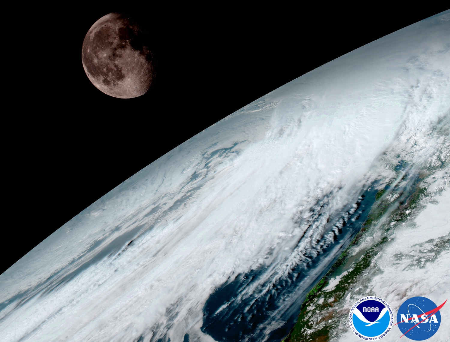
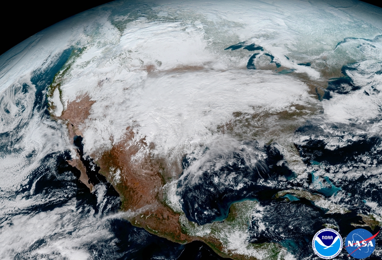
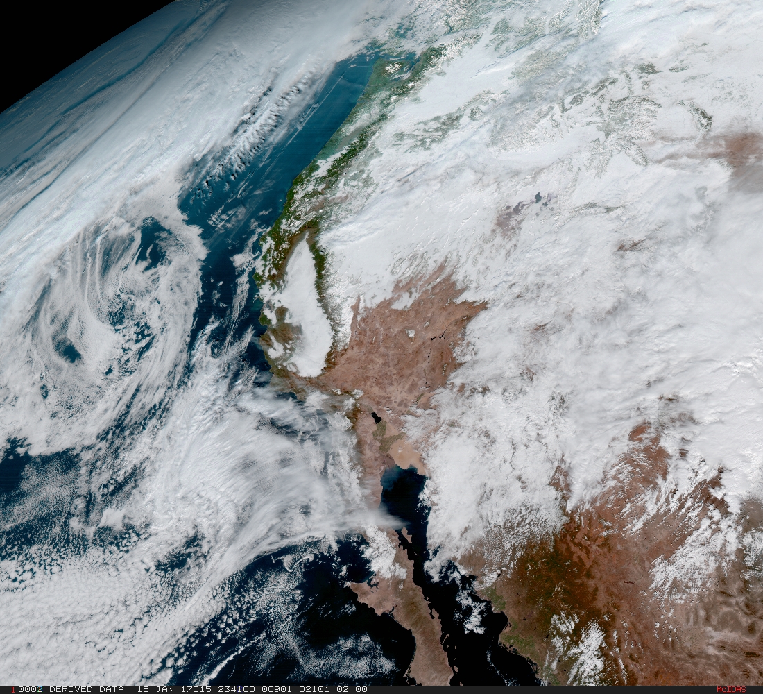
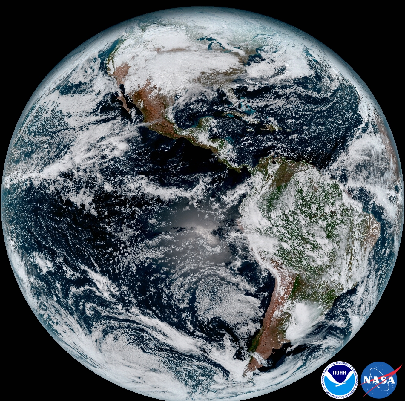
NOAA’s GOES-16 satellite, formerly known as GOES-R, has sent its first, high resolution images back to Earth. These images from GOES-16’s new Advanced Baseline Imager (ABI) instrument show the complete full disk of the Western Hemisphere and the continental United States in all 16 channels of the ABI instrument. We were at NASA’s Kennedy Space Center on November 19 when the rocket carrying the satellite into space was launched. The images made public today were snapped on January 15. The satellite will continue to go through a diagnostic and testing phase for the next several months before becoming fully operational later this fall.

GOES-16 was launched on Nov. 19, 2016 at 6:42pm EST from Cape Canaveral, Florida. The first images usher in a new era of Earth and space weather observation for the U.S. “Seeing these first images from GOES-16 is a foundational moment for the team of scientists and engineers who worked to bring the satellite to launch and are now poised to explore new weather forecasting possibilities with this data and imagery,” said Stephen Volz, Ph.D., NOAA’s Assistant Administrator for Satellite and Information Services. “The incredibly sharp images are everything we hoped for based on our tests before launch. We look forward to exploiting these new images, along with our partners in the meteorology community, to make the most of this fantastic new satellite.” GOES-16 is the first spacecraft in the GOES-R series of four new NOAA geostationary satellites, capturing higher resolution images of weather patterns and atmospheric phenomena than any of NOAA’s GOES satellites to-date. The higher resolution will allow forecasters to pinpoint the location of severe weather with greater accuracy, ultimately saving lives.


“This image is much more than a pretty picture, it is the future of weather observations and forecasting,” said Louis W. Uccellini, Ph.D., director, NOAA’s National Weather Service. “High resolution imagery from GOES-16 will provide sharper and more detailed views of hazardous weather systems and reveal features that previous instruments might have missed, and the rapid-refresh of these images will allow us to monitor and predict the evolution of these systems more accurately.  As a result, forecasters can issue more accurate, timely, and reliable watches and warnings, and provide better information to emergency managers and other decision makers.”

In May, NOAA will determine where to “park” the weather satellite; it’ll either focus on the western or eastern US and be labeled as “GOES-West or GOES-East accordingly. The next spacecraft in the series, GOES-S,  is slated for lift-off next spring.  It is currently undergoing environmental testing at Lockheed Martin’s Littleton, CO facility, where it was built. The full set of environmental, mechanical, and electromagnetic testing will take about a year to complete. After its initial on-orbit checkout, the GOES-S satellite will be moved into its new operational position as GOES-17.  GOES-17 will then become GOES-East or -West, depending on what comes of the final “parking” spot for GOES-16 now.


GOES-16 captured this view of the moon as it looked across the surface of the Earth on January 15. Like earlier GOES satellites, GOES-16 will use the moon for calibration. Image: NOAA
This image clearly shows the significant storm system that crossed North America that caused freezing and ice that resulted in dangerous conditions across the United States on January 15, 2017 resulting in loss of life. GOES-16 will offer 3x more spectral channels with 4x greater resolution, 5x faster than ever before. Image: NOAA


From its central location, GOES-16 captured this image of the west coast of the United States and the Baja Peninsula in Mexico. Once GOES-16 is determined to be operational as either GOES-East or GOES-West, GOES-S, the next spacecraft in the series, which is planned for launch in Spring 2018 will be moved into the other operational position as GOES-17. Image: NOAA


Primary Sidebar

Sponsored Ad

Search

Latest News

  • Updated Crash Forecast Puts Eastern U.S. on Alert from Soviet Union Spacecraft
  • Soviet Union Spacecraft Crash Zones Updated; NJ/NY/PA/MI at Increased Risk
  • Over 2,000 People Report Shaking from Virginia Earthquake
  • Morning Earthquake Strikes Heart of New Madrid Seismic Zone in Missouri Today
  • New York TV Weatherman Back After Brain Injury
  • NASA Monitoring Significant Magnetic Anomaly over Atlantic
  • Out of Control Soviet Union Spacecraft Could Crash Into Your House This Week
  • Elevated Tornado Threat in New Jersey, Pennsylvania, and New York
About | Careers | Contact | Contests
Terms | Privacy | Ad Choices
Weatherboy is a (R) Registered Trademark of isarithm LLC, All Rights Reserved.
All content herein is Copyright by Isarithm LLC 1997-2022