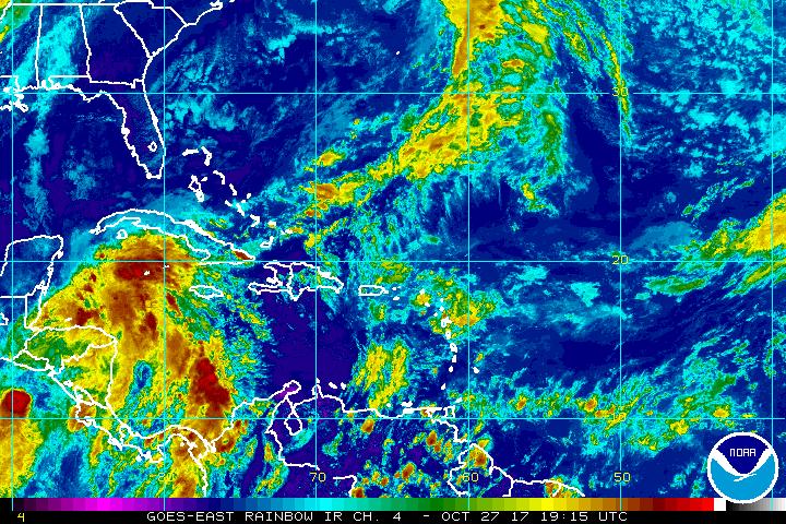
An area in the western Caribbean that has been tracked by the National Hurricane Center all week appears to be becoming better organized; with a tropical cyclone forming there, watches or warnings may need to be issued soon.
Showers and thunderstorms associated with a broad area of low pressure located over the northwestern Caribbean Sea are beginning to show signs of organization, according to the National Hurricane Center (NHC). Environmental conditions are expected to be conducive for additional development, and a tropical depression or tropical storm is likely to form later today or Saturday. The system is forecast to move north over the northwestern Caribbean Sea and then turn northeastward by late Saturday.
The NHC says tropical storm watches and warnings may be needed for the Cayman Islands, central and western Cuba, and the central and northwestern Bahamas later today or tonight. An Air Force Reserve reconnaissance aircraft is en route to investigate this system to provide the NHC with additional storm insights. If the storm does become named, it would be called Philippe. In an afternoon update, the NHC says there is an 80% chance that a tropical cyclone will form here.
Regardless of development, this disturbance is expected to produce locally heavy rainfall over the Cayman Islands, Jamaica, and portions of Cuba during the next day or two. Rainfall is also forecast to spread northward across portions of South Florida and the Keys on Saturday, and over the northwestern and central Bahamas Saturday night and Sunday. Moisture and energy from this system will eventually be brought far north, bringing severe rain and wind conditions to the northeast late Sunday into Monday.
