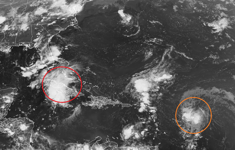
While eyes are on Fred in Florida where Tropical Storm Watches and Warnings are in effect, eyes are beginning to look over Tropical Depression #7 which formed today in the Atlantic; that could become the next named storm. With the next name on the list of Atlantic hurricane names being “Grace”, it is within the realm of possibilities that a Tropical Storm or Hurricane Grace could impact the U.S. East Coast in the future.
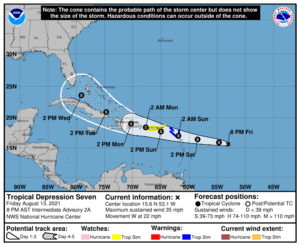
Computer forecast guidance is mixed with Tropical Depression #7’s future. Some guidance suggests modest strengthening over time, while others suggest rapid intensification to hurricane status in as little as 72 hours. The National Hurricane Center is conservative for now, suggesting tropical storm intensification soon as it moves west-northwest.
Tropical storm conditions are possible in portions of the Leeward Islands late Saturday or early Sunday, and over the Virgin Islands and Puerto Rico on Sunday. The risk of strong winds will then spread westward to the Dominican Republic Sunday night and Monday. Because of this, Tropical Storm Watches and Warnings have been issued for the storm.

The government of Antigua and Barbuda has issued a Tropical Storm Warning for Antigua and Barbuda, Anguilla, St. Kitts and Nevis, and Montserrat. The government of the Netherlands has also issued a Tropical Storm
Warning for Saba and Sint Eustatius while the government of France has issued a Tropical Storm Warning for St. Martin and St. Barthelemy. A Tropical Storm Warning means tropical storm conditions are possible within the next 36 hours.
The National Hurricane Center has issued a Tropical Storm Watch for Puerto Rico, including Vieques and Culebra, and the Virgin Islands. Tropical Storm conditions are possible in the near future in the watch area.
The National Hurricane Center warns that heavy rainfall could lead to flash and urban flooding over the Leeward and Virgin Islands. Across Puerto Rico, heavy rainfall may lead to flash, urban and small stream flooding, along with the potential for mudslides.
There is a risk of wind and rainfall impacts across Haiti, the Turks and Caicos Islands, the southeastern Bahamas, and Cuba next week, and interests in those areas should monitor the progress of this system.
Beyond the tropics, those in and around Florida and elsewhere along the U.S. East Coast should monitor this storm and confirm their hurricane action plans are in order. Later next week, it may become necessary for some to act on those plans …especially if this storm heads to the coast as a hurricane as some forecast guidance suggests is possible. If an impact were to occur to the U.S. mainland, it would likely be beyond next Wednesday afternoon.