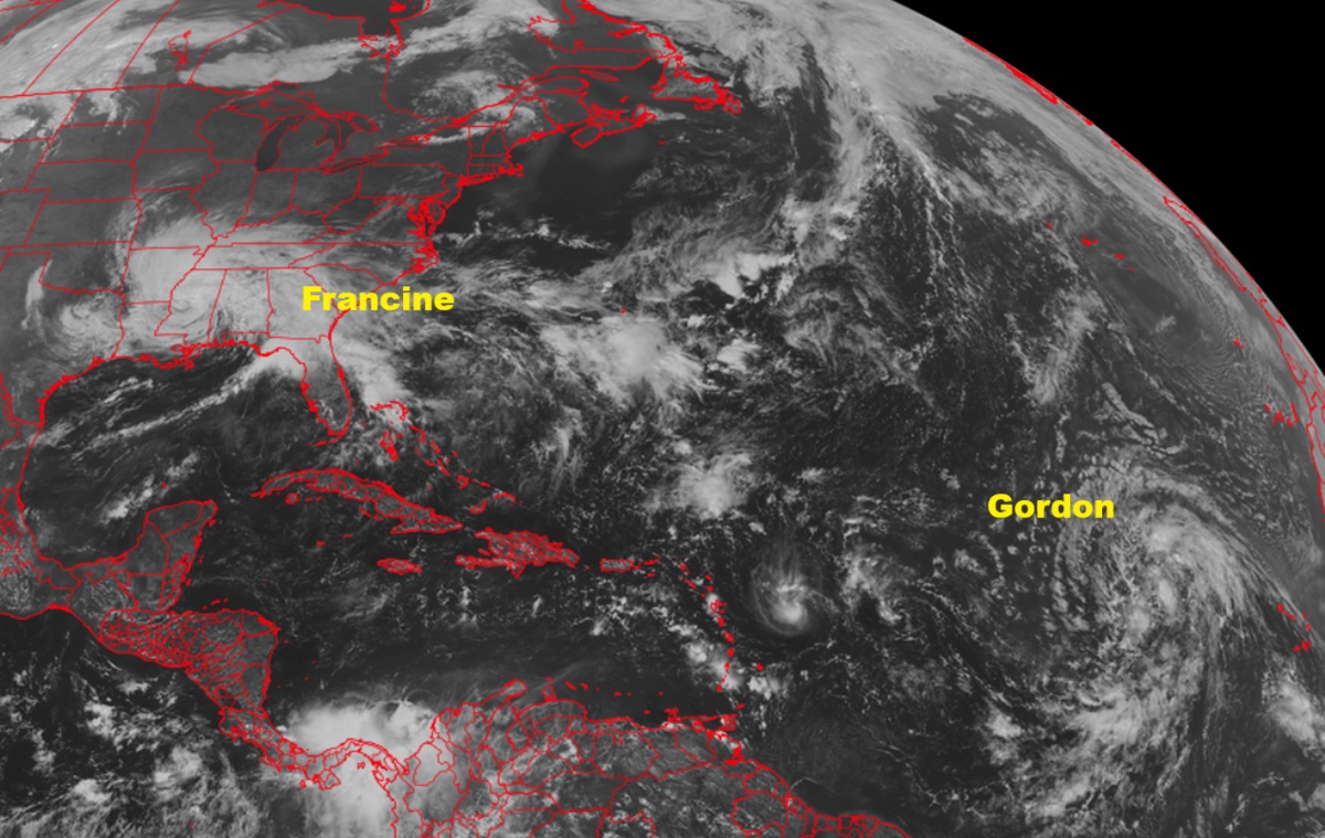
Hurricane Francine made landfall on the Louisiana coast yesterday evening at around 5 pm local time; Francine is now a tropical depression located over Mississippi. After Francine, though, meteorologists are keeping an eye on a new tropical depression in the Atlantic that is forecast to become Tropical Storm Gordon soon.
While Francine struck Louisiana as a Category 2 hurricane yesterday, it is now a tropical depression located about 15 miles north-northeast of Jackson, Mississippi. The depression is moving toward the north near 14 mph and this general motion is expected by the National Hurricane Center (NHC) to continue with a decrease in forward speed through Friday. On the forecast track, the center of Francine will move over central and northern portions of Mississippi this afternoon and tonight and move into northeastern Arkansas by Friday.
Maximum sustained winds are near 35 mph with higher gusts. Weakening is forecast, and Francine is expected to become a post-tropical cyclone later today or tonight.
Elevated water levels and high surf along portions of the Louisiana and Mississippi coasts should subside today. Until this occurs, residents in the affected area should continue to follow advice given by local officials.
Francine will continue to bring heavy rainfall and the risk of flash and urban flooding, along with river flooding, across portions of the Lower Mississippi Valley, Tennessee Valley and the Southeast. Considerable flash and urban flooding is possible through tonight over portions of Alabama and the Florida Panhandle, expanding into Georgia and middle Tennessee Friday.
While Francine is looking less and less organized, the opposite is true with Tropical Depression Seven located over the central Atlantic. According to the NHC, Tropical Depression Seven looks more organized on satellite imagery this morning, with a compact circulation and a small curved band with some deep convection. Subjective and objective analysis indicate the system is close to becoming a tropical storm. When it does become a tropical storm, it will be given the name Gordon.
The cyclone continues on a west-northwestward heading, and the general motion is expected to continue over the next 2-3 days. According to the NHC, the forward speed should gradually slow as the subtropical ridge to the north of the system weakens. Computerized track forecast guidance diverges considerably early next week, related to uncertainties with an amplifying trough over the north-central Atlantic Ocean and another ridge centered northeast of the Leeward Islands. As such, it is too soon to say with any degree of confidence where Gordon will head and if its future involves a landfall with any island or anywhere along the U.S. Coast.
