
While cold air arriving faster than departing moisture lead to a light snowfall early today across portions of the East, it appears a soaking rain storm instead of a snow storm is headed to the northeast in time for the weekend.
The meteorological set-up for the next system is a typical one for this time of year. High pressure will slide offshore Thursday night; with skies mostly clear in large parts of the East, the region should radiate efficiently with chilly over night lows. The high pressure system will move into the Canadian maritimes Friday, producing a return of airflow from the milder south. As the high moves away into Canada, a low pressure system will track up the southeast coast and up into the Mid-Atlantic late Friday into Saturday. The low will intensify as it pushes northward and will bring rain to the region.
Rain from this next system could be heavy at times. In a forecast discussion, meteorologists at the Mount Holly, New Jersey office of the National Weather Service write, “while right now it doesn’t look like we will see enough rain to cause any big flooding concerns, there may be some localized issues, especially in areas where there is poor drainage and/or where the leaves may be clogging the storm drains.”
Source: National Oceanic and Atmospheric Administration (NOAA), Oceanic and Atmospheric Research (OAR), Climate Program Office (CPO), Climate.gov; NOAA National Centers for Environmental Information (NCEI)
With a strong southerly flow, temperatures will continue to rise Friday into Saturday. Temperatures in places like Philadelphia and New York City could exceed 60 by Saturday afternoon.
The low will continue to track up into New England by Sunday, deepening as it moves north and east. Later Saturday night and Sunday, the pressure gradient will tighten up, creating gusty winds for New England and the Mid Atlantic. With those winds, conditions will start to dry out later Sunday as weak high pressure starts to edge its way into the area from the west.
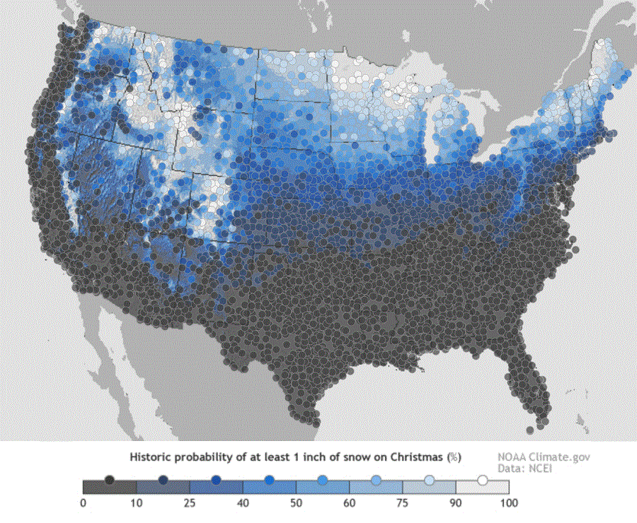
It is still too early to say who will get snow on Christmas Day or on the days leading to it. A very active weather pattern remains in place throughout the country and many areas could see more snow within the next 2 weeks ’till December 25.
