A late-season snowstorm is likely in the northeast to end this week, bringing another accumulating snowfall to wrap up the snow season in April. Some of the snow is expected to be heavy, prompting the National Weather Service to issue Winter Storm Watches for parts of the northeast beginning Thursday night.
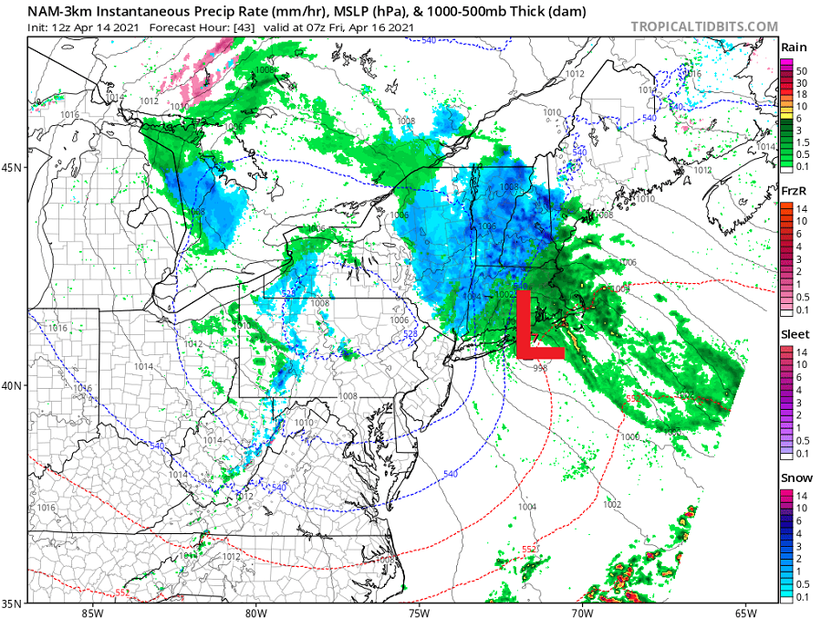
A slow moving area of low pressure will move across southern New England late Thursday night and Friday and then into the Gulf of Maine Saturday. Rain and snow will break out first across New England Thursday evening and quickly go over to all snow at higher elevations. The snow will gradually move northeastward into portions of western Maine later Thursday night and Friday morning.
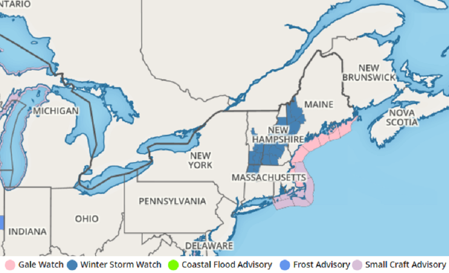
With heavy snow expected, the National Weather Service has issued Winter Storm Watches for portions of Massachusetts, New Hampshire, Vermont, and Maine. The National Weather Service cautions, “Travel could be very difficult due to low visibility and snow covered roads. The hazardous conditions could impact the Friday morning and evening commutes. Roads, and especially bridges and overpasses, will likely become slick and hazardous. ”
With marginal temperatures forecast, snow that falls will be of the heavy and wet variety. The National Weather Service warns that “the potential exists, especially above 800 feet in elevation, for enough wet snow to cause power outages.”
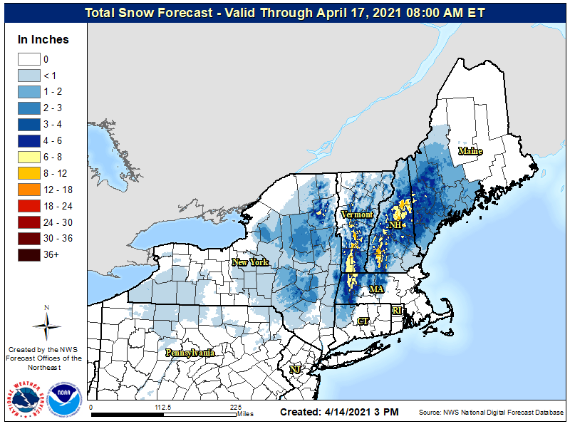
The heaviest snow is expected to be Friday morning into the early afternoon hours before becoming more intermittent Friday afternoon across southern portions of the Watch area. Much of the snow will be elevation-dependent; while heavy snow over 8″ is possible on the taller mountains, lesser amounts are expected in valleys.
While fair weather will build back into the northeast in the wake of this storm on the weekend, more cool, unsettled weather is possible next week. Around next Wednesday, models suggest another area of light, wet snow could break out across Upstate New York and portions of interior southeastern New England. While additional snow is possible then, the heaviest of the snowfalls should be from this storm moving through by Saturday.
