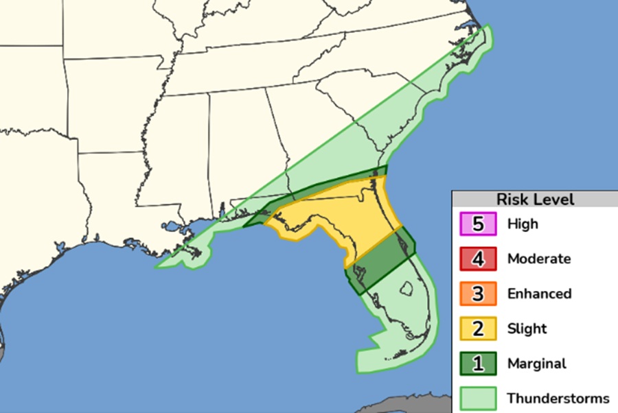
A week of severe weather across the United States will finally wrap up, with the final round of severe weather expected in the Southeast; it appears Florida will take the brunt of the severe weather. Strong to severe storms are also possible across southern Georgia Saturday morning into early evening.
A large upper trough will be present across much of the eastern U.S. on Saturday. The mid-level jet will be intensifying through the day, primarily north of a surface cold front. South of the cold front, upper 60s to low 70s dewpoints will be in place.
Early Saturday morning, convection is expected to be ongoing from southern Georgia into central Florida. The National Weather Service’s Storm Prediction Center says,” The intensity of this early activity is not certain, though thunderstorms will be in a highly sheared environment.” With shear parallel to the cold front, there is potential for the front to undercut some of the convection. However, one or more organizing linear segments/clusters could still occur along/south of the boundary.
Wind damage would likely be the primary hazard with this severe weather action. Large hail is still a possibility, but would be somewhat conditional on a discrete storm mode. The Storm Prediction Center says that the tornado threat remains less certain.
The low-level jet will be strongest in the morning before lifting north and east through the day. This would mean diurnal destabilization would be out of phase with the strongest low level wind field. While the overall threat for a tornado or two appears low, there is a narrow zone in North Florida where marginally stronger low-level shear and boundary-layer destabilization may favorably align mid/late morning.
