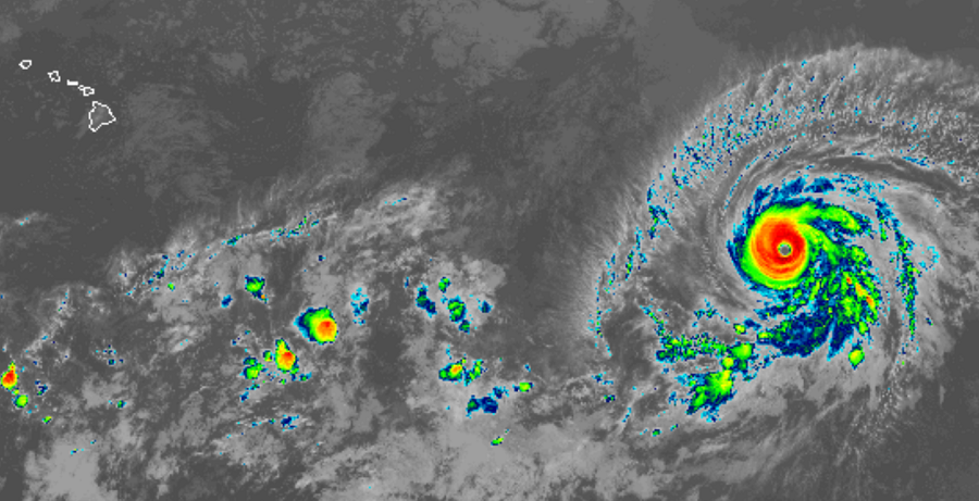
Hurricane Barbara continues to look impressive on weather satellite photography and has equally impressive statistics. In the last update from the National Hurricane Center, the hurricane has maximum sustained winds of 155mph. When a storm has 157mph or greater winds, it is considered a top-of-the-scale Category 5 hurricane. The estimated minimum central pressure of this tropical cyclone is 933 mb or 27.55 inches. Hurricane force winds extend outwards of up to 45 miles from the center while tropical storm force winds extend outward up to 185 miles.
The National Hurricane Center (NHC) believes despite its current intensity, Barbara should begin a weakening trend soon as it moves into an area less favorable to maintain the intensity it is at now. Gradual weakening is expected later today, with faster weakening likely tomorrow and Friday. By sometime on Friday, the NHC is forecasting Barbara will be back down to Tropical Storm status.
While the storm will be substantially weaker than it is now, it could still bring serious impacts to Hawaii over time. Both the American GFS and European ECMWF computer forecast models bring what’s left of Barbara to or very close the Aloha State as soon as July 9 or 10. While hurricane force winds are extremely unlikely, soaking tropical rains are possible. Several inches of rain could fall, especially on the eastern sides of Maui and Hawaii counties early next week.