A catastrophe is in the making with the National Hurricane Center and National Weather Service calling for an “unsurvivable” storm surge, destructive winds, flooding rains, threat of landslides, and widely scattered tornadoes as Hurricane Helene, forecast to become a major category 4 or 5 hurricane prior to landfall in Florida, smashes into the southeastern United States.

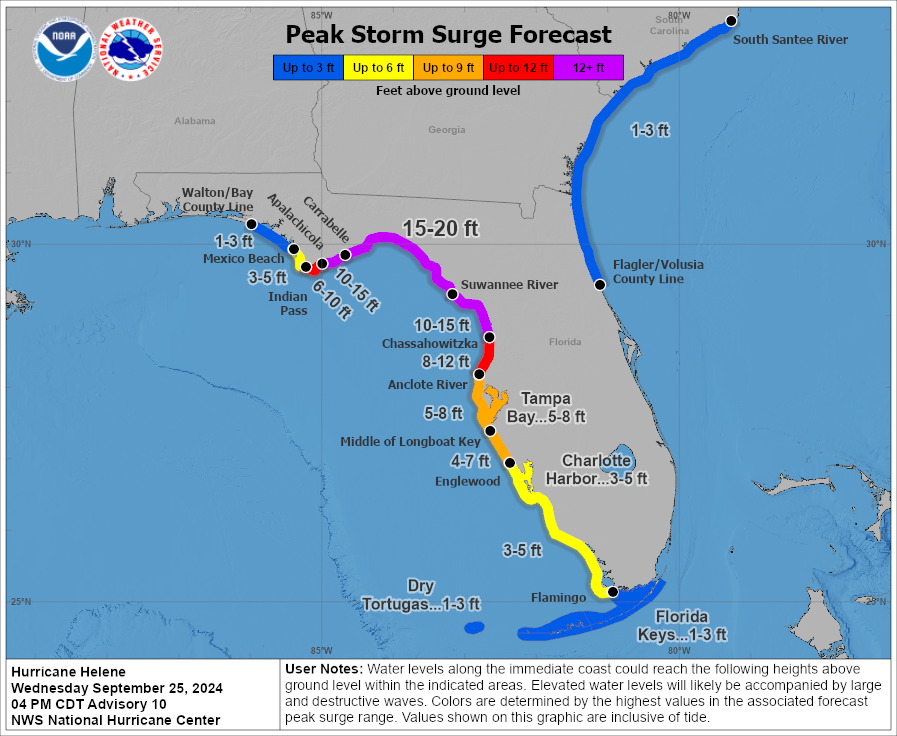
“There is increasing confidence of catastrophic and/or potentially unsurvivable storm surge for Apalachee Bay,” the National Weather Service office for Tallahassee warns. “Storm surge may begin to arrive as early as late Wednesday night ahead of the strongest winds, building through landfall. Current storm surge values across the Bay are: Carrabelle to Suwannee River, 15 to 20 feet, Apalachicola to Carrabelle, 10 to 15 feet, Indian
Pass to Apalachicola, 6 to 10 feet, Mexico Beach to Indian Pass, 3 to 5 feet, and the rest of Bay County, 1 to 3 feet.”
“There is also a danger of life-threatening storm surge along the remainder of the west coast of the Florida Peninsula,” the National Hurricane Center warns. “Residents in those areas should follow advice given by local officials and evacuate if told to do so.”
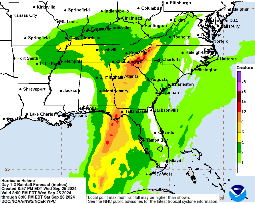
While the Gulf of Mexico will be pushed up onto and far inland along the coast due to the storm surge on Helene’s powerful winds, extremely heavy rain will also fall at the coast and hundreds of miles inland. “Communities need to prepare for catastrophic and life-threatening flooding from Helene, even well after landfall,” the National Oceanic and Atmospheric Administration said. The storm is expected to dump 6-12″ of rain across parts of the Southeastern U.S. into the southern Appalachians, with isolated totals around 18″ according to the National Hurricane Center. The National Hurricane Center (NHC) says, “This rainfall will likely result in catastrophic and potentially life-threatening flash and urban flooding, along with significant river flooding. Landslides are possible in steep terrain across the southern Appalachians.”

The language the National Hurricane Center is using to describe the flood threat is extreme: “Catastrophic and life-threatening flash and urban flooding, including landslides, is expected across portions of the southern Appalachians through Friday. Considerable to locally catastrophic flash and urban flooding is likely for northwestern and northern Florida and the Southeast through Friday. Widespread minor to moderate river flooding is likely, and isolated major river flooding is possible.”
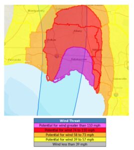
Potentially catastrophic hurricane-force winds are expected within the eyewall of Helene when it makes landfall in the Florida Big Bend region late Thursday. “Preparations to protect life and property should be completed by early Thursday before tropical storm conditions arrive. Damaging and life-threatening hurricane-force winds, especially in gusts, will penetrate well inland over portions of northern Florida and southern Georgia late Thursday and Thursday night where Hurricane Warnings are in effect,” the National Hurricane Center said. “Strong wind gusts are also likely farther north across portions of northern Georgia and the Carolinas, particularly over the higher terrain of the southern Appalachians.”
Numerous warnings are in effect for the arrival of Hurricane Helene. A Storm Surge Warning is in effect for Mexico Beach eastward and southward to Flamingo in Florida, all of Tampa Bay, and all of Charlotte Harbor. A Storm Surge Warning means there is a danger of life-threatening inundation, from rising water moving inland from the coastline, during the next 36 hours in the indicated locations.
A Hurricane Warning is in effect for the area stretching from the Anclote River to Mexico Beach while a Hurricane Watch is in effect from Englewood to Anclote River, including Tampa Bay. A Hurricane Warning means that hurricane conditions are expected somewhere within the warning area. A warning is typically issued 36 hours before the anticipated first occurrence of tropical-storm-force winds, conditions that make outside preparations difficult or dangerous. Preparations to protect life and property should be rushed to completion. A Hurricane Watch means that hurricane conditions are possible within the watch area. A watch is typically issued 48 hours before the anticipated first occurrence of tropical-storm-force winds, conditions that make outside preparations difficult or dangerous.

A Tropical Storm Warning is in effect for the Florida Keys, including the Dry Tortugas, Flamingo to Anclote River, including Tampa Bay, west of Mexico Beach to the Okaloosa/Walton County Line, Flamingo northward to Little River Inlet, and all of Lake Okeechobee. A Tropical Storm Warning means that tropical storm conditions are expected somewhere within the warning area within the next 36 hours.
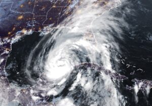
As of the 11pm ET advisory from the NHC, center of Hurricane Helene was located near latitude 23.1 North, longitude 86.6 West, which puts the growing storm roughly 425 miles southwest of Tampa, Florida and about 465 miles south-southwest of Apalachicola, Florida. Helene is moving due north at 9 mph while the minimum central pressure is down to 972 mb or 28.71″.
Maximum sustained winds are near 85 mph with higher gusts. Strengthening is forecast, and Helene is expected to be a major hurricane, possibly a Category 4 or 5 storm, when it reaches the Florida Big Bend coast Thursday evening. The NHC says weakening is expected after landfall, but Helene’s fast forward speed will allow strong, damaging winds, especially in gusts, to penetrate well inland across the southeastern United States, including over the higher terrain of the southern Appalachians.
Helene is a large storm and is forecast to become larger. Hurricane-force winds extend outward up to 35 miles from the center and tropical-storm-force winds extend outward up to 345 miles, creating a field of damaging winds roughly 700 miles wide.
As the storm approaches land and makes landfall, many tornadoes could spin up. The risk for tornadoes will increase on Thursday, expanding northward across Florida into parts of Georgia and South Carolina.