Epic catastrophe has been followed by epic catastrophe in portions of Central America and it looks like they may need to brace for round three. On November 3, Major Hurricane Eta slammed into Central America, pushing a very high storm surge inland while 20-30″ of rain fell from severe wind-whipped skies. Yesterday, nearly the same thing happened in the same location: Major Hurricane Iota struck land, moving ashore just 15 miles away from where Eta struck less than two weeks earlier. Heavy rain and strong winds continue to lash the region today as Iota weakens. Unfortunately, the National Hurricane Center says there’s a chance that another tropical cyclone could form in the area. Even if it doesn’t, heavy rain and gusty winds from the potential system will bring additional misery to the region still recovering from the earlier two disasters.
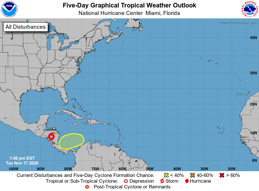
According to the latest Tropical Outlook from the National Hurricane Center, a broad area of low pressure could form in a day or so over the southwestern Caribbean Sea. Environmental conditions do not appear to be as conducive for development as once thought in Hurricane Iota’s wake, but slow development is possible over the next several days while the system moves slowly westward or west-southwestward across the southwestern Caribbean Sea. The National Hurricane Center believes there’s a 30% chance of tropical cyclone formation here over the next 5 days.
Regardless of tropical cyclone formation, areas of heavy rain are possible during the next several days from Nicaragua southward across Central America and into Colombia. Some of these areas have seen over 4 feet of rain in the last 3 weeks. Any additional rains will make living post-disaster after Eta and Iota extremely difficult, especially with the ongoing COVID-19 Pandemic continuing there.
