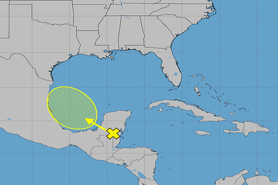
There is some concern in Texas for an area being watched for possible tropical cyclone development in the Bay of Campeche and the Gulf of America in the coming days. While the National Hurricane Center (NHC) says its unlikely a tropical cyclone will form in the short-term here, an abundance of moisture from decaying tropical cyclones from the Eastern Pacific Basin impacting Central America could make its way north into northeastern Mexico and the state of Texas.
On June 8, with persistent deep convection, an area of low pressure in the Eastern Pacific was classed as a tropical depression and it was designated Tropical Depression Three-E. Soon after, the depression intensified into a tropical storm and was named Cristina. Cristina produced heavy rains that caused deadly flooding in San Pedro Sula, Honduras, left people missing in Costa Rica, and claimed at least 5 lives in Guatemala. After impacting these areas, the storm weakened into a tropical depression. Earlier today what was left of Cristina opened up into a trough as the circulation was no longer well defined and its remnant moisture is moving north across Central America. Eventually, what’s left of it will approach the Bay of Campeche along with other moisture and a tropical wave.
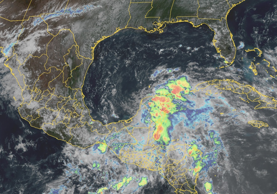
According to the NHC, a broad area of low pressure is likely to form over the Bay of Campeche on Friday from a westward-moving tropical wave currently located over the Yucatan Peninsula of Mexico. Environmental conditions are forecast by the NHC to be only marginally conducive for development before the system moves inland over eastern Mexico late
Saturday or Sunday.
However, computer forecast guidance is conflicted with what happens there. Some forecast models, like Google’s Deep Mind, suggest a tropical cyclone could take shape off the coast of Mexico and move east-northeast over time across the central Gulf Coast. The tropical cyclone could be a tropical depression or a named tropical storm. Other guidance suggests remnant moisture will simply soak south Texas without any tropical cyclone forming.
For now, the NHC says odds of formation of a tropical cyclone are low. Over the next 7 days, the NHC pegs odds of tropical cyclone development at only 10%.
As more data is analyzed and the low takes shape in the Bay of Campeche, meteorologists will have a better idea of what, if any, tropical cyclone characteristics this system will take on along with an understanding of what, if any, direct or direct impacts will come to the Texas coast and elsewhere along the Gulf of America coastline.
In addition to monitoring the Gulf of America for potential tropical cyclone development, the National Weather Service is encouraging residents and visitors to be aware of other hazards too. Forecasters at the NWS’s Houston/Galveston office caution, “If you have any beach plans within the next 7 days, make sure to watch out for rip currents. Swim near a lifeguard, if possible, and be sure to avoid swimming near any rocks, jetties, and piers where rip currents frequently occur.”
