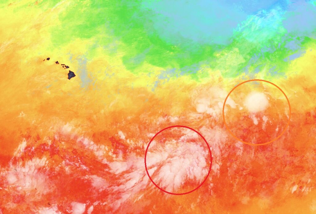
Two systems are taking shape well south and east of Hawaii now and over time, as soon as this weekend, one or both could threaten the islands as a tropical storm or hurricane. While the National Hurricane Center (NHC) in Miami, Florida is issuing updates on these potential storm threats, the Honolulu, Oahu office of the National Weather Service is also encouraging people to prepare for potential impacts.
“Residents and visitors should prepare now for potential tropical cyclone impacts this weekend,” warns the National Weather Service.
Visible satellite imagery indicates that a well-defined low-level center has formed in association with the low pressure system located about 1,050 miles east-southeast of the Hawaiian Islands. But according to the NHC, shower and thunderstorm activity remains disorganized. Nevertheless, environmental conditions are conducive for further development, and a tropical depression or storm is expected to form on Wednesday while the system moves generally west-northwestward at around 15 mph. Right now, the National Hurricane Center says there is a 90% chance this system will develop into a tropical cyclone.
The second area of concern is a well-defined low pressure system located about midway between Hawaii and the west coast of Mexico. This area is currently producing some shower and thunderstorm activity. According to the NHC, any significant increase in the organization of the showers and thunderstorms would result in the formation of a tropical depression later today or on Wednesday. The system is forecast to move northwestward at 5 to 10 mph over the next couple of days and encounter less favorable environmental conditions late this week. The NHC says there’s a 70% chance of tropical cyclone formation here within the next 48 hours.
It is still not crystal clear how these systems will take shape and how their close proximity to each other will help or hinder development. When two tropical cyclones get within roughly 870 miles of each other, they begin a Fujiwhara effect, orbiting a shared center point and altering each other’s paths, intensities, and future behavior. The Fujiwhara effect is a meteorological phenomenon where two nearby cyclonic vortices spin around a common central point in a counterclockwise “dance”; it is named after Japanese meteorologist Sakuhei Fujiwhara. When two spinning low-pressure systems get close enough, their atmospheric circulations begin to exert a mutual pull on one another. Rather than acting independently, their tracks and intensities change based on their relative size and strength.
