• Skip to primary navigation
  • Skip to main content
  • Skip to primary sidebar

Weatherboy

Weatherboy Weather News, Maps, RADAR, Satellite, and Forecasts.

  • Local
  • Earth Science News
  • RADAR
  • Current Warnings
  • Satellite
  • Current Maps
  • Forecast Maps
  • Video

Damaging Wind Gusts Likely with Winter Storm

by Weatherboy Team Meteorologist - January 16, 2022

Winds over 40 mph will reach far inland into western portions of Pennsylvania and New York; at the coast, especially in coastal New England, winds can gust 55-75 mph. Image: NWS


While a winter storm drops heavy snow, rain, and ice over portions of the eastern United States today and tomorrow, it will also bring another hazard with it: damaging wind gusts to portions of the northeast.

A slew of watches, warnings, and advisories are up for the eastern U.S. due to the winter storm moving through. Image: weatherboy.com

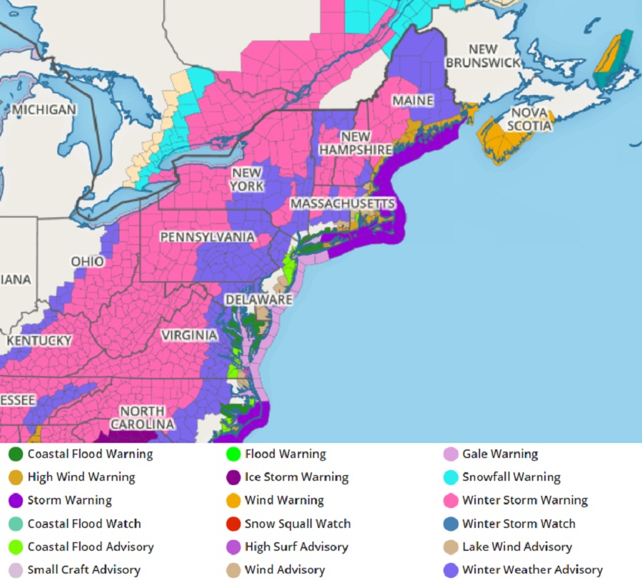
In addition to widespread Winter Storm Warnings and Winter Weather Advisories that extend from the southeast to the northeast today, Lake Wind Advisories, Wind Advisories, and High Wind Warnings have been issued for the northeast.

Damaging wind gusts, especially as a squall line moves through as part of the evolution of the winter storm tomorrow, could knock down power lines, tree branches, and perhaps even trees, killing power for some. People should be prepared for the possibility of power outages in the wake of this storm.


Zooming into New England shows damaging wind gusts are expected along the immediate coast. Image: NWS

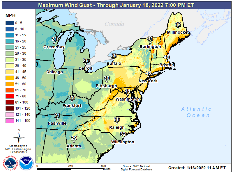
While winds will be gusty far inland, they’ll be more severe at the coast. Gusts up to 26 mph are possible in Detroit; 39 mph in Buffalo and 30 mph in Pittsburgh. Boston, New York City, and Washington, DC will all see wind gusts over 40 mph.

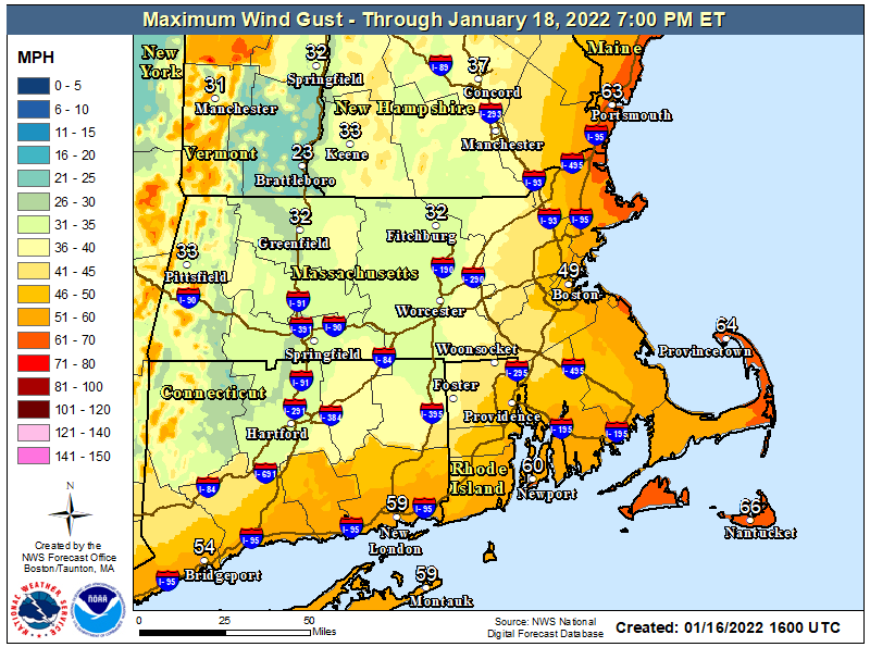
In coastal New England, wind gusts will be over 60 mph, with a greater threat of damage and power outages there.

The heavy inland snows and heavy coastal rains will wrap up by Monday evening from southwest to northeast, with dry air arriving. However, bitter cold weather will also be arriving in the days ahead in the wake of this storm. Those without power may have issues keeping their water lines and perhaps even themselves warm as crews work to restore utilities.

Once this storm exits the region, attention will be paid to the next one. That storm looks like it’ll bring heavy snow to portions of the I-95 corridor seeing rain this storm. More specifics about precipitation types, amounts, and locations will be better known once this current storm exits the region.

Primary Sidebar

Sponsored Ad

Search

Latest News

  • Preliminary NTSB Report Shows Something other than Turbulence Killed Passenger on New England Flight
  • SEVERE Geomagnetic Storm Alert Issued; Massive Aurora On Display in North America
  • World’s Largest Volcano Quakes; No Tsunami Threat Around Hawaii
  • Impacts from Geomagnetic Storm Expected Thursday through Saturday; Watch Issued
  • Three Quakes Rattle Mid Atlantic Ridge; No East Coast Tsunami Threat
  • Spring 2023 Arrives Today
  • Incident Meteorologists Provide Additional Support at Special All-Hazard Events
  • Unseasonably Cold Air Surges South and East Triggering Warnings
About | Careers | Contact | Contests
Terms | Privacy | Ad Choices
Weatherboy is a (R) Registered Trademark of isarithm LLC, All Rights Reserved.
All content herein is Copyright by Isarithm LLC 1997-2022