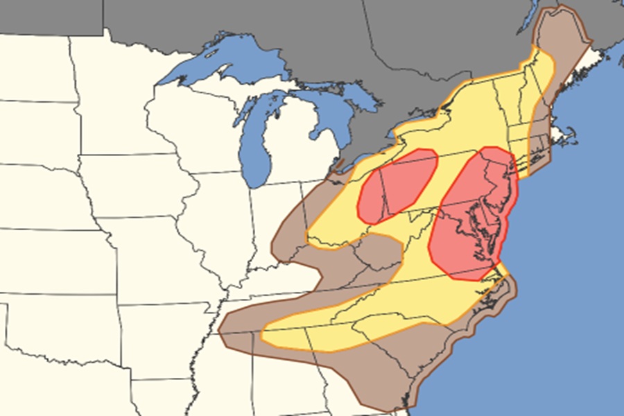
The National Weather Service’s Storm Prediction Center (SPC) is warning of the increasing threat of damaging straight-line winds and wind gusts in portions of the Mid Atlantic this afternoon and evening. According to the SPC, the greatest threat of damaging winds is across all of New Jersey and Delaware, and portions of New York, Ohio, Pennsylvania, Maryland, and Virginia.
According to the National Weather Service, a thunderstorm becomes “severe” when it produces at least one of the following criteria: hail 1 inch or larger in diameter, wind gusts of 58 mph or higher, or a tornado. For today’s storms, while there’s a threat of all three, the threat of damaging winds is highest.
Damaging winds are often called “straight-line” winds to differentiate the damage they cause from tornado damage. Strong thunderstorm winds can come from a number of different processes. Most thunderstorm winds that cause damage at the ground are a result of outflow generated by a thunderstorm downdraft. Damaging winds are classified as those exceeding 50-60 mph.
Damage from severe thunderstorm winds account for half of all severe reports in the lower 48 states and is more common than damage from tornadoes. Wind speeds can reach up to 100 mph and can produce a damage path extending for hundreds of miles.
