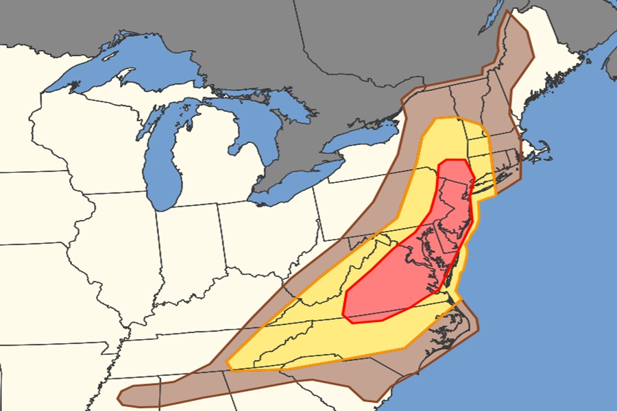
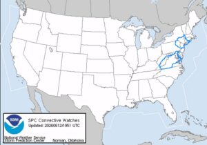
Strong to severe storms capable of damaging winds are expected across parts of the Appalachians, Mid-Atlantic, and Northeast this afternoon and evening. Due to this threat, the National Weather Service’s Storm Prediction Center has issued Severe Thunderstorm Watches for portions of New Jersey, New York, Connecticut, Pennsylvania, Virginia, West Virginia, and Maryland; more watches and/or warnings are likely to be issued in the coming hours. While severe storms could contain large hail and isolated tornadoes, the primary threat from today’s storms will be from damaging straight-line winds.
Within the northern stream, a shortwave trough will progress east-northeastward over the lower Great Lakes this evening while an associated surface cold front moves eastward into New England and southeastward into the Mid-Atlantic. The moderate buoyancy in an environment with steep low-level lapse rates and weak upper flow will set a stage that favors multicell clusters with occasional wind damage. The National Weather Service said, “Weak low level shear, high wetbulb zero heights, should hinder the threat for tornadoes and/or large hail” for areas north and east of Philadelphia.
The severe weather will bring a brief break to very hot weather for some. Dangerous heat is expected to continue for the rest of this afternoon as high temperatures are forecast to peak into the low to mid 90s with dew points in the low to mid 70s in portions of the Mid Atlantic; this results in heat indicies of 95 to 105 degrees across the much of the area. According to the National Weather Service, this level of heat and humidity can become dangerous quickly for sensitive individuals and those outdoors for extended periods of time.
The cold front bringing the severe storms is forecast to move through the region overnight, which will knock the temperatures down a few degrees and allow dew points to return to more comfortable levels for the weekend. Although it will still be hot with high temperatures in the upper 80s to low 90s over the weekend, dew points will mainly be in the upper 50s to low 60s. Therefore, heat indices will not be far removed from the actual air temperature. Because of this, the National Weather Service doesn’t expect to issue heat-related advisories for the region for the weekend.
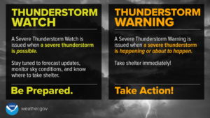
A Severe Thunderstorm Watch is issued when conditions are favorable for severe thunderstorms in and close to the watch area. Persons in these areas should be on the lookout for threatening weather conditions and listen for later statements and possible warnings. Severe thunderstorms can and occasionally do produce tornadoes.
