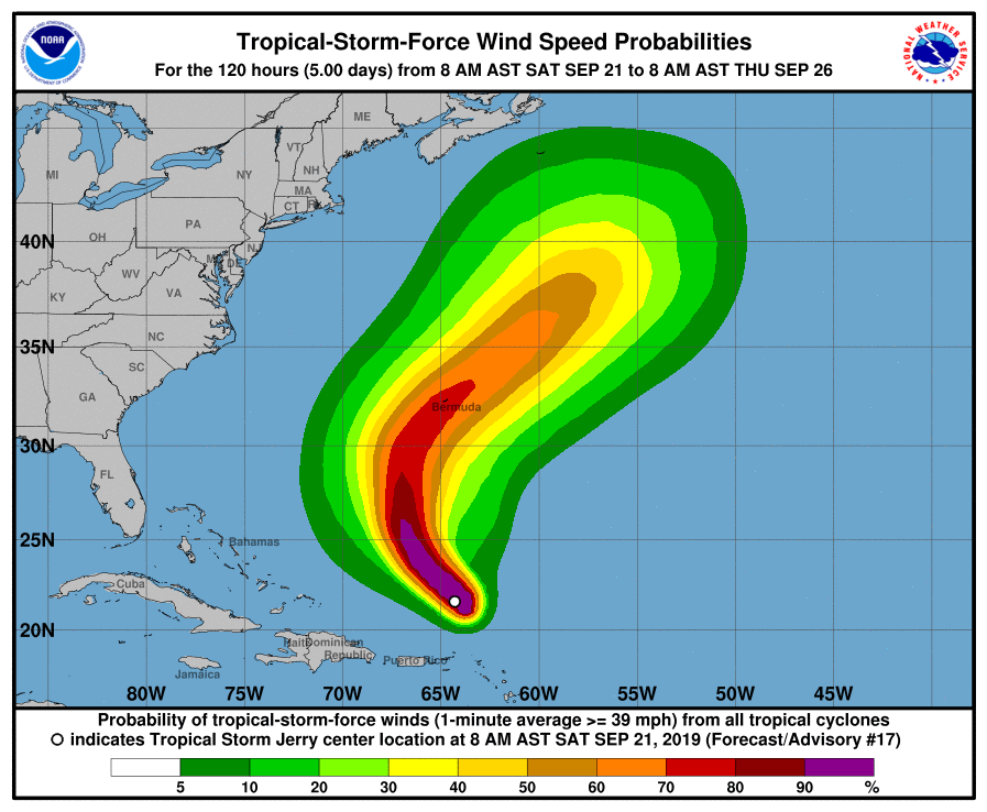
Only days after being lashed by hurricane conditions from Hurricane Humberto, it appears Bermuda may see a direct hit from Hurricane Jerry in the coming days. While no watches or warnings are up now for Jerry, which is a Tropical Storm, the National Hurricane Center (NHC) believes it’ll regain hurricane strength and brings the eye close to Bermuda by Tuesday.
As of the latest update from the NHC, the center of Tropical Storm Jerry was located near latitude 22.0 North, longitude 65.0 West. Jerry is moving toward the northwest near 14 mph, and this general motion is expected to continue today by the NHC. Jerry is forecast to turn northward on Sunday and then accelerate northeastward early next week. On the forecast track, the center of Jerry will continue to pass well north Puerto Rico today and pass well east of the southeastern Bahamas on Sunday. However, the NHC track brings the center of the storm to Bermuda by Tuesday.
Data from an Air Force Reserve hurricane hunter plane indicate that the maximum sustained winds of Jerry remain near 65 mph with higher gusts. Little change in strength is forecast during the next several days, but an increase to hurricane strength is possible by Tuesday. Tropical-storm-force winds extend outward up to 90 miles from the center of the storm. The estimated minimum central pressure based on data from the hurricane hunter plane is 999 mb or 29.50 inches of mercury.
Swells generated by Jerry are affecting portions of the northern Leeward Islands. These swells are likely to cause life-threatening surf and rip current conditions. For now, the storm is too far away from the U.S. and Bermuda to bring dangerous swells to either location.