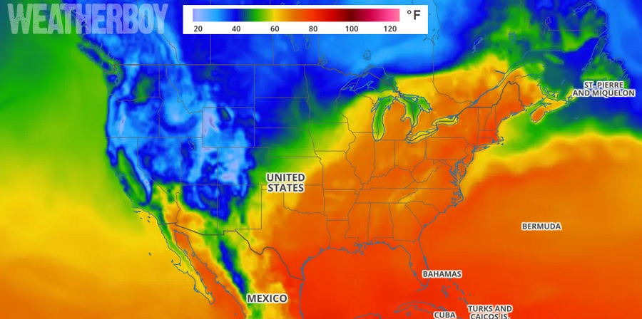
A dramatic mid-May warm-up with push temperatures north of 90 degrees well up the east coast this week; however, the hot weather won’t last long.
A summer-like pattern will develop over the eastern US thanks to the development of a Bermuda ridge. Southwesterly return flow on the backside of this high pressure system will draw heat and moisture up the eastern seaboard. The heat will be aided by strong subsidence underneath the east coast ridge. The peak of this mid-May heat wave should arrive on Thursday, although Wednesday and Friday will be very warm too prior to the arrival of a cold front.
Unlike heat-waves later in the summer season, dew points for this mid-May warm spell will be in the low to mid 60’s, which will prevent humidity levels from feeling oppressive. However, the air temperature on its own will be very warm, with highs in the 90-95 range expected as far north as Boston. With dewpoints in the 60’s, it will feel a few degrees warmer than it actually is.
On Friday, forecast highs will generally be in the 80’s in the northeastern US with increasing clouds and cooler air there arriving in the form of a cold front. If the front slows, temperatures may surge back to 90 in the highly urbanized areas along I-95 from Washington, DC to New York City again.
By Monday, temperatures will be 10-20 degrees colder than they will be on Thursday in the northeast.
Looking ahead to the Memorial Day Weekend, mid-range forecast guidance suggests temperatures will be cooler then they will be this week. Temperatures in the northeast may only be in the 60s and 70s, with chilly conditions expected along the Atlantic coast with cold water temperatures keeping the air a bit cooler there.