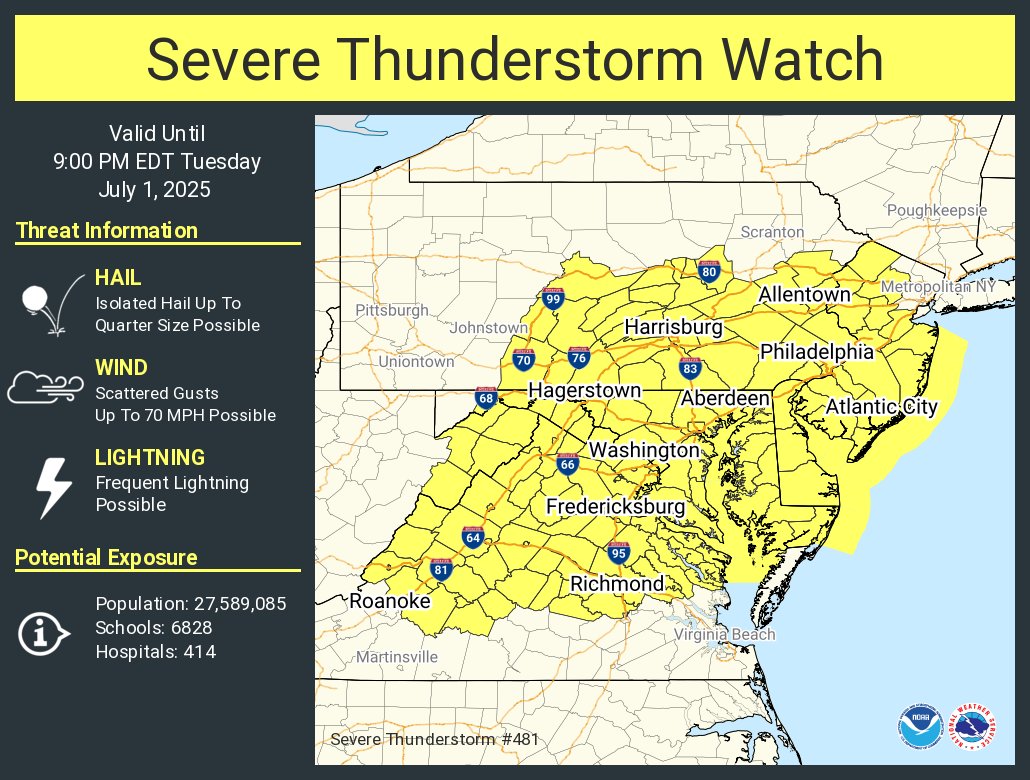
A severe weather outbreak is likely to unfold this afternoon and evening across portions of the Mid Atlantic, prompting the National Weather Service’s Storm Prediction Center (SPC) to issue a Severe Thunderstorm Watch for portions of New Jersey, Pennsylvania, Virginia, West Virginia, and Maryland, as well as all of Delaware.
According to the SPC, recent satellite imagery shows a well-defined shortwave trough extending from western Quebec through the middle Ohio Valley into the Mid Mississippi Valley. Regional radar imagery depicts showers and thunderstorms preceding this wave from across the mid Ohio Valley, with the stronger storms occurring along an associated cold front that extends from far western New York southwestward across western Pennsylvania and along the West Virginia / Ohio border through eastern Kentucky.

The SPC forecasts that this shortwave trough and associated cold front will advance east into the increasingly moist and unstable airmass downstream, promoting widespread thunderstorm development this afternoon. This overall environment will support some organization of storms into line segments and clusters. Scattered thunderstorms will increase in coverage with time and numerous thunderstorms are expected by mid-late afternoon while moving east from Pennsylvania and West Virginia into New Jersey, Delaware, Maryland, and Virginia.
According to the SPC, strong to severe gusts of 50-65 mph are possible with the stronger downdrafts. An isolated tornado or large hail can’t be ruled out, but the dominant threat today is from severe wind and severe wind gusts.
Due to this, the Severe Thunderstorm Watch has been issued and will remain in effect through 9 pm tonight although the SPC may drop the watch earlier if storms clear the coast sooner.
