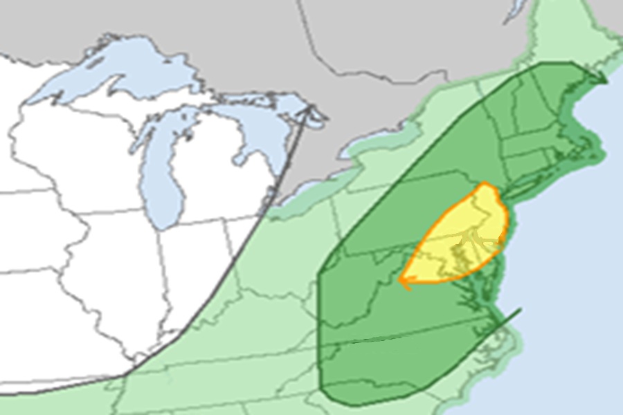
Just days after a severe weather event brought destructive winds and widespread power outages to portions of New Jersey and Pennsylvania, it appears yet another severe weather event will strike on the first day of July. The heart of the severe weather outbreak will be over New Jersey, eastern Pennsylvania, Delaware, and eastern Maryland.
According to the National Weather Service’s Storm Prediction Center (SPC), a mid-level trough will traverse the Northeast as an upper ridge persists over the central U.S. and a mid-level low meanders over California on Tuesday. The East Coast mid-level trough will encourage the eastward advancement of a cold front, which will provide enough lift for scattered to widespread thunderstorm development across the Carolinas into the Northeast. Rich low-level moisture preceding the front will encourage enough buoyancy, amid marginal but adequate vertical wind shear, to support strong thunderstorms, some of which could be severe.
As the surface cold front advances eastward across the eastern U.S., surface temperatures will warm into the 80s to near 90 with dewpoints in the mid 70s from the Southeast into the Mid Atlantic, boosting atmospheric instability.

The SPC cautions, “…the magnitude of buoyancy, combined with widespread thunderstorm coverage over a large area, will foster ample opportunity for at least isolated damaging gusts with wet downbursts, from the Southeast to New England.”
The SPC says there is a a more concentrated area of damaging gust potential over all of New Jersey, most of Delaware and eastern Maryland, and southeastern Pennsylvania. Here the SPC says that line segments are expected to organize amid a region of maximum atmospheric instability driven by stronger west-southwesterly mid-level flow grazing the area.
While there’s a slight risk of tornadoes and large hail in severe thunderstorms, the greatest threat from Tuesday’s forecast outbreak is from the wind, as was the case last week.
