Tropical Storm Eta, the record-tying 28th named storm of the 2020 Atlantic Hurricane Season, is forecast to become a hurricane soon by experts at the National Hurricane Center in Miami, Florida. When Eta formed last night, it tied with 2005 for the most named storms to form in the basin in a single season on record. This is the first time “Eta” from the Greek alphabet has ever been used to name a storm; while 2005 had the same number of storms as this season, one storm that was identified in post-season analysis was never named.
When Eta becomes a hurricane as forecast, it will become the 12th hurricane of the 2020 Atlantic season. Only 3 years saw 12 or more hurricanes: 1969 with 12, 2005 with 15, and 2010 with 12. With the Atlantic Hurricane Season running through the end of this month, and storm formation possible even in off-season months, it is possible 2020 could even break those records.
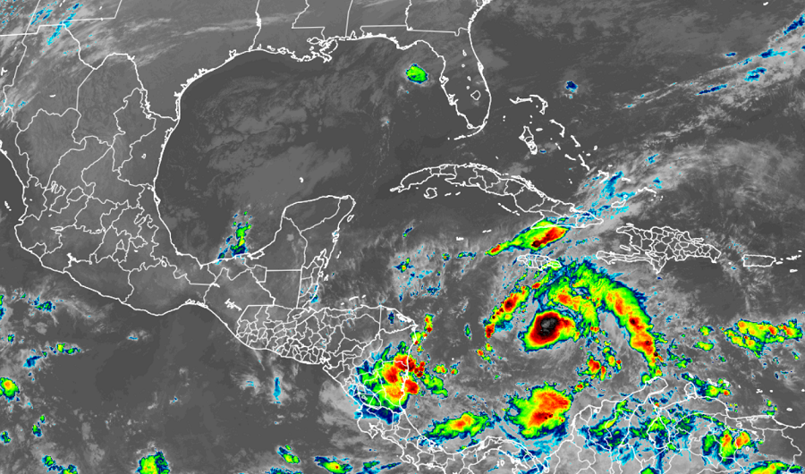
Eta is currently located about 215 miles south of Kingston, Jamaica and about 435 miles east of Cabo Gracias A Dios on the Nicaragua/Honduras border. With maximum sustained winds of 40 mph, the storm has a minimum central pressure of 1005 mb or 29.68 inches.
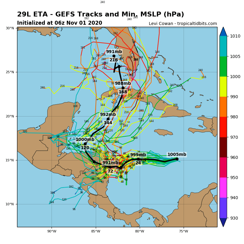
Large questions loom over where Eta will eventually go. The tropical storm is currently moving to the west at 15 mph. The National Hurricane Center says that this motion with a decrease in forward speed is expected today. For tomorrow and Tuesday, an even slower drift is expected to the west or southwest. On such a forecast track, the center of the cyclone would be bear the northeastern coasts of Nicaragua and Honduras by Tuesday.
With Eta moving into an area favorable for intensification, and perhaps rapid intensification, the National Hurricane Center believes it’ll strengthen into a hurricane by Monday.
Computer forecast guidance remains conflicted with where the system will go beyond Tuesday. Some model runs suggest the storm will move across Central America, while others suggest it’ll drift over Central America or just east of it for days. Some models also suggest that after drifting around Central America, it would advance north towards the United States with time.
